Please see my main site ANTIQUEPRINTS.COM For original antique prints and maps
Charing Cross - 1837
Home » Topographical prints (named places) » England, prints and county maps >>> » Westmoreland, antique prints and maps
Westmoreland, Ambleside Rushbearing, 1836. "The Rushbearing at Ambleside" engraved by J.Redaway after a picture by T.Allom, published Fisher's Drawing Room Scrap Book, 1836. Steel engraved print with recent hand colour. Strong plate mark in good margins. Size 16 x 10 cms. Ref D9610
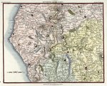
The Lake District, 1815. "Environs of the Lakes" by J.Cary, published in Cary's New Itinerary, about 1815. Copper engraved map with recent hand colour. One vertical fold, with slight damage along fold (no loss.) Size 21 x 16 cms. Ref D8184
Westmoreland, Moule, 1848. "Westmoreland" by Thomas Moule, published in James Barclay's Complete and Universal Dictionary ..., about 1848. Steel engraved map with recent hand colour. Margins slightly trimmed to left and right with a small amount of loss (these maps were often tightly trimmed by the publisher) and a slightly weak impression. Size 26.5 x 20 cms. Ref C9694
Westmoreland, Colwith Force, 1832. "Colwith Force, Westmoreland" engraved by W.Tombleson after a picture by T.Allom, published 1832. Steel engraved print with recent hand colour. Size 10 x 15 cms. Ref C6941
Westmoreland, Brougham Hall, 1832. "Brougham Hall" drawn by T. Allom, engraved by W. Taylor, published by Fisher & Son, 1832. Steel engraved print with recent hand colour. Size 15.5 x 10 cms. Ref 6751
© 2003 - 2020 Website copyright Steve Bartrick Royalty free stock images of antique prints of interest to historians, students and family history researchers