Home » Topographical prints (named places) » England, prints and county maps >>> » Worcestershire, antique prints and maps

 
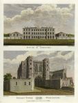
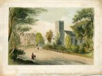
Worcester, House of Industry & Edgars Tower, 1796

Worcester, House of Industry & Edgars Tower, 1796.
"House of Industry" and "Edgar's Tower ..." (Worcester) drawn and engraved by James Ross, published in The History and Antiquities of the City of Worcester, 1796. Copper engraved print with recent hand colour. Good condition with platemark and wide margins. Size 18 x 25 cms including inscription. Ref E940

 
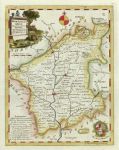
Worcestershire, 1790

Worcestershire, 1790.
"Worcestershire ..." by Thomas Kitchin, engraved by Condor, published by Alex Hogg, about 1790. Copper engraved map with recent hand colour. Plate mark and wide margind. Size 17 x 22 cms. Ref E758

 
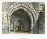
Worcester Edgar's Tower Gateway, 1830

Worcester Edgar's Tower Gateway, 1830.
"Gate-Way, Edgar's Tower, at Worcester" engraved by J.LeKeux after a picture by W.H.Bartlett, published in Britton's Picturesque Antiquities of English Cities, 1830. Copper engraved print with recent hand colour. Good margins. Tear in upper margin to within 1cm of image edge. Size 21 x 15.5 cms. Ref E291


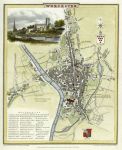
Worcester plan, Cole & Roper, 1806

Worcester plan, Cole & Roper, 1806.
"Worcester" engraved by J.Roper from a drawing by G.Cole, published in The Beauties of England & Wales, 1806. A clear early impression copper engraved map with recent hand colouring. Centrefold as published, wide margins. Size 19 x 23 cms. Ref D9370

 
Worcestershire, Upton on Severn view, 1790

Worcestershire, Upton on Severn view, 1790.
"A View of Upton Upon Severn" anonymous engraver, copper engraving published in a county history, about 1790, with recent hand colour. Plate mark and good margins. Size 33.5 x 23 cms to plate mark. Ref D6845

 
Lancashire, Astley, St.Stepehn's Church & Parsonage, 1850

Lancashire, Astley, St.Stepehn's Church & Parsonage, 1850.
"View of St. Stephen's Church & Parsonage, Astley" anonymous stone lithograph with original hand colouring, published about 1845. Staining and soiling in the margins, close trimmed to part of lower margin. Size 19.5 x 15 cms including title, plus margins. Ref D6185


Worcester view, 1770

Worcester view, 1770.
"The South View of the City of Worcester" anonymous engraver, copper engraving published about 1780, recent hand colour. Size 19 x 10.5 cms. Ref D5830

 
Worcester City view, 1753

Worcester City view, 1753.
"The City of Worcester" anonymous engraver, published in The London Magazine, 1753. Copper engraving with recent hand colour. Size 20 x 11 cms. Ref D4396

 
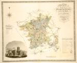
Worcestershire, large map, 1831

Worcestershire, large map, 1831.
"Worcestershire .. from an actual survey made in the years 1820 & 1821" by C. & J. Greenwood, engraved by J. & C. Walker and published in Atlas of the Counties of England, 1830. Large steel engraved map with original hand colour, vignette view of Worcester Cathedral lower left. Centre fold as published, plate mark and good margins. Extremely slight age browning soiling, mainly in the margins. Size 70 x 58 cms. Ref D4085


Worcestershire, 1789

Worcestershire, 1789.
"Worcestershire" published by Francis Grose in his Antiquities of England and Wales, 1787. Originally drawn, engraved and published by John Seller around 1695, this re-issue by Grose has Seller's name removed. Printed on the top half of a page, the rest of which (and the reverse) carries a historical description of the county in letterpress. Copper engraved map with original outline hand colour, very good condition with plate mark and wide margins. Size 14.5 x 12 cms. Ref C8735

 
Worcestershire, Malvern from the Zig-Zag, 1845

Worcestershire, Malvern from the Zig-Zag, 1845.
"Malvern from the Zig Zag" anonymous, published about 1850. Three colour lithograph. Slightly soiled in top margin (see image.) Size 11.5 x 8.5 cms. Ref C7040

 
Worcester view, 1792

Worcester view, 1792.
"Worcester" drawn by E. Burney, engraved by W. & J. Walker, published by Harrison & Co., 1792. Copper engraved print with recent hand colour. On thick paper with a clear plate mark and wide margins. Size 16.5 x 11 cms. Ref C6808


Worcestershire, Bewdeley Bridge, 1814

Worcestershire, Bewdeley Bridge, 1814.
"Bewdley Bridge" drawn by J.Neale, engraved by Sands, published in The Beauties of England & Wales, 1814. Copper engraved print with recent hand colour. Size 15 x 10 cms. Ref C6451

 
Worcestershire, Stourport Bridge, 1815

Worcestershire, Stourport Bridge, 1815.
"Stourport Bridge" drawn by J.Neale, engraved by H.Hobson, published in The Beauties of England & Wales, 1815. Copper engraved print with recent hand colour. Slightly soiled in margins. Size 15 x 10 cms. Ref C6448

 
Worcestershire, Little Malvern Church, stone lithograph, 1830

Worcestershire, Little Malvern Church, stone lithograph, 1830.
"Little Malvern Church" drawn on stone by I. Bradley, printed by C. Hullmandel. Fine and scarce stone lithograph with recent hand colour. Good condition with very wide margins. Size 26 x 17 cms. Ref C6215


Worcester, Netherton House, 1825

Worcester, Netherton House, 1825.
"Netherton House, Worcester" drawn on stone by J.Wood, lithographed by C.Hullmandel, published about 1840. Scarce stone lithograph on India paper, laid down on thicker paper, early hand colour. Some soiling, wide margins. Size 30 x 21 cms. Ref C4120

 
Worcestershire, folding map. 1840

Worcestershire, folding map. 1840.
"Worcestershire", by J. & C. Walker. Steel engraved travellers map, disected and laid on linen, folds into a neat pocket book size cover with original label "Walker's Worcestershire, price 2/6". Original hand colouring, and in good condition. Size (opened) 41.5 x 35 cms, (closed) 9 x 12.5 cms. Ref C3977


« Previous | 1 | 2 | 3 | 4 | 5 | 6 | 7 | 8 | 9 | Next »


© 2003 - 2020 Website copyright Steve Bartrick
Royalty free stock images of antique prints of interest to historians, students and family history researchers