Please see my main site ANTIQUEPRINTS.COM For original antique prints and maps
Charing Cross - 1837
Home » Topographical prints (named places) » England, prints and county maps >>> » Cumberland, antique prints and maps
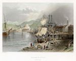
Cumberland, Workington, 1842. "Workington" engraved by R.Wallis after a picture by W.H.Bartlett, published in Finden's Ports and Harbours..., 1842. Steel engraved print with recent hand colour. Size 18 x 12.5 cms. Ref D9517
Cumberland, Carlisle, 1828. "S.E. View of The City of Carlisle" engraved by Tombleson after a drawing by G.F.Robson, published in Robson's Picturesque Views of English Cities, 1828. Detailed steel engraving with recent hand colour. Perfect condition with wide margins. Size 21.5 x 12.5 cms. Ref D5979
Cumberland, Moule, 1848. "Cumberland" by Thomas Moule, published in James Barclay's Complete and Universal Dictionary ..., about 1848. Decorative steel engraved map with recent hand colour. The vignette shows Carlisle. Close trimmed and re-edged to top and bottom margins with some loss (these maps were often tightly trimmed by the publishers). Size 20 x 26 cms. Ref D1099
Cumberland, Derwent Water & Lowdore, 1835. "Derwent Water & Lowdore" drawn by H.Gastineau, engraved by W.LePettit. Steel engraved print published about 1833, with recent hand colour. Size 15.5 x 10 cms. Ref D908
Cumberland, Corby Castle, 1832. "Corby Castle" drawn by T. Allom, engraved by W. Floyd, published by Fisher & Son, 1832. Steel engraved print with recent hand colour. Size 15.5 x 10 cms. Ref C6944
© 2003 - 2020 Website copyright Steve Bartrick Royalty free stock images of antique prints of interest to historians, students and family history researchers