Home » Topographical prints (named places) » All prints and maps

 
Syria, taking Coffee on the Heights of Subeibeh, 1880

Syria, taking Coffee on the Heights of Subeibeh, 1880.
"A Cup of Coffee on the Heights of Subeibeh" wood engraved print published in Picturesque Palestine, about 1880. With recent hand colour. Letterpress text on the reverse. Size 17 x 14 cms including title, plus margins. Ref F6

 
Syria, Caesarea Philippi, 1880

Syria, Caesarea Philippi, 1880.
"Sculptured Niches Dedicated to Pan, at Caesarea Philippi" wood engraved print published in Picturesque Palestine, about 1880. With recent hand colour. Letterpress text on the reverse. Size 16.5 x 20 cms including title, plus margins. Ref F5

 
Israel, view near Nazareth, 1880

Israel, view near Nazareth, 1880.
"A Galilean Hamlet near Nazareth" wood engraved print published in Picturesque Palestine, about 1880. With recent hand colour. Letterpress text on the reverse. Size 16.5 x 19 cms including title, plus margins. Ref F4


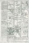
Staffordshire, route map with Lichfield, Rugeley, Stone and Stableford Bridge, 1764

Staffordshire, route map with Lichfield, Rugeley, Stone and Stableford Bridge, 1764.
[ Route map with Lichfield, Rugeley, Stone and Stableford Bridge ] by Emanuel Bowen after the earlier survey by John Ogilby, and published by John Owen in Britannia Depicta ..., 1764. On the verso is part of a route through Namptwich, Torperley to Chester. Copper engraved map. Size 12 x 18 cms plus margins. Ref E9990

 
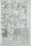
Warwickshire, route map with Coventry, Meriden, Coleshill & Lichfield, 1764

Warwickshire, route map with Coventry, Meriden, Coleshill & Lichfield, 1764.
[ Route map with Coventry, Meriden, Coleshill & Lichfield ] by Emanuel Bowen after the earlier survey by John Ogilby, and published by John Owen in Britannia Depicta ..., 1764. On the verso is part of a route through Towcester, Daventry and Dunchurch. Copper engraved map. Size 12 x 18 cms plus margins. Ref E9989

 
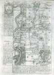
Kent, route map with London, Deptford, Dartford, Chatham & Rainham, 1764

Kent, route map with London, Deptford, Dartford, Chatham & Rainham, 1764.
[ Route map with London, Deptford, Shooters Hill, Dartford, Chatham & Rainham ] by Emanuel Bowen after the earlier survey by John Ogilby, and published by John Owen in Britannia Depicta ..., 1764. On the verso is part of a description of London. Copper engraved map. Size 12 x 18 cms plus margins. Ref E9984


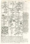
Essex, route map with London, Ilford, Rumford, Burntwood & Chelmsford, 1764

Essex, route map with London, Ilford, Rumford, Burntwood & Chelmsford, 1764.
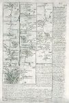
[ Route map with London, Ilford, Rumford, Burntwood & Chelmsford ] by Emanuel Bowen after the earlier survey by John Ogilby, and published by John Owen in Britannia Depicta ..., 1764. On the verso is part of a route through Witham, Kelvedon, Colchester to Harwich. Copper engraved map. Size 12 x 18 cms plus margins. Ref E9982

 
Gloucestershire, route map with Birdlip Hill, Gloucester, Longhope & Monmouth, 1764

Gloucestershire, route map with Birdlip Hill, Gloucester, Longhope & Monmouth, 1764.
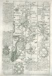
[ Route map with Birdlip Hill, Brockworth, Gloucester, Longhope, Mitcheldean & Monmouth ] by Emanuel Bowen after the earlier survey by John Ogilby, and published by John Owen in Britannia Depicta ..., 1764. On the verso is part of a route through Abingdon, Faringdon, Lechlade, Fairford and Barnsley in Gloucestershire. Copper engraved map. Size 12 x 18 cms plus margins. Ref E9981

 
Gloucestershire / Somerset, route map with Bristol, Axbridge & Huntspill, 1764

Gloucestershire / Somerset, route map with Bristol, Axbridge & Huntspill, 1764.
[ Route map with Bristol, Axbridge & Huntspill ] by Emanuel Bowen after the earlier survey by John Ogilby, and published by John Owen in Britannia Depicta ..., 1764. On the verso is part of a route through Marlborough, Caln, Chippenham & Marshfield. Copper engraved map. Size 12 x 18 cms plus margins. Ref E9979


Middlesex / Bucks / Berkshire, route map with London, Brentford, Maidenhead & Reading, 1764

Middlesex / Bucks / Berkshire, route map with London, Brentford, Maidenhead & Reading, 1764.
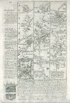
[ Route map with London, Brentford, Hounslow, Maidenhead & Reading ] by Emanuel Bowen after the earlier survey by John Ogilby, and published by John Owen in Britannia Depicta ..., 1764. On the verso is part of a route through Newbury, Hungerford & Marlborough. Copper engraved map. Size 12 x 18 cms plus margins. Ref E9978

 
Middlesex / Surrey, route map with London, Brentford, Staines & Bagshot, by Owen / Bowen, 1764

Middlesex / Surrey, route map with London, Brentford, Staines & Bagshot, by Owen / Bowen, 1764.
[ Route map with London, Kensington, Brentford, Staines & Bagshot ] by Emanuel Bowen after the earlier survey by John Ogilby, and published by John Owen in Britannia Depicta ..., 1764. On the verso is part of a description of London. Copper engraved map. Size 12 x 18 cms plus margins. Ref E9977

 
Wiltshire / Hampshire, route map with Andover & Salisbury, by Owen / Bowen, 1764

Wiltshire / Hampshire, route map with Andover & Salisbury, by Owen / Bowen, 1764.
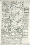
[ Route map with Andover, Middle Wallop & Salisbury ] by Emanuel Bowen after the earlier survey by John Ogilby, and published by John Owen in Britannia Depicta ..., 1764. On the verso is part of a route through Basingstoke to Andover in Hampshire. Copper engraved map. Size 12 x 18 cms plus margins. Ref E9976


Dorset / Somerset, route map with Shaftsbury, Sherborne, Yeovil & Crookhorn, by Owen / Bowen, 1764

Dorset / Somerset, route map with Shaftsbury, Sherborne, Yeovil & Crookhorn, by Owen / Bowen, 1764.
[ Route map with Shaftsbury, Sherborne, Yeovil (also called Evil) & Crookhorn ] by Emanuel Bowen after the earlier survey by John Ogilby, and published by John Owen in Britannia Depicta ..., 1764. On the verso is part of a route through Axminster, Honiton & Exeter in Devon. Copper engraved map. Size 12 x 18 cms plus margins. Ref E9975

 
Kent, Canterbury, Christ Church, 1786

Kent, Canterbury, Christ Church, 1786.
"Stranger's Hall at Christ Church, Canterbury, in Kent" engraved by Coote, published in Picturesque Views of the Antiquities of England & Wales, 1786. Copper engraved print, good condition. Size 19 x 32 cms including title, plus margins. Ref E9966

 
Kent, Barfreston Church, 1786

Kent, Barfreston Church, 1786.
"Barfreston Church, in Kent" engraved by Peltro, published in Picturesque Views of the Antiquities of England & Wales, 1786. Copper engraved print, good condition. Size 19 x 32 cms including title, plus margins. Ref E9965


Berkshire, Donnington Castle & St.Georges Chapel in Windsor, 1786

Berkshire, Donnington Castle & St.Georges Chapel in Windsor, 1786.
"Dunnington Castle in Berkshire" and St.Georges Chapel at Windsor" engraved by Thornton, published in Picturesque Views of the Antiquities of England & Wales, 1786. Pair of copper engraved prints on one sheet. Good condition. Size 19 x 33.5 cms including title, plus margins. Ref E9962

 
Lancashire, Tower of Liverpool, 1843

Lancashire, Tower of Liverpool, 1843.
"Tower of Liverpool" (two views) tinted stone lithograph by W.G.Herdman, published in Pictorial Relics of Ancient Liverpool, 1843. On thick paper, slight foxing. Size 17 x 26 cms including title, plus margins. Ref E9897

 
Lancashire, Tower of Liverpool, 1843

Lancashire, Tower of Liverpool, 1843.
"Tower of Liverpool" tinted stone lithograph by W.G.Herdman, published in Pictorial Relics of Ancient Liverpool, 1843. On thick paper. Size 17 x 19 cms including title, plus margins. Ref E9896

 
« Previous | 1170 | 1171 | 1172 | 1173 | 1174 | 1175 | 1176 | 1177 | 1178 | 1179 | 1180... | Next »


© 2003 - 2020 Website copyright Steve Bartrick
Royalty free stock images of antique prints of interest to historians, students and family history researchers