Home » Topographical prints (named places) » All prints and maps

 
London, St. Austin, Watling St., 1810

London, St. Austin, Watling St., 1810.
"St. Austin (i.e Augustin), Watling St." etched by W.Preston after a drawing by W.Pearson, published in Architectura Ecclesiastica Londini, dated 1810. Copper etched print, good condition. Size 16 x 25.5 cms including title and description, plus good margins. Ref H3815

 
London, St. Paul's, Covent Garden, 1810

London, St. Paul's, Covent Garden, 1810.
"St. Paul's, Covent Garden" etched by Preston after a drawing by W.Pearson, published in Architectura Ecclesiastica Londini, dated 1810. Copper etched print, good condition. Size 21.5 x 22 cms including title and description, plus good margins. Ref H3814

 
London, Allhallows Barking, 1810

London, Allhallows Barking, 1810.
"Allhallows Barking" drawn and etched by W.Pearson, published in Architectura Ecclesiastica Londini, dated 1810. Copper etched print, good condition. Size 20.5 x 22.5 cms including title and description, plus good margins. Ref H3813


London, St.Antholins, Watling Street, 1810

London, St.Antholins, Watling Street, 1810.
"St. Antholins, Watling St." etched by Preston after a picture by Pearson, published in Architectura Ecclesiastica Londini, dated 1810. Copper etched print, good condition. Size 16 x 28 cms including title and description, plus good margins. Ref H3812

 
London, St.Alban's, Wood Street, 1810

London, St.Alban's, Wood Street, 1810.
"St. Albans Wood Str." etched by White after a picture by Pearson, published in Architectura Ecclesiastica Londini, dated 1810. Copper etched print, very slight soiling lower right, otherwise good condition. Size 16.5 x 27 cms including title and description, plus good margins. Ref H3811

 
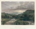
Sussex, Sunset, after G.Cole, 1877

Sussex, Sunset, after G.Cole, 1877.
"Sunset - Sussex" engraved by John Saddler after a picture by G.Cole, published in The Art Journal, 1877. Steel engraved print with recent hand colour, good condition. Size 25 x 20.5 cms including title, plus margins. Ref H3806


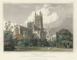
Gloucester Cathedral, from the north east, 1828

Gloucester Cathedral, from the north east, 1828.
"Gloucester Cathedral, from the N.E." engraved by H LeKeux after a picture by W.H.Bartlett, published in Cathedral Antiquities of England, 1828. Copper engraved print with recent hand colour. Small stain in sky area, otherwise good condition. Size 21.5 x 17 cms including title, plus good margins. Ref H3804

 
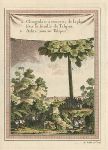
Ceylon (Sri Lanka), Tree and leaves as umbrellas, 1760

Ceylon (Sri Lanka), Tree and leaves as umbrellas, 1760.
"a. Chingulais a couverts de la pluie sous la feuille de Talipot. B. Arbre nomme Talipot" (Sri Lanka) engraved by Chedel, published in Prevost's Histoire Generale Des Voyages, about 1760. Copper engraved print with recent hand colour, partial plate mark and good margins. Good condition. Size 14 x 19.5 cms, plus margins. Ref H3801

 
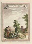
India, Patricians in covered Ox Carts, 1760

India, Patricians in covered Ox Carts, 1760.
"Coches Mogols tires par des Boeufs" (India) engraved by Chedel, published in Prevost's Histoire Generale Des Voyages, about 1760. Copper engraved print with recent hand colour, partial plate mark and good margins. Good condition. Size 14 x 19.5 cms, plus margins. Ref H3800


India, Rauchenara Begum, 1760

India, Rauchenara Begum, 1760.
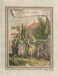
"Rauchenara Begum" (India) engraved by Cano(?), published in Prevost's Histoire Generale Des Voyages, about 1760. Copper engraved print with recent hand colour, partial plate mark and good margins. Good condition. Size 13.5 x 17.5 cms, plus margins. Ref H3799

 
India, Begum Saheb, 1760

India, Begum Saheb, 1760.
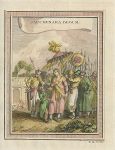
"Begum Saheb" (India) engraved by Cano, published in Prevost's Histoire Generale Des Voyages, about 1760. Copper engraved print with recent hand colour, partial plate mark and good margins. Good condition. Size 13.5 x 17.5 cms, plus margins. Ref H3798

 
India, view of Cananor, 1760

India, view of Cananor, 1760.
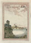
"Ville de Cananor" (Malabar coast, India) engraved by Chedel, published in Prevost's Histoire Generale Des Voyages, about 1760. Copper engraved print with recent hand colour, partial plate mark and good margins. Good condition. Size 14.5 x 19.5 cms, plus margins. Ref H3797


London plan, 1835

London plan, 1835.
"Plan of London and Its Environs" engraved by J & C Walker after R. Creighton, published by Samuel Lewis in his Topographical Dictionary of England, 1835. Large steel engraved city plan with recent hand colour. Very detailed. Several (flattened) folds as published. Stain in left margin to neatine. Size 47 x 38.5 cms plus margins. Ref H3796

 
Durham map, 1784

Durham map, 1784.
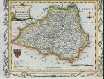
"A New & Correct Map of Durham, Drawn from the Best Authorities" published in Walpoole's New and Complete British Traveller, about 1784. Copper engraved map with partial decorative border, recent hand colouring. Upper margin trimmed to neatline, otherwise good condition. Map size 20 x 16 cms, plus margins on three sides. Ref H3793

 
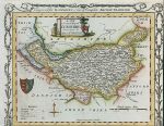
Cheshire map, 1784

Cheshire map, 1784.
"A New & Correct Map of Cheshire, Drawn from the Best Authorities" published in Walpoole's New and Complete British Traveller, about 1784. Copper engraved map with partial decorative border, recent hand colouring. Lower margin trimmed to neatline, otherwise good condition. Map size 20 x 16 cms, plus margins on three sides. Ref H3792


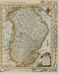
Lincolnshire map, 1784

Lincolnshire map, 1784.
"A New Map of Lincolnshire Drawn from the latest & best Authorities" published in Walpoole's New and Complete British Traveller, about 1784. Copper engraved map with partial decorative border, recent hand colouring. Left margin trimmed to neatline, otherwise good condition. Map size 15.5 x 19 cms, plus margins on three sides. Ref H3791

 
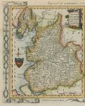
Lancashire map, 1784

Lancashire map, 1784.
"A New Map of Lancashire Drawn from the latest & best Authorities" published in Walpoole's New and Complete British Traveller, about 1784. Copper engraved map with partial decorative border, recent hand colouring. Right margin trimmed to neatline, otherwise good condition. Map size 15.5 x 19 cms, plus margins on three sides. Ref H3790

 
Cumberland, Westmoreland & Northumberland maps, 1784

Cumberland, Westmoreland & Northumberland maps, 1784.
"A New Map of Cumberland and Westmoreland Drawn from the Latest Authorities" and "A New Map of Northumberland ..." published in Walpoole's New and Complete British Traveller, about 1784. Pair of copper engraved maps with decorative border, recent hand colouring. Good condition. Size 34 x 21.5 cms, plus margins. Ref H3789

 
« Previous | ...340 | 341 | 342 | 343 | 344 | 345 | 346 | 347 | 348 | 349 | 350... | Next »


© 2003 - 2020 Website copyright Steve Bartrick
Royalty free stock images of antique prints of interest to historians, students and family history researchers