Home » Topographical prints (named places) » All prints and maps

 
China, Itinerant Doctor at Tien-sing, 1843

China, Itinerant Doctor at Tien-sing, 1843.
"An Itinerant Doctor at Tien-sing" engraved by P.Lightfoot after a picture by Thomas Allom, published in China Illustrated, 1843. Steel engraved print with recent hand colouring. Good condition. Size 20 x 15 cms including title, plus margins. Ref G4338

 
Turkey, The Bosphorus, Constantinople, 1875

Turkey, The Bosphorus, Constantinople, 1875.
"The Bosphorus, Constantinople" engraved by J.Godfrey after a picture by J.D.Woodward, published in Picturesque Europe, about 1875. Steel engraved antique print. Good condition. Size 22.5 x 17 cms including title, plus margins. Ref G4336

 
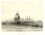
Egypt, coast off Alexandria, David Roberts, 1855

Egypt, coast off Alexandria, David Roberts, 1855.
"Approach to Alexandria" tinted lithograph by David Roberts, published in The Holy Land, Syria, Idumea, Arabia, Egypt & Nubia, 1855. Very good condition. Size 21 x 16.5 cms including title, plus margins. Ref G4335


Lebanon, Beirut and Mount Lebanon, c1852

Lebanon, Beirut and Mount Lebanon, c1852.
"Mount Lebanon from Beyrout" engraved by W.Richardson after a photograph by J.Cramb, published about 1852. Steel engraving with chromolithographic colour. Size 21 x 16.5 cms including title, plus margins. Ref G4334

 
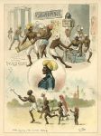
India, several scenes by W.Lloyd, published about 1880

India, several scenes by W.Lloyd, published about 1880.
[ Several scenes relating to India - Pleasures of Railway Travelling, a Railway Guard, and Kite Flying ] chromolithograph by W.Lloyd, published about 1880. Slight soiling. Size 20 x 27.5 cms plus margins. Ref G4333

 
Turkey, plan of Constantinople, c1880

Turkey, plan of Constantinople, c1880.
"Constantinople" colour lithographic plan published in Bradshaw's Continental Railway Guide, about 1880. Several folds as published. Good condition. Size 28 x 21 cms, plus margins. Ref G4330


India, New and Old Delhi, bird's-eye view, 1858

India, New and Old Delhi, bird's-eye view, 1858.
"Panoramic view of New & Old Delhi & the Surrounding Country" steel engraved print published in 1858, recent hand colour. Size 21 x 14 cms including title and key, plus margins. Ref G4329

 
India, Lucknow, bird's-eye view, 1858

India, Lucknow, bird's-eye view, 1858.
"Bird's-eye view of Lucknow and the country towards Cawnpore" steel engraved print published in 1858, recent hand colour. Size 21 x 14 cms including title and key, plus margins. Ref G4328

 
London and vicinity map, about 1780

London and vicinity map, about 1780.
"A New and Correct map of the Countries upwards of Twenty Miles around London ..." anonymous engraver, published in Thornton's New and Complete History and Survey of London and Westminster, about 1780. Copper engraved antique map with recent hand colour, several flattened folds, slight offsetting from text once opposite the map. A detailed and interesting map, covering the area west to Windsor, east to Gravesend, north to Hertford and south to Reigate. Size 37 x 34 cms, plus margins with full plate mark. Ref G4327


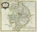
Warwickshire map, Morden, c1695

Warwickshire map, Morden, c1695.
"Warwickshire" by Robert Morden, published in Camden's Britannia, 1695. Copper engraved antique map with recent hand colour, centre fold as published. Several repaired worm holes affecting map area mainly near margins, and a few small ones near centrefold. Size 43 x 37 cms, plus margins with full plate mark. Ref G4324

 
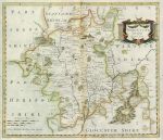
Worcestershire map, Morden, c1695

Worcestershire map, Morden, c1695.
"Worcestershire" by Robert Morden, published in Camden's Britannia, 1695. Copper engraved antique map with recent hand colour, centre fold as published. Several repaired worm holes affecting map area mainly near centrefold. Size 42.5 x 36.5 cms, plus good margins with full plate mark. Ref G4323

 
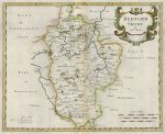
Bedfordshire map, Morden, c1695

Bedfordshire map, Morden, c1695.
"Bedfordshire" by Robert Morden, published in Camden's Britannia, 1695. Copper engraved antique map with recent hand colour, centre fold as published. Some worm holes affecting map area mainly near centrefold. Size 39.5 x 32 cms, plus good margins with full plate mark. Ref G4322


East London map, Kent & Essex, 1796

East London map, Kent & Essex, 1796.
"A Map of those Parishes in the Counties of Kent and Essex which lie within Twelve Miles of London" by J.Cary, published in Lyson's The Environs of London, 1796. Copper engraved map with recent hand colour, good condition with good margins. Size 18 x 23 cms, plus margins. Ref G4321

 
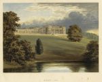
Wiltshire, Bowood Park, 1880

Wiltshire, Bowood Park, 1880.
"Bowood Park" colour woodblock print published in Morris's County Seats ..., about 1880. Some foxing in the margins. Size 19.5 x 16 cms including title, plus margins. Ref G4320

 
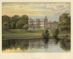
Lancashire, Astley Hall, 1880

Lancashire, Astley Hall, 1880.
"Astley Hall" colour woodblock print published in Morris's County Seats ..., about 1880. Good condition. Size 19.5 x 16 cms including title, plus margins. Ref G4319


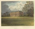
Yorkshire, Beningbrough Hall, 1880

Yorkshire, Beningbrough Hall, 1880.
"Beningbrough Hall" colour woodblock print published in Morris's County Seats ..., about 1880. Good condition. Size 19.5 x 16 cms including title, plus margins. Ref G4318

 
Leicestershire, Donington Castle, 1880

Leicestershire, Donington Castle, 1880.
"Donington Castle" colour woodblock print published in Morris's County Seats ..., about 1880. Good condition. Size 19.5 x 16 cms including title, plus margins. Ref G4317

 
Scotland, Dunmore Park, 1880

Scotland, Dunmore Park, 1880.
"Dunmore Park" colour woodblock print published in Morris's County Seats ..., about 1880. Good condition. Size 19.5 x 16 cms including title, plus margins. Ref G4316

 
« Previous | ...700 | 701 | 702 | 703 | 704 | 705 | 706 | 707 | 708 | 709 | 710... | Next »


© 2003 - 2020 Website copyright Steve Bartrick
Royalty free stock images of antique prints of interest to historians, students and family history researchers