Home » Topographical prints (named places) » England, prints and county maps >>> » All prints and maps

 
Westmoreland, Upper Fall at Rydal, 1832

Westmoreland, Upper Fall at Rydal, 1832.
"The Upper Fall at Rydal" engraved by T.Jeavons after a picture by H.Gastineau, published in 1833. Steel engraved antique print with recent hand colour. Size 10 x 16 cms including title, plus margins. Ref G950

 
Ambleside, the Mill on the Stock-Gill, 1832

Ambleside, the Mill on the Stock-Gill, 1832.
"The Mill, on the Stock-Gill, near Ambleside" engraved by T.Jeavons after a picture by H.Gastineau, published in 1833. Steel engraved antique print with recent hand colour. Size 10 x 16 cms including title, plus margins. Ref G949

 
Durham, Cauldron Snout, Teesdale, 1832

Durham, Cauldron Snout, Teesdale, 1832.
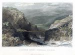
"Caldron Snout, Teesdale, Durham" (Cauldron Snout) engraved by W.LePetit after a picture by Thomas Allom, published in 1833. Steel engraved antique print with recent hand colour. Size 15.5 x 11 cms including title, plus margins. Ref G948


Northumberland, Mitford Castle, 1832

Northumberland, Mitford Castle, 1832.
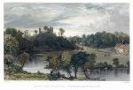
"Mitford Castle, Northumberland" engraved by J.Sands after a picture by Thomas Allom, published in 1833. Steel engraved antique print with recent hand colour. Size 15.5 x 10.5 cms including title, plus margins. Ref G947

 
Durham, Palace of the Bishop of Durham at Bishop Auckland, 1832

Durham, Palace of the Bishop of Durham at Bishop Auckland, 1832.
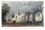
"The Palace of the Bishop of Durham at Bishop Auckland" engraved by S.Lacey after a picture by Thomas Allom, published in 1833. Steel engraved antique print with recent hand colour. Size 15.5 x 10.5 cms including title, plus margins. Ref G946

 
Belgium, Ostend, 1849

Belgium, Ostend, 1849.
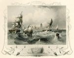
"Ostend" engraved by A.H.Payne after a picture by A.Carse, published in Payne's Book of Art .. Galleries of Munich, 1849. Steel engraved antique print with recent hand colouring. Good condition. Size 20 x 16 cms including title, plus margins. Ref G925


Derbyshire, Hathersage, 1820 / 1886

Derbyshire, Hathersage, 1820 / 1886.
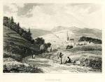
"Hathersage" etched by George Cooke(?) after a picture by J.C.Hofland, published in Chantrey's Peak Scenery .., 1886. Copper plate etching originally published about 1820, this is a high quality restrike published in 1886. Very good condition. Size 20 x 16 cms including title, plus margins. Ref G923

 
London, St.Mary Lambeth, the Pedlar & His Dog (stained glass), 1801

London, St.Mary Lambeth, the Pedlar & His Dog (stained glass), 1801.
"The Pedlar & His Dog, Saint Mary, Lambeth" (stained glass) copper plate etching originally published by N.Smith for the Society of Antiquaries in 1791, this example being bound into Antiquities of London and it's Environs ..., about 1801. Library blind-stamp in margins (not affecting the image), otherwise good condition with full plate mark. Size 15.5 x 21.5 cms including title, plus good margins. Ref G922

 
London, Leathersellers Hall Kitchin, 1801

London, Leathersellers Hall Kitchin, 1801.
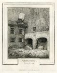
"The Kitchin belonging to Leathersellers Hall, Demolished in 1799" copper plate etching originally published by Manson for the Society of Antiquaries in 1800, this example being bound into Antiquities of London and it's Environs ..., about 1801. Library blind-stamp in margins (not affecting the image), otherwise good condition with full plate mark. Size 17 x 20.5 cms including title, plus good margins. Ref G921


London, plan of Broad Street & Cornhill Wards by Bowen, 1771

London, plan of Broad Street & Cornhill Wards by Bowen, 1771.
"Broad Street & Cornhill Wards, Divided into Parishes, according to a new Survey" by T.Bowen, published about 1771. Copper engraved plan, the main roads shown are Lothbury, Throgmorton St., Broad St., London Wall, Threadneedle St., Cornhill and Bishopsgate St. Two folds as published, good condition. Size 23.5 x 18 cms plus good margins. Ref G871

 
London, plan of Aldersgate Ward by Bowen, 1771

London, plan of Aldersgate Ward by Bowen, 1771.
"Aldersgate Ward, with it's Divisions into Precints and Parishes, and the Liberty of St.Martins le Grand, according to a new Survey" by T.Bowen, published about 1771. Copper engraved plan, the main roads shown are Pickax St., Aldersgate St., St.Martins le Grand, Noble St. Two folds as published, good condition. Size 23.5 x 18.5 cms plus good margins. Ref G870

 
London, plan of Aldgate Ward by Bowen, 1771

London, plan of Aldgate Ward by Bowen, 1771.
"Aldgate Ward, with it's Divisions into Precints and Parishes, according to a new Survey" by T.Bowen, published about 1771. Copper engraved plan, the main roads shown are Poor Jury Lane, Leadenhall St., Fenchurch St., Croched Fryers and the East India Warehouses. Two folds as published, good condition. Size 23.5 x 18 cms plus good margins. Ref G869


London, plan of Bishopsgate Ward Within & Without by Bowen, 1771

London, plan of Bishopsgate Ward Within & Without by Bowen, 1771.
"Bishopsgate Ward Within and Without, according to a new Survey" by T.Bowen, published about 1771. Copper engraved plan, the main roads shown are Bishopsgate, Gracechurch St., Wormwood Street. Two folds as published, good condition. Size 23 x 17.5 cms plus good margins. Ref G868

 
London, plan of Billingsgate Ward and Bridge Ward Within by Bowen, 1771

London, plan of Billingsgate Ward and Bridge Ward Within by Bowen, 1771.
"Billingsgate Ward and Bridge Ward Within, with their Divisions into Parishes, according to a new Survey" by T.Bowen, published about 1771. Copper engraved plan, the main roads shown are Fish Street Hill, Gracechurch Street, Pudding Lane, Thames Street and end of London Bridge. Two folds as published, crease across lower right corner, otherwise good condition. Size 23 x 17 cms plus good margins. Ref G867

 
London, plan of Walbrook and Dowgate Wards by Bowen, 1771

London, plan of Walbrook and Dowgate Wards by Bowen, 1771.
"Walbrook Ward and Dowgate Ward with their Divisions into Parishes, according to a new Survey" by T.Bowen, published about 1771. Copper engraved plan, the main roads shown are Coleman Street, Basinghall and Lothbury. Two folds as published, good condition. Size 25.5 x 18 cms plus good margins. Ref G866


London, plan of Breadstreet and Cordwainers Wards by Bowen, 1771

London, plan of Breadstreet and Cordwainers Wards by Bowen, 1771.
"Breadstreet Ward and Cordwainers Ward with their Divisions into Parishes, according to a new Survey" by T.Bowen, published about 1771. Copper engraved plan, the main roads shown are Watling Street, Distaff Lane, Baising Lane and Old Fish Street. Two folds as published, good condition. Size 23 x 17 cms plus good margins. Ref G865

 
London, plan of Coleman St. and Bassishaw Wards by Bowen, 1771

London, plan of Coleman St. and Bassishaw Wards by Bowen, 1771.
"The Wards of Coleman Street, and Bassishaw, taken from the latest Survey ..." by T.Bowen, published about 1771. Copper engraved plan, the main roads shown are Coleman Street, Basinghall and Lothbury. Two folds as published, good condition. Size 17 x 22.5 cms plus good margins. Ref G864

 
Wiltshire, Salisbury, Old Council House, 1834

Wiltshire, Salisbury, Old Council House, 1834.
"The Old Council House with Mr. Wheeler's Shop" (Salisbury) anonymous etcher, published in Picturesque Memorials of Salisbury, 1834. Good condition with full plate mark. Size 17.5 x 10 cms plus good margins. Ref G828

 
« Previous | ...310 | 311 | 312 | 313 | 314 | 315 | 316 | 317 | 318 | 319 | 320... | Next »


© 2003 - 2020 Website copyright Steve Bartrick
Royalty free stock images of antique prints of interest to historians, students and family history researchers