Please see my main site ANTIQUEPRINTS.COM For original antique prints and maps
Charing Cross - 1837
Home » Topographical prints (named places) » England, prints and county maps >>> » All prints and maps
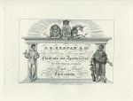
Cheltenham, Trade Advert, Beavan & Co. Chemist, 1826. Trade advert for J.G.Beavan & Co., Chemist and Apothecary, published in Griffith's History of Cheltenham, 1826. Copper engraved antique print, good plate mark and wide margins. Good condition. Size 15 x 11 cms to plate mark (as shown in scan), plus margins. Ref F3943
Kent, Penshurst Garden Front, pencil drawing, 1893. "Garden Front, Penshurst, Kent" pencil drawing initialled M.B.J. undated but about 1893. Glue traces on reverse as this was once in a scrapbook. Size 17 x 13 cms. Ref F3942
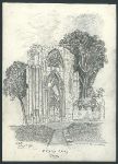
York, St. Mary's Abbey, pencil drawing, 1893. "St. Mary's Abbey, York" pencil drawing initialled M.B.J. and dated July 11, 1893. Glue traces on reverse as this was once in a scrapbook. Size 13 x 18 cms. Ref F3941
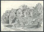
York, King's Manor House, pencil drawing, 1893. "King's Manor House, York" pencil drawing initialled M.B.J. and dated July 24, 1893. Glue traces on reverse as this was once in a scrapbook. Size 17.5 x 13 cms. Ref F3940
London, St.Ann's Society Schools in Brixton, letterhead, 1836. "Saint Ann's Society Schools, Brixton Hill, Surrey & Aldersgate, London" steel engraved letterhed with letter expressing thanks to those who supported the Institution's Fancy Fair recently held in Regent's Park, dated 11th Feb 1836 and addressed to Mr.Williams of Brunswick Place, Brixton Hill. Creasing, pinprick holes on the folds and slight soiling, glue traces on reverse as this was once in a scrapbook. Size 18.5 x 23 cms. Ref F3939
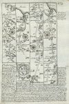
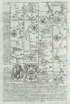
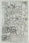
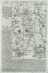
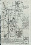
Yorkshire, route map with Whitby, Mew Malton and Scarborough, 1764. [ Route map with Whitby, Mew Malton and Scarborough ] by Emanuel Bowen after the earlier survey by John Ogilby, and published by John Owen in Britannia Depicta ..., 1764. Blank verso. Copper engraved map. Size 12 x 18 cms plus margins. Ref F3938
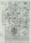
Durham, route map with Norton, Durham, Sunderland & Tynemouth, 1764. [ Route map with Norton, Durham, Sunderland & Tynemouth ] by Emanuel Bowen after the earlier survey by John Ogilby, and published by John Owen in Britannia Depicta ..., 1764. On the verso is part of a route in Yorkshire with Whitby & Guisborough. Copper engraved map. Size 12 x 18 cms plus margins. Ref F3937
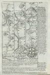
Hampshire & Dorset, route map with Poole, Christchurch, Southampton and Winchester, 1764. [ Route map with Knaston, Poole, Christchurch, Southampton and Winchester ] by Emanuel Bowen after the earlier survey by John Ogilby, and published by John Owen in Britannia Depicta ..., 1764. On the verso is part of a route with Alresford, Winchester, Rumsey and Ringwood. Copper engraved map. Size 12 x 18 cms plus margins. Ref F3936
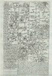
Yorkshire, route map with Leyburn, Richmond, Pontefract & Wakefield, 1764. [ Route map from just north of Ripon, with Leyburn, Richmond, Pontefract & Wakefield ] by Emanuel Bowen after the earlier survey by John Ogilby, and published by John Owen in Britannia Depicta ..., 1764. On the verso is part of a route with Ferrybridge, Wetherby, Aberford and Ripon. Copper engraved map. Size 12 x 18 cms plus margins. Ref F3935
Devon & Dorset, route map with Exeter, Sidford, Colyford, Lyme and Chideock, 1764. [ Route map with Exeter, Sidford, Colyford, Lyme and Chideock ] by Emanuel Bowen after the earlier survey by John Ogilby, and published by John Owen in Britannia Depicta ..., 1764. On the verso is a description of Dorchester & Lyme Regis. Copper engraved map. Size 12 x 18 cms plus margins. Ref F3934
Essex & Kent, route map with Gravesend, Hondon, Canterbury, Sandwich Deal & Dover, 1764. [ Route map with Gravesend, Horndon, Canterbury, Sandwich Deal & Dover ] by Emanuel Bowen after the earlier survey by John Ogilby, and published by John Owen in Britannia Depicta ..., 1764. On the verso is a route including Chelmsford, Raleigh & Billericay. Copper engraved map. Size 12 x 18 cms plus margins. Ref F3933
Lancashire, route map with Riponden, Manchester, Eccles and Warrington, 1764. [ Route map with Riponden, Manchester, Eccles and Warrington ] by Emanuel Bowen after the earlier survey by John Ogilby, and published by John Owen in Britannia Depicta ..., 1764. On the verso is a route from Warrington through Frodham to Chester, and part of another route from Manchester to Stopford. Copper engraved map. Size 12 x 18 cms plus margins. Ref F3931
Yorkshire & Lancashire, route map with Skipton, Settle, Clapham, Hornby & Lancaster, 1764. [ Route map with Skipton, Settle, Clapham, Hornby & Lancaster ] by Emanuel Bowen after the earlier survey by John Ogilby, and published by John Owen in Britannia Depicta ..., 1764. On the verso is a route from York through Knaresborough and Ripley to Bolton. Copper engraved map. Size 12 x 18 cms plus margins. Ref F3930
Northumberland, route map with Tynemouth, Newcastle and Hexam, 1764. [ Route map with Tynemouth, Newcastle and Hexam ] by Emanuel Bowen after the earlier survey by John Ogilby, and published by John Owen in Britannia Depicta ..., 1764. On the verso is a route from near Hexam on to Carlisle. Copper engraved map. Size 12 x 18 cms plus margins. Ref F3929
Warwicks, Leics & Derbys, route map with Southam, Coventry, Nuneaton to Derby, 1764. [ Route map through Southam, Coventry, Nuneaton, Atherston & Ashby de la Zouch to Derby ] by Emanuel Bowen after the earlier survey by John Ogilby, and published by John Owen in Britannia Depicta ..., 1764. On the verso is a route from Oxford through Deddington and Banbury. Copper engraved map. Size 12 x 18 cms plus margins. Ref F3927
Bucks, Beds & Cambs, route map from Newport Pagnell through Bedford to Cambridge, 1764. [ Route map from from Newport Pagnell through Bedford to Cambridge ] by Emanuel Bowen after the earlier survey by John Ogilby, and published by John Owen in Britannia Depicta ..., 1764. On the verso is a route from Oxford through Burcester and Buckingham. Copper engraved map. Size 12 x 18 cms plus margins. Ref F3926
Berkshire, route map from Oxford through Farringdon, Highworth & Purton, 1764. [ Route map from from Oxford through Fifield, Farringdon, Highworth & Purton ] by Emanuel Bowen after the earlier survey by John Ogilby, and published by John Owen in Britannia Depicta ..., 1764. On the verso is a description of Oxford University. Copper engraved map. Size 12 x 18 cms plus margins. Ref F3925
Nottinghamshire & Lincs, route map from Nottingham to Lincoln, 1764. [ Route map from Nottingham to Lincoln, through Newark ] by Emanuel Bowen after the earlier survey by John Ogilby, and published by John Owen in Britannia Depicta ..., 1764. On the verso is the route on from Lincoln to Grimsby. Copper engraved map, very close cropped to left side. Size 12 x 18 cms plus margins. Ref F3924
© 2003 - 2020 Website copyright Steve Bartrick Royalty free stock images of antique prints of interest to historians, students and family history researchers