Home » Topographical prints (named places) » England, prints and county maps >>> » All prints and maps

 
Lancashire, Preston, 1830

Lancashire, Preston, 1830.
"Preston, from the north" engraved by E.Finden after a picture by W.Westall, published in Great Britain Illustrated, 1830. Steel engraving with recent hand colour. Size 15 x 10.5 cms. Ref F2697

 
Kent, Hythe from the Canal Bridge, 1830

Kent, Hythe from the Canal Bridge, 1830.
"Hythe, from the Canal Bridge" engraved by E.Finden after a picture by W.Westall, published in Great Britain Illustrated, 1830. Steel engraving with recent hand colour. Size 15 x 10.5 cms. Ref F2696

 
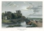
Westmoreland, Brough Castle, 1830

Westmoreland, Brough Castle, 1830.
"Brough Castle, Westmoreland" engraved by E.Finden after a picture by W.Westall, published in Great Britain Illustrated, 1830. Steel engraving with recent hand colour. Size 15.5 x 10.5 cms. Ref F2695


London, Old St.Pauls Cathedral, 1786

London, Old St.Pauls Cathedral, 1786.
"North View of Old St.Paul's Church, after the Spire was destroy'd by Lightning" with "South View of Old St.Paul's Church, after the Spire was destroy'd by Lightning" and "South View of Old St.Paul's, when the Spire was standing" anonymous engraver, published in Picturesque Views of the Antiquities of England & Wales, 1786. Copper engraved print, good condition with full plate mark. Size 16.5 x 29.5 cms including title, plus margins. Ref F2667

 
Yorkshire, Middleham Castle, 1786

Yorkshire, Middleham Castle, 1786.
"Middleham Castle, in Yorkshire" engraved by Thornton, published in Picturesque Views of the Antiquities of England & Wales, 1786. Copper engraved print, good condition with full plate mark. Size 18.5 x 32 cms including title, plus margins. Ref F2666

 
Kent, Ostenhanger House, 1786

Kent, Ostenhanger House, 1786.
"Ostenhanger House, in Kent" engraved by Coote, published in Picturesque Views of the Antiquities of England & Wales, 1786. Copper engraved print, good condition with full plate mark. Size 18.5 x 32 cms including title, plus margins. Ref F2665


Cheshire, Beeston Castle, 1786

Cheshire, Beeston Castle, 1786.
"Beeston Castle, in Cheshire" engraved by Rennoldson, published in Picturesque Views of the Antiquities of England & Wales, 1786. Copper engraved print, good condition with full plate mark. Size 18.5 x 32 cms including title, plus margins. Ref F2664

 
Sussex, Lewes Priory, 1786

Sussex, Lewes Priory, 1786.
"Lewes Priory, in Sussex" engraved by Page, published in Picturesque Views of the Antiquities of England & Wales, 1786. Copper engraved print, good condition with full plate mark. Size 19 x 31.5 cms including title, plus margins. Ref F2663

 
Cumberland, Lanercost Priory, 1786

Cumberland, Lanercost Priory, 1786.
"Lanercost Priory, in Cumberland" engraved by J.Wooding, published in Picturesque Views of the Antiquities of England & Wales, 1786. Copper engraved print, good condition with full plate mark. Size 19 x 32.5 cms including title, plus margins. Ref F2662


Worcestershire, Dudley Priory, 1786

Worcestershire, Dudley Priory, 1786.
"Dudley Priory in Worcestershire" engraved by Coote, published in Picturesque Views of the Antiquities of England & Wales, 1786. Copper engraved print, good condition with full plate mark. Size 18 x 32 cms including title, plus margins. Ref F2660

 
Somerset, Glastonbury Abbey, 1786

Somerset, Glastonbury Abbey, 1786.
"The Abbot's Kitchin at Glastonbury Abbey" and "Glastonbury Abbey in Somersetshire" engraved by Noble, published in Picturesque Views of the Antiquities of England & Wales, 1786. Copper engraved print, good condition with full plate mark. Size 19 x 32 cms including title, plus margins. Ref F2659

 
Yorkshire, Coverham Abbey, 1786

Yorkshire, Coverham Abbey, 1786.
"Coverham Abbey in Yorkshire" engraved by Eastgate, published in Picturesque Views of the Antiquities of England & Wales, 1786. Copper engraved print, good condition with full plate mark. Size 19 x 32.5 cms including title, plus margins. Ref F2658


Norfolk, Castle Acre, 1786

Norfolk, Castle Acre, 1786.
"Castle Acre Castle" and "Castle Acre Monastery, in Norfolk" engraved by J.Wooding, published in Picturesque Views of the Antiquities of England & Wales, 1786. Copper engraved print, good condition with full plate mark. Size 18 x 32 cms including title, plus margins. Ref F2657

 
Oxfordshire, Stanton Harcourt, 1786

Oxfordshire, Stanton Harcourt, 1786.
"Chapel at Stanton Harcourt" and "Old Kitchin at Stanton Harcourt, in Oxfordshire" engraved by Noble, published in Picturesque Views of the Antiquities of England & Wales, 1786. Copper engraved print, soiling to upper view, otherwise good condition with full plate mark. Size 19 x 32 cms including title, plus margins. Ref F2656

 
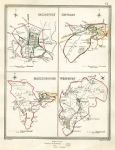
Wiltshire - Salisbury, Devizes, Marlborough & Westbury town plans, 1835

Wiltshire - Salisbury, Devizes, Marlborough & Westbury town plans, 1835.
"Salisbury", "Devizes", "Marlborough" and "Westbury" engraved by J. & C. Walker after plans by R.Creighton, published in Samuel Lewis's Topographical Dictionary of England, 1835. The plans were originally produced by Creighton to illustrate the 'former and present' boundaries of cities and boroughs in relation to the great Reform Act of 1832. Steel engraved antique map with original hand colour, coded to show the old and new boundaries. Slight foxing. Size 18.5 x 25 cms plus margins. Ref F2573


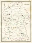
Wiltshire, 1835

Wiltshire, 1835.
"Wiltshire" engraved by J & C Walker after R. Creighton, published by Samuel Lewis in his Topographical Dictionary of England, 1835. Plain steel engraved antique map showing electoral divisions, places of election, polling places and the Borough Towns entitled to return Members of Parliament. Original hand colour. Size 18.5 x 25 cms plus margins. Ref F2572

 
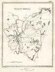
Westmoreland, Kirby Kendal town plan, 1835

Westmoreland, Kirby Kendal town plan, 1835.
"Kirby Kendal" engraved by J. & C. Walker after plans by R.Creighton, published in Samuel Lewis's Topographical Dictionary of England, 1835. The plans were originally produced by Creighton to illustrate the 'former and present' boundaries of cities and boroughs in relation to the great Reform Act of 1832. Steel engraved antique map with original hand colour, coded to show the old and new boundaries. Size 18 x 23.5 cms plus margins. Ref F2571

 
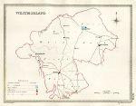
Westmoreland, 1835

Westmoreland, 1835.
"Westmoreland" engraved by J & C Walker after R. Creighton, published by Samuel Lewis in his Topographical Dictionary of England, 1835. Plain steel engraved antique map showing electoral divisions, places of election, polling places and the Borough Towns entitled to return Members of Parliament. Original hand colour. Size 23 x 18 cms plus margins. Ref F2570

 
« Previous | ...440 | 441 | 442 | 443 | 444 | 445 | 446 | 447 | 448 | 449 | 450... | Next »


© 2003 - 2020 Website copyright Steve Bartrick
Royalty free stock images of antique prints of interest to historians, students and family history researchers