Please see my main site ANTIQUEPRINTS.COM For original antique prints and maps
Charing Cross - 1837
Home » Topographical prints (named places) » England, prints and county maps >>> » All prints and maps
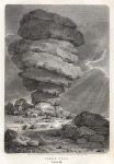
Cornwall, Cheesewring (rock formation, Bodmin Moor), 1804. "Cheese-wring, Cornwall" copper engraved print published in The Beauties of England and Wales, 1804. Size 10 x 16 cms including title, plus margins. Ref F1047
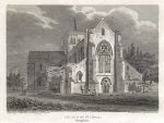
Hampshire, Church of St. Cross, 1804. "Church of St. Cross, Hampshire" copper engraved print published in The Beauties of England and Wales, 1804. Size 14.5 x 11 cms including title, plus margins. Ref F1046
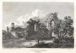
Hampshire, St. Dennis's Priory, 1804. "St. Dennis's Priory, Hampshire" copper engraved print published in The Beauties of England and Wales, 1804. Size 15.5 x 11 cms including title, plus margins. Ref F1045
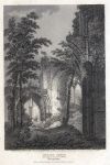
Hampshire, Netley Abbey, 1805. "Netley Abbey, Hampshire" copper engraved print published in The Beauties of England and Wales, 1805. Size 10.5 x 16.5 cms including title, plus margins. Ref F1044
Hampshire, Netley Castle and Abbey, 1808. "Netley Castle & Abbey, Hampshire" copper engraved print published in The Beauties of England and Wales, 1808. Size 16 x 11.5 cms including title, plus margins. Ref F1043
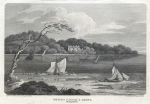
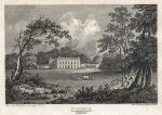
Hampshire, Cuffnells, 1805. "Cuffnells, Hampshire" copper engraved print published in The Beauties of England and Wales, 1805. Size 15.5 x 11 cms including title, plus margins. Ref F1042
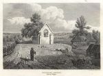
Isle of Wight, Shanklin Church, 1812. "Shanklin Church, Isle of Wight" copper engraved print published in The Beauties of England and Wales, 1812. Size 15 x 11 cms including title, plus margins. Ref F1041
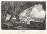
Hampshire, Freshwater Cave, 1807. "Freshwater Cave, Hampshire" copper engraved print published in The Beauties of England and Wales, 1807. Size 15.5 x 11 cms including title, plus margins. Ref F1040
Hereford, Chapter House ruins, 1803. "Remains of the Chapter House at Hereford" copper engraved print published in The Beauties of England and Wales, 1803. Size 10.5 x 16.5 cms including title, plus margins. Ref F1039
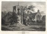
Hereford, Cross at the Monastery of the Black Friars, 1805. "Cross with part of the Monastery of Black Friars, Hereford" copper engraved print published in The Beauties of England and Wales, 1805. Size 15 x 11 cms including title, plus margins. Ref F1038
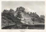
Herefordshire, Goodrich Castle, 1807. "Goodrich Castle, Herefordshire" copper engraved print published in The Beauties of England and Wales, 1807. Size 16 x 11.5 cms including title, plus margins. Ref F1037
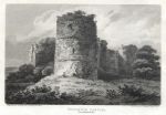
Herefordshire, Clifford Castle, 1805. "Clifford Castle, Herefordshire" copper engraved print published in The Beauties of England and Wales, 1805. Size 15.5 x 11 cms including title, plus margins. Ref F1036
Hampshire, Portsmouth, Portsea & Spithead, 1858. "Plan of Portsmouth, Portsea, Spithead and vicinity" published by A. Fullarton & Co. in The Imperial Gazetteer of England & Wales, 1858. Lithographic map, with original hand colour. Size 23.5 x 14 cms plus margins. Ref F1015
Yorkshire, Hull plan, 1858. "Hull" plan published by A. Fullarton & Co. in The Imperial Gazetteer of England & Wales, 1858. Lithographic map, with original hand colour. Size 23 x 13.5 cms plus margins. Ref F1013
Yorkshire, Hartlepool & Whitby, 1858. "Hartlepool & Whitby" published by A. Fullarton & Co. in The Imperial Gazetteer of England & Wales, 1858. Pair of lithographic maps on one sheet, with original hand colour. Size 23 x 13.5 cms plus margins. Ref F1012
Devon, Plymouth Sound, 1858. "Plymouth Sound" (with Devonport) published by A. Fullarton & Co. in The Imperial Gazetteer of England & Wales, 1858. Lithographic map with original hand colour. Size 14 x 23.5 cms plus margins. Ref F1011
Scilly Isles, 1858. "Scilly Isles" and "Portland" published by A. Fullarton & Co. in The Imperial Gazetteer of England & Wales, 1858. Lithographic map with original hand colour. Size 23 x 13.5 cms plus margins. Ref F1010
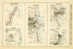
Ports on the East Coast of England (Grimsby, Sunderland, Harwich, Scarborough & Goole) 1858. "Ports & Harbours on the East Coast of England" published by A. Fullarton & Co. in The Imperial Gazetteer of England & Wales, 1858. With plans of Grimsby, Harwich, Sunderland, Scarborough and Goole. Lithographic map with original hand colour. Size 23 x 15.5 cms plus margins. Ref F1009
© 2003 - 2020 Website copyright Steve Bartrick Royalty free stock images of antique prints of interest to historians, students and family history researchers