Home » Antique maps » Europe maps >>> » All prints and maps

 
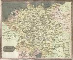
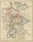
Germany map, 1817

Germany map, 1817.
"Germany divided into Circles" engraved by T.Clerk, published in A New and Complete System of Modern Geography, 1817. Copper engraved antique map, lower margin close trimmed, otherwise good condition. Size 23.5 x 19.5 cms including title, plus margins. Ref H7076

 
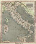
Italy map, 1817

Italy map, 1817.
"Italy" anonymous engraver, published in A New and Complete System of Modern Geography, 1817. Copper engraved antique map, good condition. Size 19.5 x 24.5 cms including title, plus margins. Ref H7075

 
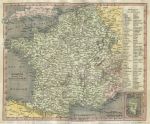
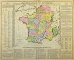
France map, 1817

France map, 1817.
"France divided into Departments" engraved by T.Clerk, published in A New and Complete System of Modern Geography, 1817. Copper engraved antique map, narrow lower margin, otherwise good condition. Size 24 x 20 cms including title, plus margins. Ref H7072


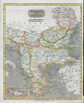
Turkey in Europe (Balkans) map, 1817

Turkey in Europe (Balkans) map, 1817.
"Turkey in Europe" engraved by T.Clerk, published in A New and Complete System of Modern Geography ..., 1817. Copper engraved antique map with recent hand colouring, narrow right margin, otherwise good condition. Size 19.5 x 24.5 cms, plus margins. Ref H6788

 
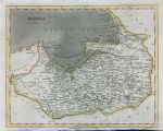
Prussia map, 1817

Prussia map, 1817.
"Prussia" engraved by T.Clerk, published in A New and Complete System of Modern Geography ..., 1817. Copper engraved antique map with recent hand colouring, narrow lower margin, otherwise good condition. Size 24 x 19 cms, plus margins. Ref H6787

 
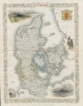
Denmark, Tallis/Rapkin map, 1853

Denmark, Tallis/Rapkin map, 1853.
"Denmark" classic decorative Tallis/Rapkin map published in Tallis's The Illustrated Atlas ..., about 1853. Steel engraved map with original outline hand colour and further recent hand colour to the vignettes. The decorative vignettes include Copenhagen and Sleswig. Centrefold as published, creasing near centrefold, otherwise good condition with good margins. Size 25 x 34 cms including decorative border, plus margins. Ref H6699


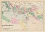
The Scripture World, distances from Jerusalem, Hardesty, 1883

The Scripture World, distances from Jerusalem, Hardesty, 1883.
"The Scripture World giving Distances from Jerusalem" chromo-lithographic map showing the the Eastern Mediterranean, with distances from Jerusalem. Published by H.H.Hardesty in Hardesty's Historical & Geographical Encyclopedia, 1883. Slight age browning, printed on the verso, otherwise good condition. Size 34.5 x 24 cms including inscription, plus margins. Ref H6684

 
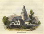
Surrey, Shalford Old Church, 1845

Surrey, Shalford Old Church, 1845.
"Shalford Old Church" anonymous artist/engraver, published in A Topographical History of Surrey, 1845. Wood engraved antique print, with recent hand colour. On a page of text with text on the reverse. Good condition. Size 11.5 x 9 cms including inscription, plus margins. Ref H6540

 
Germany map, 1856

Germany map, 1856.
"Germany" engraved by the Omnigraph by F.P.Becker & Co., published published in Becker’s Omnigraph Atlas of Modern Geography, about 1856. Steel engraved map with original hand colouring. Good condition. Size 19 x 24.5 cms plus margins. Ref H6537


France, battle sites, Lavoisne Atlas, 1830

France, battle sites, Lavoisne Atlas, 1830.
"Geographical and Statistical Map of France. Places Remarkable for Battles and Sieges, Indicated by a Flag" engraved after a map by C.Gros, published in Lavoisne's Complete ... Geographical Atlas, 1830 (map dated 1828.) Copper engraved antique map with original hand colouring. Centrefold as published. Size 52 x 42 cms plus margins. Ref H6445

 
Turkey map, 1820

Turkey map, 1820.
"Environs of Constantinople" (Turkey & Greece) engraved by J.Picken after Arrowsmith, published in Rees's Cyclopedia; or, Universal Dictionary ..., 1820. Copper engraved antique map with recent hand colouring, centrefold as published, good condition. Size 40.5 x 25.5 cms, plus margins. Ref H6352

 
Hungary map, 1820

Hungary map, 1820.
"Hungary" engraved by Cooper after Arrowsmith, published in Rees's Cyclopedia; or, Universal Dictionary ..., 1820. Copper engraved antique map with recent hand colouring, centrefold as published, good condition. Size 40 x 25.5 cms, plus margins. Ref H6351


Prussia map, 1820

Prussia map, 1820.
"Prussia" engraved by Lowry after Arrowsmith, published in Rees's Cyclopedia; or, Universal Dictionary ..., 1820. Copper engraved antique map with recent hand colouring, centrefold as published, good condition. Size 37.5 x 24.5 cms, plus margins. Ref H6350

 
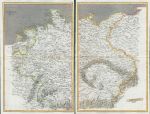
Germany map on two sheets, 1820

Germany map on two sheets, 1820.
"Germany" drawn & engraved by John Cooke, published in Rees's Cyclopedia; or, Universal Dictionary ..., 1820. Pair of copper engraved antique maps with recent hand colouring, centrefolds as published, good condition. Size 25.5 x 39.5 cms each, plus margins. Ref H6349

 
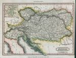
Austrian Dominions, 1817

Austrian Dominions, 1817.
"Austrian Dominions" engraved by A.Findlay, published in an encyclopedia, 1817. Copper engraved antique map with recent hand colour. Very narrow right margin. Size 25 x 19 cms including title, plus margins. Ref H6303


North Wales map on two sheets, by Walker, 1846

North Wales map on two sheets, by Walker, 1846.
"North Wales" by John & Charles Walker, published in their British Atlas, about 1846. Pair of steel engraved antique maps with original hand colouring. Each has a centrefold as published. Some splitting and weakness along the fold of the left hand (west) map, otherwise good condition with good margins. Size 32.5 x 39 cms each, plus margins. Ref H6296

 
Portugal map, 1820

Portugal map, 1820.
"Portugal" engraved by Lowry after Arrowsmith, published in Rees's Cyclopedia; or, Universal Dictionary ..., 1820. Copper engraved antique map with recent hand colouring, centrefold as published, good condition. Size 22 x 40.5 cms, plus margins. Ref H6143

 
Switzerland map, 1820

Switzerland map, 1820.
"Switzerland" engraved by John Cooke after Arrowsmith, published in Rees's Cyclopedia; or, Universal Dictionary ..., 1820. Copper engraved antique map with recent hand colouring, centrefold as published, good condition. Size 39 x 25.5 cms, plus margins. Ref H6142

 
« Previous | 10 | 11 | 12 | 13 | 14 | 15 | 16 | 17 | 18 | 19 | 20... | Next »


© 2003 - 2020 Website copyright Steve Bartrick
Royalty free stock images of antique prints of interest to historians, students and family history researchers