Home » Antique maps » Europe maps >>> » Spain and Portugal antique maps

 
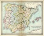
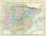
Spain & Portugal, 1834

Spain & Portugal, 1834.
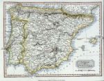
"Spain and Portugal" drawn and engraved by Alex Findlay, published by Thomas Kelly in 1834. Steel engraved map with original hand colouring. Centrefold as published with some age browning down the fold. Size 24.5 x 20 cms plus good margins. Ref E3620

 
Spain & Portugal, Delamarche, 1826

Spain & Portugal, Delamarche, 1826.
"Espagne et Portugal" by Delamarche, published in his Atlas de La Geographie Ancienne et Moderne, 1826. Copper engraved map with original hand colouring. Centrefold as published. Some traces of old pencil annotations. Plate mark and good margins. Size 33 x 26 cms plus margins. Ref E3253

 
Spain & Portugal, 1868

Spain & Portugal, 1868.
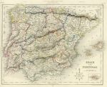
"Spain & Portugal" drawn and engraved by John Archer, published in The National Encyclopedia Atlas, 1868. Lithographic map with full original hand colouring, centrefold as published. Lower 3 cms of centrefold split (no loss), otherwise good condition. Size 29 x 23 cms plus margins. Ref E3176


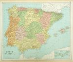
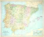
Spain and Portugal, 1864

Spain and Portugal, 1864.
" Spain and Portugal " by J.Bartholomew, published in Philips' Imperial Library Atlas (edited by William Hughes), London, 1864. Large chromo-lithographic map, centrefold as published, inset map of the Canary Islands. Some soiling and edge browning. Size 61 x 50 cms. Ref E2760

 
Spain & Portugal, 1818

Spain & Portugal, 1818.
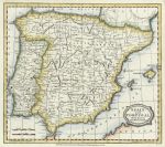
" Spain and Portugal " engraved by A.Findlay(?) and published by Thomas Kelly in A New and Complete System of Universal Geography, 1818. Copper engraved map with recent hand colouring. Close trimmed right margin, otherwise good condition. Size 25 x 18.5 cms. Ref E2727

 
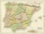
Spain & Portugal, College Atlas, 1850

Spain & Portugal, College Atlas, 1850.
"Spain and Portugal" drawn and engraved by J.Archer, published in The College Atlas, about 1850. Steel engraved map with original outline hand colour. Centrefold as published. Good margins. Size 29 x 23 cms. Ref E2202


Spain & Portugal, Wyld General Atlas, about 1823

Spain & Portugal, Wyld General Atlas, about 1823.
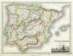
" Spain & Portugal " drawn by J. Wyld, engraved by N.R. Hewitt and published in Edinburgh by John Thompson & Co. in A General Atlas ... of the Several Empires, Kingdoms and States in the World, about 1823. Copper engraved map with recent hand colour. Small vignette of Bay of Lisbon lower right. Good condition. Size 29.5 x 22.5 cms. Ref E1397

 
Spain & Portugal map, 1809

Spain & Portugal map, 1809.
" Spain and Portugal from the Best Authorities " engraved by Barlow, published in The General Gazetteer, 1809. Copper engraved map with original outline hand colour. Good condition with good margins. Size 22.5 x 19.5 cms. Ref E1003

 
Spain & Portugal, 1853

Spain & Portugal, 1853.
" Spain & Portugal " engraved by Sidney Hall and published in Butler's Atlas of Modern Geography, 1853. Steel engraved map with original hand colour. Centrefold as published, age browning down fold. Size 27 x 20.5 cms. Ref E0511


Spain & Portugal, large map, 1856

Spain & Portugal, large map, 1856.
" Spain & Portugal " engraved by Sidney Hall, printed in colours by Fr. Schenck, Edinburgh and published by A & C Black, about 1856. Early chromo-lithographic map. Centrefold as published, good condition with good margins. Size 51 x 37.5 cms. Ref E376

 
Spain & Portugal, large map, 1867

Spain & Portugal, large map, 1867.
" Spain & Portugal " by W.Hughes FRGS, published in Philip's General Atlas of the World, 1867. Large colour lithographic map. Scanned detail showing part of the map. Centrefold as published, good margins. Size 60 x 50 cms. (NOTE - the large image is washed out due to being from a digital photo, see the detail for an accurate view of the map's colour and detail.) Ref D9573

 
Spain & Portugal, historical map, 711-1028 AD, 1880

Spain & Portugal, historical map, 711-1028 AD, 1880.
" Iberische Halbinsel von der Ankunft der Araber bis zum Untergangeder Omaijaden 711 bis 1028 " (arrival of the Arabs up to 1028 AD) by Spruner and Menke, published in the Spruner-Menke Hand-Atlas, Gotha, 1880. Finely detailed steel engraved map with original hand colouring. Inset map showing the period up to 1086 AD. Good condition with plate mark and good margins. Centrefold as published. Size 40 x 33.5 cms. Ref D6513


Spain & Portugal, 1863

Spain & Portugal, 1863.
" Spain & Portugal " by A.K.Johnston, colour lithographic map published by William Blackwood in Johnston's School Atlas of General & Descriptive Geography, 1863. Centrefold as published with closed tear of 1.5 cms to lower part of fold, just into neatline. Size 24.5 x 30.5 cms. Ref D6423

 
Spain & Portugal, 1877

Spain & Portugal, 1877.
" Espagne et Portugal " engraved by Erhard after Vuillemin, published in Atlas Universel D'Histoire et de Geographie, Paris, 1877. Lithographic map with original hand colour. Centre-fold as published. Size 26.5 x 20 cms. Ref D4581

 
Spain & Portugal, 1817

Spain & Portugal, 1817.
" Spain and Portugal " engraved by A.Findlay, published in History of the Revolution..., by T.Kelly, London, 1817. Copper engraved map with original hand colour. Slight soiling in margins. Size 24.5 x 18.5 cms. Ref D936

 
« Previous | 1 | 2 | 3 | 4 | 5 | Next »


© 2003 - 2020 Website copyright Steve Bartrick
Royalty free stock images of antique prints of interest to historians, students and family history researchers