Please see my main site ANTIQUEPRINTS.COM For original antique prints and maps
Charing Cross - 1837
Home » Antique maps » Europe maps >>> » Italy, antique maps
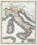
Italy, 1817. "Italy with the Alpine Country" engraved by T.Clerk, published in The History of the Wars of the French Revolution, 1817. Copper engraved map with recent hand colouring. Size 19 x 23.5 cms plus margins. Ref E4322
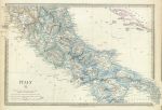
South Italy, 1830. "Italy II" (modern) engraved by J. & C. Walker, published by The Society for the Diffusion of Useful Knowledge (SDUK), 1830. Steel engraved map with original hand colour. Slight soiling, otherwise good condition with good margins, including small folding tab lower right. Size 38 x 25.5 cms plus margins. Ref E4294
Ancient south Italy, 1830. "Ancient Italy II" engraved by J. & C. Walker, published by The Society for the Diffusion of Useful Knowledge (SDUK), 1832. Steel engraved map with original hand colour. Good condition with good margins, including small folding tab lower right. Size 39 x 25 cms plus margins. Ref E4293
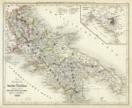
Southern Italy, 1852. "Die Königreich beider Sielien ..., 1849" published in Joseph Meyer's Neuster Zeitungs Atlas..., 1852. Detailed steel engraved map with original hand colour. Inset map of the Vesuvius - Naples area. Slight age browning, otherwise good condition with weak plate mark and good margins. Size 27 x 21.5 cms plus margins. Ref E3921
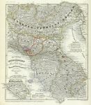
North Italy, 1852. "Die Staaten von Ober Italien ..., 1850" published in Joseph Meyer's Neuster Zeitungs Atlas..., 1852. Detailed steel engraved map with original hand colour. Very slight age browning and one fox mark lower right, otherwise good condition with weak plate mark and good margins. Size 25 x 18.5 cms plus margins. Ref E3919
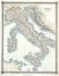
Italy, 1843. "Italy" engraved by Alex Findlay and published by Thomas Kelly in A New and Complete System of Universal Geography ..., London, 1843. Steel engraved map with recent hand colouring. Size 20 x 25 cms. Ref E3459
Italy, 1868. "Italy" drawn and engraved by John Archer, published in The National Encyclopedia Atlas, 1868. Pair of lithographic maps with full original hand colouring, centrefolds as published. Closed split to lower 4 cms of centrefold to Northern Italy map (no loss), otherwise good condition. Size 28.5 x 23 cms each plus margins. Ref E3181
Italy, 1864. " Italy " by J.Bartholomew, published in Philips' Imperial Library Atlas (edited by William Hughes), London, 1864. Chromo-lithographic maps on two large sheets, each with a centrefold as published, the northern map having an inset map of the Rome and Turin areas and the southern map of Naples and Malta. Slight soiling and edge browning to each map. Size 61 x 50 cms each. Ref E2759
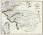
Italy, Piedmont etc, 1836. " The Protestant Valleys of Piedmont " drawn and engraved by T.Starling, published in The Waldenses, or Protestant Valleys of Piedmont & Dauphiny, 1836. Centered on Pignerol, with Turin to the east, insets showing Savoy and the Pays de Neff. Steel engraved map with recent hand colour. On thin paper with several (flattened) folds as published. Tear in right margin stopping short of the image area. Size 39.5 x 31 cms. Ref E2100
Italy, map on 2 sheets, 1850. " Italy " (north and south) drawn and engraved by J.Archer, published in The College Atlas, about 1850. Pair of steel engraved maps with original outline hand colour. Centrefolds as published. Slight soiling and centrefold split to lower 6 cms on the north Italy map (no loss). Good margins. Size 29 x 23 cms each. Ref E2056
Italy (Roman) on 2 maps, 1877. " Italia Superior " and " Italia Inferior " (Roman period) engraved by Erhard after Vuillemain, published in Atlas Universel D'Histoire et de Geographie, Paris, 1877. Lithographic maps with original hand colour. Both have centre-folds as published. Size 26.5 x 20 cms each. Ref D4378
© 2003 - 2020 Website copyright Steve Bartrick Royalty free stock images of antique prints of interest to historians, students and family history researchers