Please see my main site ANTIQUEPRINTS.COM For original antique prints and maps
Charing Cross - 1837
Home » Topographical prints (named places) » England, prints and county maps >>> » Bedfordshire antique prints and maps
Bedfordshire, Leighton Buzzard Cross, 1801. "Leighton Beaudesert Cross, Bedfordshire" copper engraved print published in The Beauties of England and Wales, 1801. Size 10 x 17 cms including title, plus margins. Ref F1689
Bedfordshire, Chicksand Priory, 1812. "Chicksand Priory, Bedfordshire" copper engraved print published in The Beauties of England and Wales, 1812. Size 15 x 11 cms including title, plus margins. Ref F1688
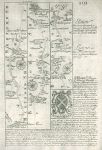
Hertford / Bedfordshire, route map with St.Albans, Bedford and Oakley, 1764. [ Route map with St.Albans, Bedford and Oakley ] by Emanuel Bowen after the earlier survey by John Ogilby, and published by John Owen in Britannia Depicta ..., 1764. On the verso is part of a route through Wellingborough, Kettering, Uppingham to Oakham. Copper engraved map. Size 12 x 18 cms plus margins. Ref F295
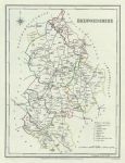
Bedfordshire, 1848. "Bedfordshire" engraved by J & C Walker after a map by R.Creighton, published in Lewis' Topographical Dictionary, 1848. Steel engraved map with original hand colour. Good condition. Size 17.5 x 23.5 cms plus good margins. Ref E9309
Bedfordshire, Elstow, Bunyan's Birthplace, 1843. "Birth place of Bunyan" steel engraved print with recent hand colour, published in The Youth's Magazine .., 1848. Size 12 x 8 cms including title, plus margins. Ref E8748
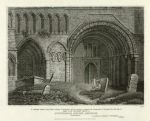
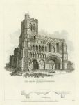
Bedfordshire, Dunstable Priory Church western front, 1830. "Part of the Western front of Dunstable Priory Church, Bedfordshire" copper engraved print by J.Roffe after a drawing by G.Arnold, published in Britton's Architectural Antiquities of Great Britain, 1830. Slight age browning. Size 20 x 16 cms including title, plus good margins. Ref E8212
Bedfordshire, Dunstable Priory Church, 1830. "The Western front of The Priory Church, Dunstable, Bedfordshire" copper engraved print by A.Birrol after a drawing by S.Prout, published in Britton's Architectural Antiquities of Great Britain, 1830. Slight age browning. Size 15 x 20 cms including title, plus good margins. Ref E8210
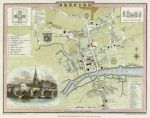
Bedford plan, Cole & Roper, 1807. "Bedford" engraved by J.Roper from a drawing by G.Cole, published in The Beauties of England & Wales, 1806. A clear early impression copper engraved plan with recent hand colouring. Size 28.5 x 18.5 cms plus good margins. Ref E8099
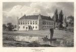
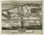
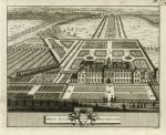
Bedfordshire, Wrest House, Van der Aa, 1708. "Wrest House, Bedfordshire" by Pieter Van der Aa, published in Lieden, about 1708. Original copper engraved antique print, good condition with partial plate mark and good margins. Size 16 x 12.5 cms plus margins. Ref E6112
Bedfordshire, Wrest House, Van der Aa, 1708. "Wrest House, Bedfordshire" by Pieter Van der Aa, published in Lieden, about 1708. Original copper engraved antique print, good condition with partial plate mark and good margins. Size 16 x 12.5 cms plus margins. Ref E6111
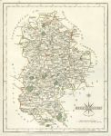
Bedfordshire, 1787. "Bedfordshire" by John Cary. Copper engraved antique map with original hand colouring published in the 1787 edition of Cary's New and Correct English Atlas. Good margins. Slight traces of red pencil in map area. Size 21.5 x 26.5 cms plus margins. Ref E5726
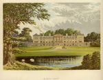
Bedfordshire, Woburn Abbey, 1880. "Woburn Abbey" chromolithograph published in Morris's County Seats ..., about 1880. Good condition. Size 19 x 13 cms plus title and margins. Ref E4532
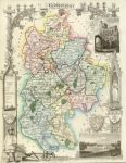
Bedfordshire, Moule 1st edition, 1837. " Bedfordshire " engraved by W.Schmollinger, published in Thomas Moule's English Counties ..., 1837. Steel engraved map with original hand colour. Very scarce in this first state. Lower margin close trimmed with slight loss of engraver's inscription, otherwise good condition. Size 20 x 27 cms. Ref E2647
Bedfordshire, Lewis, 1831. " Bedfordshire " drawn by R.Creighton, engraved by J&C Walker for Lewis' Topographical Dictionary published in 1831. Steel engraved map with recent hand colour. Size 18 x 23.5 cms. Ref D3743
Bedfordshire, Pigot, 1840. " Bedfordshire " engraved by I.Slater and published in I.Slater's New British Atlas (a later edition of Pigot and Co.'s British Atlas), 1857. Fine steel engraved map with original hand colouring. Detail showing the Luton area. Size 22.5 x 35.5 cms. Ref D3637
Bedfordshire, Cary, 1793. " Bedfordshire " by John Cary, published in his New and Correct English Atlas, 1793. Copper engraved map with original hand colour. Detail showing the Bedford area. Very slightly soiled and narrow left margin, otherwise good condition. Size 21.5 x 26.5 cms. Ref D3588
Bedfordshire, Moule, 1850. " Bedfordshire " by Thomas Moule, published in James Barclay's Complete and Universal Dictionary ..., about 1848. Decorative steel engraved map with recent hand colour. The vignettes show Dunstable priory and Woburn Abbey. Detail showing the Bedford area. Close trimmed to top and bottom margins with no loss (these maps were often tightly trimmed by the publishers). Size 20.5 x 26.5 cms. Ref D1941
Bedfordshire, Shelton Church, 1825. " Shelton Church S. " stone lithograph by J. B. Ladbrooke, dated 1822. Large crudely repaired tear upper middle and some very slight soiling. Size 24.5 x 15.5 cms. Ref 5804
© 2003 - 2020 Website copyright Steve Bartrick Royalty free stock images of antique prints of interest to historians, students and family history researchers