Home » Antique maps » Canada antique maps

 
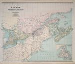
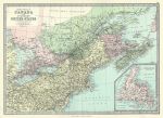
Canada, 1867

Canada, 1867.
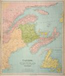
"Canada, New Brunswick, Nova Scotia, Cape Breton Island, Prince Edward Island and Newfoundland" by J.Bartholomew, published in Philip's General Atlas of the World, 1867. Inset map of Newfoundland. Large colour lithographic map with centrefold as published, good condition. Size 61 x 51 cms plus margins. (NOTE - this image is from a digital camera and is not as clear as a scan.) Ref F1369

 
Canada, Plan of the City and Fortifications of Louisburg, about 1750

Canada, Plan of the City and Fortifications of Louisburg, about 1750.
"A Plan of the City and Fortifications of Louisburg. taken from a Survey made by Mr. Gridley Liut. Coll. of Artillery in 1845" and "A View of Fort St.Louis on the East Side of ye Isle of Senegal" anonymous engraver, copper engraved map published about 1850, recent hand colour. Size 11 x 18 cms plus narrow margins. Ref F663

 
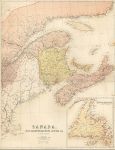
Canada, NB & NS, 1857

Canada, NB & NS, 1857.
"Canada, New Brunswick, Nova Scotia &c. East Sheet" large chromolithographic map by J Bartholomew, published by A & C Black, Edinburgh, about 1855. Centrefold as published, split of about 2 cms to left side of fold, without loss. Size 41.5 x 54 cms plus good margins. Ref F591


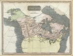
British Posessions in North America, 1825

British Posessions in North America, 1825.
"British Posessions in America" anonymous engraver, published by E.Khull & Co. of Glasgow in The Glasgow Geography, 1825. Copper engraved map with recent hand colour. Two folds as published, some age browning and slight soiling . Size 25.5 x 20 cms plus margins. Ref E9842

 
Canada, Siege of Louisburg 1745 and 1758, published 1863

Canada, Siege of Louisburg 1745 and 1758, published 1863.
"Siege of Louisburg .. 1745" and "Siege of Louisburg by the British Forces July 1758" lithographic antique map published in History of the United States of America, 1863. Recent hand colouring. Size 23.5 x 14.5 cms plus good margins. Ref E9444

 
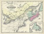
Canada, New Brunswick, Nova Scotia etc., 1860

Canada, New Brunswick, Nova Scotia etc., 1860.
"Canada, New Brunswick, Nova Scotia etc." drawn by J. Wells, engraved by Geo. E. Sherman and published in McNally's System of Geography, 1860. Lithographic map with original hand colour. Text on verso, good condition. Size 27 x 21.5 cms plus margins. Ref E9400


Canada, Western, 1895

Canada, Western, 1895.
"Canada, Western" colour lithographic map published in The Times Atlas, 1895. Size 23.5 x 37 cms plus margins. Ref E9358

 
Canada, Eastern, 1895

Canada, Eastern, 1895.
"Canada, Eastern" colour lithographic map published in The Times Atlas, 1895. Size 36 x 24 cms plus margins. Ref E9357

 
Eastern Canada & North East United States, 1885

Eastern Canada & North East United States, 1885.
"Eastern Provinces of Canada and Northern United States" by J.Bartholomew. Colour lithographic map published in The Popular Atlas of the World, 1885. Centrefold as published, good condition. Size 41 x 29 cms plus good margins. Ref E8112


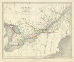
Canada, 1846

Canada, 1846.
"Canada" drawn and engraved by J. Gellatly, published in Chambers Atlas for the People .., 1846. Steel engraved map with original hand colouring. Some foxing. Size 25 x 20.5 cms plus good margins. Ref E7882

 
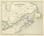
British Posession North America (Canada), 1846

British Posession North America (Canada), 1846.
"Principal British Posession North America" drawn and engraved by J. Gellatly, published in Chambers Atlas for the People .., 1846. Steel engraved map with original hand colouring. Very slight soiling. Size 25 x 21 cms plus good margins. Ref E7880

 
Canada, Wellington Channel, 1856

Canada, Wellington Channel, 1856.
"Wellington Channel, Melville Island &c." drawn and engraved from an Admiralty chart, published by A. Fullarton & Co. in a gazetteer, about 1856. Steel engraved map with original hand colour. Size 23.5 x 11 cms plus margins. Ref E7672


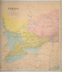
Canada, western, large map, 1864

Canada, western, large map, 1864.
"Canada, West Sheet" by J.Bartholomew, published in Philips' Imperial Library Atlas (edited by William Hughes), London, 1864. Large chromo-lithographic antique map, centrefold as published. Moderate soiling and edge browning. Size 53 x 61 cms plus margins of 1 cm or more. Ref E5510

 
Canada, eastern, large map, 1864

Canada, eastern, large map, 1864.
"Canada, New Brunswick, Nova Scotia, Cape Breton Island, Prince Edward Island and Newfoundland" by J.Bartholomew, published in Philips' Imperial Library Atlas (edited by William Hughes), London, 1864. Large antique chromo-lithographic map, centrefold as published. Inset map of Newfoundland. Moderate soiling and edge browning. Size 52 x 62 cms plus margins of 1 cm or more. Ref E5509

 
Canada, Manitoba, large map, 1887

Canada, Manitoba, large map, 1887.
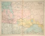
"Manitoba" (with some of Ontario and the United States) published in Stanford's London Atlas of Universal Geography, 1887. Large chromolithographic antique map with centrefold as published. Size 61 x 47 cms plus good margins. (Note - this is a digital camera image with uneven lighting that accentuates the slight browning on the fold.) Ref E5486


Canada, Quebec, Ontario, New Brunswick &c., very large map, 1887

Canada, Quebec, Ontario, New Brunswick &c., very large map, 1887.
"Quebec, Ontario, New Brunswick, Nova Scotia, Prince Edward Is., Newfoundland, with the Adjacent parts of the United States" by J.Arrowsmoth, published in Stanford's London Atlas of Universal Geography, 1887. Pair of large chromolithographic antique maps, each with centrefold as published, designed such that they can be joined. Slight damage to one centrefold (without loss.) Size 48 x 61 cms each, plus good margins. (Note - this is a digital camera image with uneven lighting that accentuates the slight browning on the fold.) Ref E5485

 
Canada, 1856

Canada, 1856.
"Canada, New Brunswick, Nova Scotia &c. East Sheet" and "Canada, West Sheet" engraved by J.Bartholomew, printed in colours by Fr. Schenck, Edinburgh and published by A & C Black, about 1856. Pair of early chromo-lithographic maps, inset map of the Montreal environs on the west sheet. Centrefolds as published, good condition. Size 41 x 50 cms each. Ref E4756 (Note - this is a digital camera image which lacks the clarity of my normal scanned images)

 
Canada, Schenck/Bartholomew/Black, 1856

Canada, Schenck/Bartholomew/Black, 1856.
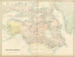
"British America" engraved by J.Bartholomew, printed in colours by Fr. Schenck, Edinburgh and published by A & C Black, about 1856. Early chromo-lithographic map. Centrefold as published, good condition with good margins. Size 56 x 43 cms. Ref E415

 
« Previous | 1 | 2 | 3 | 4 | 5 | Next »


© 2003 - 2020 Website copyright Steve Bartrick
Royalty free stock images of antique prints of interest to historians, students and family history researchers