Home » Antique maps » Europe maps >>> » Scotland, antique maps

 
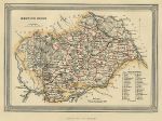
Scotland, Berwickshire, 1865

Scotland, Berwickshire, 1865.
"Berwickshire" published by A.Fullarton & Co. in The Imperial Gazetteer of Scotland, 1865. Lithographic antique map with original hand colour. Size 17.5 x 12.5 cms plus good margins. Ref E5348

 
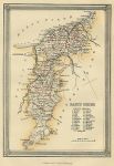
Scotland, Banffshire, 1865

Scotland, Banffshire, 1865.
"Banffshire" published by A.Fullarton & Co. in The Imperial Gazetteer of Scotland, 1865. Lithographic antique map with original hand colour. Size 12.5 x 17.5 cms plus good margins. Ref E5347

 
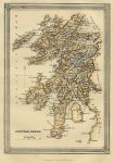
Scotland, Argyleshire, 1865

Scotland, Argyleshire, 1865.
"Argyleshire" published by A.Fullarton & Co. in The Imperial Gazetteer of Scotland, 1865. Lithographic antique map with original hand colour. Size 12.5 x 17.5 cms plus good margins. Ref E5345


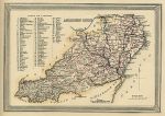
Scotland, Aberdeenshire, 1865

Scotland, Aberdeenshire, 1865.
"Aberdeenshire" published by A.Fullarton & Co. in The Imperial Gazetteer of Scotland, 1865. Lithographic antique map with original hand colour. Size 17.5 x 12.5 cms plus good margins. Ref E5344

 
Scotland, Ports & Harbours on the Nort East coast, 1865

Scotland, Ports & Harbours on the Nort East coast, 1865.
"Ports and Harbours on the North East coast of Scotland" drawn and engraved by G.H.Swanston, published by A. Fullarton & Co. in The Imperial Gazetteer of Scotland, about 1865. Shows Peterhead, Boddam and Aberdeen. Lithographic antique map with original hand colour. Size 13 x 22 cms. Ref E5165

 
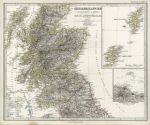
Scotland, 1869

Scotland, 1869.
"Grossbritannien ... Schottland u. der Nordlichste Theil England's" published in Adolf Stieler's Hand Atlas Uber Alle Theile Der Erde ..., 1869. Extremely detailed steel engraved map with original hand colour, centrefold as published. Inset map of the Orkney and Shetland Isles, also inset plan of Edinburgh and Leith area. Very light soiling, stain in lower left margin. Size 40.5 x 33 cms, plus margins. Ref E4340


Scotland, Ports and Harbours on the north east coast, 1856

Scotland, Ports and Harbours on the north east coast, 1856.
"Ports and Harbours on the North East coast of Scotland" drawn and engraved by G.H.Swanston, published by A. Fullarton & Co. in a gazetteer, about 1856. Shows Peterhead, Boddam and Aberdeen. Steel engraved map with original hand colour. Uniform age browning. Size 13 x 22 cms. Ref E4308

 
Scotland, 1864

Scotland, 1864.
" Scotland " by J.Bartholomew, published in Philips' Imperial Library Atlas (edited by William Hughes), London, 1864. Chromo-lithographic maps on two large sheets, each with a centrefold as published, the southern map having an inset map of the Edinburgh area and the northern map of the Shetlands. Slight soiling and edge browning to each map. Size 61 x 50 cms each. Ref E2758

 
Scotland, Linlithgowshire, 1857

Scotland, Linlithgowshire, 1857.
" Linlithgow Shire " published by A.Fullarton & Co. in The Imperial Gazetteer of Scotland, 1857. Lithographic map with original hand colour. Size 17 x 12 cms. Ref C9268

 
« Previous | 1 | 2 | 3 | 4 | 5 | Next »


© 2003 - 2020 Website copyright Steve Bartrick
Royalty free stock images of antique prints of interest to historians, students and family history researchers