Please see my main site ANTIQUEPRINTS.COM For original antique prints and maps
Charing Cross - 1837
Home » All prints and maps
Germany, The Lurley Berg near St.Goar, 1832. "The Lurley Berg near St.Goar" steel engraved print after a picture by W.Tombleson, published in Tombleson's Views of the Rhine, 1832. Good condition. Size about 15.5 x 11 cms including title, plus margins. Ref F8645
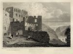
Germany, Ruins of Rheinfels, 1832. "Ruins of Rheinfels" steel engraved print after a picture by W.Tombleson, published in Tombleson's Views of the Rhine, 1832. Good condition. Size about 15.5 x 11 cms including title, plus margins. Ref F8644
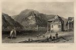
Germany, St.Goarhausen and Ruins of the Katze, 1832. "St.Goarhausen and Ruins of the Katze" steel engraved print after a picture by W.Tombleson, published in Tombleson's Views of the Rhine, 1832. Good condition. Size about 15.5 x 11 cms including title, plus margins. Ref F8643
Germany, St.Goar and Ruins of Fort Rheinfels, 1832. "St.Goar and Ruins of Fort Rheinfels" steel engraved print after a picture by W.Tombleson, published in Tombleson's Views of the Rhine, 1832. Good condition. Size about 15.5 x 11 cms including title, plus margins. Ref F8642
Germany, Bornhofen & Ruins of the Brothers, 1832. "Bornhofen & Ruins of the Brothers" steel engraved print after a picture by W.Tombleson, published in Tombleson's Views of the Rhine, 1832. Good condition. Size about 15.5 x 11 cms including title, plus margins. Ref F8641
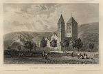
Germany, Boppart Church, 1832. "Boppart Church" steel engraved print after a picture by W.Tombleson, published in Tombleson's Views of the Rhine, 1832. Good condition. Size about 15.5 x 11 cms including title, plus margins. Ref F8640
Germany, Boppart, 1832. "Boppart" steel engraved print after a picture by W.Tombleson, published in Tombleson's Views of the Rhine, 1832. Good condition. Size about 15.5 x 11 cms including title, plus margins. Ref F8639
Germany, Braubach and the Marksburgh, 1832. "Braubach and the Marksburgh" steel engraved print after a picture by W.Tombleson, published in Tombleson's Views of the Rhine, 1832. Good condition. Size about 15.5 x 11 cms including title, plus margins. Ref F8638
Germany, Lahneck Castle, 1832. "Lahneck Castle" steel engraved print after a picture by W.Tombleson, published in Tombleson's Views of the Rhine, 1832. Good condition. Size about 15.5 x 11 cms including title, plus margins. Ref F8637
Germany, St.John's Church, near Niederlahnstein, 1832. "St.John's Church, near Niederlahnstein" steel engraved print after a picture by W.Tombleson, published in Tombleson's Views of the Rhine, 1832. Good condition. Size 15 x 11 cms including title, plus margins. Ref F8636
Germany, Oberlanstein, 1832. "Oberlanstein" steel engraved print after a picture by W.Tombleson, published in Tombleson's Views of the Rhine, 1832. Good condition. Size 15.5 x 12 cms including title, plus margins. Ref F8635
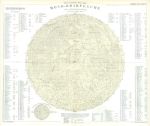
Moon map, 1877. "Die sichtbare Seite der Mond-Oberflache ..." (map of the moon) published in Adolf Stieler's Hand Atlas Uber Alle Theile Der Erde ..., 1877. Detailed steel engraved map with lithographic colour, centrefold as published. Good condition with good margins. Size 40.5 x 34.5 cms, plus margins with plate mark. Ref F8634
Solar System chart, 1877. "Planeten-System der Sonne" (Solar System) published in Adolf Stieler's Hand Atlas Uber Alle Theile Der Erde ..., 1877. Detailed steel engraved map with hand colour, centrefold as published. Good condition with good margins. Size 35 x 32.5 cms, plus margins with plate mark. Ref F8633
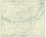
Star Chart for Southern Hemisphere, 1877. "Der Sudliche Stern-Himmel" (Star Chart for Northern Hemisphere) published in Adolf Stieler's Hand Atlas Uber Alle Theile Der Erde ..., 1877. Detailed steel engraved map with lithographic colour, centrefold as published. Good condition with good margins. Size 36.5 x 29.5 cms, plus margins with plate mark. Ref F8632
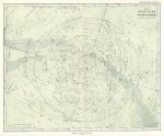
Star Chart for Northern Hemisphere, 1877. "Der Nordliche Stern-Himmel" (Star Chart for Northern Hemisphere) published in Adolf Stieler's Hand Atlas Uber Alle Theile Der Erde ..., 1877. Detailed steel engraved map with lithographic colour, centrefold as published. Good condition with good margins. Size 35 x 29 cms, plus margins with plate mark. Ref F8631
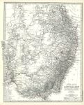
South East Australia map, 1877. "Sud-Ost Australien" (Australia) published in Adolf Stieler's Hand Atlas Uber Alle Theile Der Erde ..., 1877. Very detailed steel engraved map with original hand colour, centrefold as published. Good condition with good margins. Size 34.5 x 41 cms, plus margins with plate mark. Ref F8630
South West Germany map, 1877. "Sud-West Deutschland und Schweiz, Nordlicher Theil" (South West Germany and Switzerland, northern part) published in Adolf Stieler's Hand Atlas Uber Alle Theile Der Erde ..., 1877. Very detailed steel engraved map with original hand colour, centrefold as published. Inset maps of the Metz & Strasburg areas.Good condition with good margins. Size 40 x 35 cms, plus margins with plate mark. Ref F8629
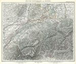
South West Germany and Switzerland map, 1877. "Sud-West Deutschland und Schweiz, Sudlicher Theil" (South West Germany and Switzerland, southern part) published in Adolf Stieler's Hand Atlas Uber Alle Theile Der Erde ..., 1877. Very detailed steel engraved map with original hand colour, centrefold as published. Good condition with good margins. Size 41 x 34 cms, plus margins with plate mark. Ref F8628
© 2003 - 2020 Website copyright Steve Bartrick Royalty free stock images of antique prints of interest to historians, students and family history researchers