Home » All prints and maps

 
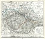
South East Germany map, 1877

South East Germany map, 1877.
"Ostliches Deutschland sowie Bohmen, Mahren, ind Oesterreichisch Schlesien" (Germany) published in Adolf Stieler's Hand Atlas Uber Alle Theile Der Erde ..., 1877. Very detailed steel engraved map with original hand colour, centrefold as published. Good condition with good margins. Size 35.5 x 30 cms, plus margins. Ref F8392

 
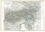
South West Austria map, 1877

South West Austria map, 1877.
"Oesterreich, Sud Westlicher Theil" (Austria) published in Adolf Stieler's Hand Atlas Uber Alle Theile Der Erde ..., 1877. Very detailed steel engraved map with original hand colour, centrefold as published. Good condition with good margins. Size 41 x 29 cms, plus margins. Ref F8391

 
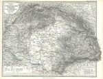
Hungary map, 1877

Hungary map, 1877.
"Lander der Ungarischen Krone: Ungarn, Siebenburgen, Slavonien und ein Theil von Kroatien" published in Adolf Stieler's Hand Atlas Uber Alle Theile Der Erde ..., 1879. Extremely detailed steel engraved map with original hand colour, centrefold as published. Small inset plan of Budapest. Good condition with good margins. Size 43 x 35 cms, plus margins. Ref F8390


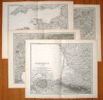
France, detailed map on 4 sheets, 1877

France, detailed map on 4 sheets, 1877.
"Frankreich in 4 Blattern" (France) after A.Petermann, published in Adolf Stieler's Hand Atlas Uber Alle Theile Der Erde ..., 1877. Set of 4 very detailed steel engraved maps with original hand colour, centrefolds as published. One inset map of the Paris area. Size 41 x 34 cms each, plus margins. Ref F8389

 
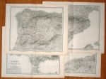
Spain & Portugal, detailed map on 4 sheets, 1877

Spain & Portugal, detailed map on 4 sheets, 1877.
"Spanien und Portugal in 4 Blattern" (Spain & Portugal) after A.Petermann, published in Adolf Stieler's Hand Atlas Uber Alle Theile Der Erde ..., 1877. Set of 4 very detailed steel engraved maps with original hand colour, centrefolds as published. One inset map of the Madrid area. Size 41 x 34 cms each, plus margins. Ref F8388

 
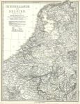
Holland & Belgium map, 1877

Holland & Belgium map, 1877.
"Niederlande und Belgium" published in Adolf Stieler's Hand Atlas Uber Alle Theile Der Erde ..., 1877. Very detailed steel engraved map with original hand colour, centrefold as published. Good condition with good margins. Size 32 x 43 cms, plus margins with plate mark. Ref F8387


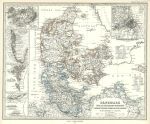
Denmark and dependencies map, 1877

Denmark and dependencies map, 1877.
"Danemark und die Danischen Kolonien ..." published in Adolf Stieler's Hand Atlas Uber Alle Theile Der Erde ..., 1877. Very detailed steel engraved map with original hand colour, centrefold as published. Inset maps of Iceland, Greenland, Faroe Islands, part of the West Indies and a plan of Copenhagen. Good condition with good margins. Size 41 x 33 cms, plus margins with plate mark. Ref F8386

 
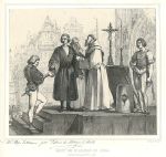
'Mort de Dn. Alvaro de Luna (in 1453), stone lithograph after Madrazo, 1839

'Mort de Dn. Alvaro de Luna (in 1453), stone lithograph after Madrazo, 1839.
"Mort de Dn. Alvaro de Luna (Execute a Valladolid le 7 Juin 1453)" (Spanish history) stone lithograph by the Madrazo brothers, published in Album Cosmopolite, about 1839. Publisher's blind-stamp in margin below print. Damp stain upper right, just to image edge. Size 29 x 26 cms including title, plus good margins. Ref F8385

 
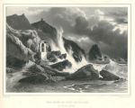
Coastal view with a shrine, stone lithograph after Biermann, 1839

Coastal view with a shrine, stone lithograph after Biermann, 1839.
"Vue Prise au Bord de la Mer" stone lithograph by A.St.Aulaire after a picture by E.Biermann of Berlin, published in Album Cosmopolite, about 1839. Publisher's blind-stamp in margin below print. Damp stain upper right, just to image edge. Size 29.5 x 24 cms including title, plus good margins. Ref F8384


Belgium - Lierre, and Notre Dame in Paris, stone lithographs after Durand, 1839

Belgium - Lierre, and Notre Dame in Paris, stone lithographs after Durand, 1839.
"Vue de Liere, prise d'Anvers" and "Vue de Notre Dame de Paris" stone lithographs by Andre Durand, published in Album Cosmopolite, about 1839. Publisher's blind-stamp in margin below print. Damp stain affecting upper part of Notre Dame view. Size 37 x 28 cms including title, plus good margins. Ref F8383

 
View of Amsterdam, stone lithograph after L.Meyer, 1835

View of Amsterdam, stone lithograph after L.Meyer, 1835.
"Vue d'Amsterdam, Prise de Saardam" stone lithograph by A.St.Aulaire after a picture by L.Meyer of Amsterdam, published in Album Cosmopolite, about 1835. Publisher's blind-stamp in margin below print. Size 26 x 22 cms including title, plus good margins. Ref F8382

 
'Quattre Dessins a la Plume', etchings, 1835

'Quattre Dessins a la Plume', etchings, 1835.
[ Quattre Dessins a la Plume ] four etchings after Kloeber, Schoppe, Wenzel and Matthey, published in Album Cosmopolite, about 1835. Publisher's blind-stamp in margin below print. Size 46 x 29 cms, plus good margins. Ref F8381


Austria, Country near Vienna, stone lithograph after Moesmer, 1835

Austria, Country near Vienna, stone lithograph after Moesmer, 1835.
"Paysage des Environs de Vienne" stone lithograph by Champin after a picture by Prof. Moesmer of Vienna, published in Album Cosmopolite, about 1835. Publisher's blind-stamp in margin below print. Size 27.5 x 24 cms including title, plus good margins. Ref F8380

 
Titlepage for '... Thirty Miles around London' with a view of London, 1839

Titlepage for '... Thirty Miles around London' with a view of London, 1839.
Titlepage for 'Select Illustrated Topography of Thirty Miles around London' with a general view of the city, engraved by W.Henshall after an original drawing by C.Marshall, published in 1839. Steel engraved antique print with recent hand colour. Size 12 x 19 cms including titles, plus margins. Ref F8378

 
Titlepage for 'Wood's Views in London ...' with the Monument, 1838

Titlepage for 'Wood's Views in London ...' with the Monument, 1838.
Titlepage for 'Wood's Views in London ...' with the "Monument and St.Magnus Church" engraved by John Woods after an original drawing by Shepherd, published in The History of London: Illustrated by Views in London & Westminster, (known as 'Wood's Views in London'), 1838. Steel engraved antique print with recent hand colour. Size 10.5 x 21 cms including titles, plus margins. Ref F8377


Francis Grose (antiquary), 1786

Francis Grose (antiquary), 1786.
"Francis Grose Esq. F.A.S" engraved by Bartolozzi after a portrait by N.Dance, published by Francis Grose in his Antiquities of England and Wales, 1786. Copper engraved print. Several light impressions from being bound before a folded map, otherwise good condition with plate mark and good margins. Size 21 x 28 cms to plate mark, plus margins. Ref F8376

 
Northamptonshire map, 1786

Northamptonshire map, 1786.
"Northamptonshire" published by Francis Grose in his Antiquities of England and Wales, 1786. Originally drawn, engraved and published by John Seller around 1695, this re-issue by Grose has Seller's name removed. Printed on the top half of a page, the rest of which (and the reverse) carries a historical description of the county in letterpress. Copper engraved map with original hand colour. Good condition with plate mark and wide margins. Map size 14.5 x 12 cms plus text and wide margins. Ref F8375

 
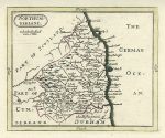
Northumberland map, 1786

Northumberland map, 1786.
"Northumberland" published by Francis Grose in his Antiquities of England and Wales, 1786. Originally drawn, engraved and published by John Seller around 1695, this re-issue by Grose has Seller's name removed. Printed on the top half of a page, the rest of which (and the reverse) carries a historical description of the county in letterpress. Copper engraved map with original hand colour. Good condition with plate mark and wide margins. Map size 14.5 x 12 cms plus text and wide margins. Ref F8374

 
« Previous | ...1330 | 1331 | 1332 | 1333 | 1334 | 1335 | 1336 | 1337 | 1338 | 1339 | 1340... | Next »


© 2003 - 2020 Website copyright Steve Bartrick
Royalty free stock images of antique prints of interest to historians, students and family history researchers