Home » All prints and maps

 
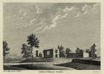
Yorkshire, St. Martins Monastery, 1786

Yorkshire, St. Martins Monastery, 1786.
"St. Martins Monastery, Yorkshire" copper engraved print published in Francis Grose's Antiquities of England and Wales, 1786. Good condition with plate mark and good margins. Size 15 x 11 cms, including title, plus margins. Ref F8067

 
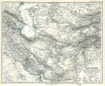
Iran, Pakistan & Afghanistan map, 1877

Iran, Pakistan & Afghanistan map, 1877.
"Iran & Turan oder: Persien, Afghanistan, Balutschistan, Turkestan" published in Adolf Stieler's Hand Atlas Uber Alle Theile Der Erde ..., 1877. Detailed steel engraved map with original hand colour, centrefold as published. Good condition with good margins. Size 41 x 33 cms, plus margins with plate mark. Ref F8066

 
India, Nepal, Tibet map, 1877

India, Nepal, Tibet map, 1877.
"Indien & Inner-Asien in 2 Blattern" published in Adolf Stieler's Hand Atlas Uber Alle Theile Der Erde ..., 1877. Pair of detailed steel engraved maps with original hand colour, centrefold as published. Colour coded to indicate colonial posessions. Inset maps of Calcatta, Bombay and Madras areas. Good condition with good margins. Size 41 x 33 cms each, plus margins with plate marks. Ref F8065


China & Japan map, 1877

China & Japan map, 1877.
"China (Ostl.Thiel), Korea und Japan" published in Adolf Stieler's Hand Atlas Uber Alle Theile Der Erde ..., 1877. Detailed steel engraved map with original hand colour, centrefold as published. Colour coded to indicate colonial posessions. Inset maps of Shanghia, Jedo Canton & Hong Kong areas. Good condition with good margins. Size 41 x 33 cms, plus margins with plate mark. Ref F8064

 
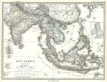
India and East Indies map, 1877

India and East Indies map, 1877.
"Ost-Indien" (India & East Indies) published in Adolf Stieler's Hand Atlas Uber Alle Theile Der Erde ..., 1877. Detailed steel engraved map with original hand colour, centrefold as published. Colour coded to indicate colonial posessions. Good condition with good margins. Size 40.5 x 31 cms, plus margins with plate mark. Ref F8063

 
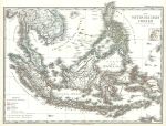
East Indies map, 1877

East Indies map, 1877.
"Die Ostindischen Inseln" (East India Islands) published in Adolf Stieler's Hand Atlas Uber Alle Theile Der Erde ..., 1877. Detailed steel engraved map with original hand colour, centrefold as published. Colour coded to indicate colonial posessions. Good condition with good margins. Size 40 x 31.5 cms, plus margins with plate mark. Ref F8062


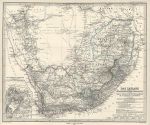
South Africa map, 1877

South Africa map, 1877.
"Das Capland" (South Africa) published in Adolf Stieler's Hand Atlas Uber Alle Theile Der Erde ..., 1877. Detailed steel engraved antique map with original hand colour, coded to indicate various colonial 'posessions'. Inset plan of Cape Town area. Centrefold as published, very good condition. Size 40.5 x 33.5 cms, plus margins. Ref F8061

 
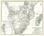
Southern Africa & Madagascar map, 1877

Southern Africa & Madagascar map, 1877.
"Sud - Afrika & Madagaskar" published in Adolf Stieler's Hand Atlas Uber Alle Theile Der Erde ..., 1877. Detailed steel engraved antique map with original hand colour, coded to indicate various colonial 'posessions'. Inset map of the Table Bay and False Bay area. Centrefold as published, very good condition. Size 40.5 x 33 cms, plus margins. Ref F8060

 
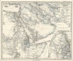
Arabia & North East Africa map, 1877

Arabia & North East Africa map, 1877.
"Nordost - Afrika und Arabien" published in Adolf Stieler's Hand Atlas Uber Alle Theile Der Erde ..., 1877. Detailed steel engraved antique map with original hand colour. Centrefold as published, very good condition. Size 40.5 x 34 cms, plus margins. Ref F8059


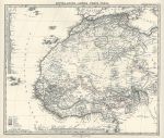
North West Africa map, 1877

North West Africa map, 1877.
"Mittel & Nord Afrika, Westl. Theil" published in Adolf Stieler's Hand Atlas Uber Alle Theile Der Erde ..., 1877. Detailed steel engraved antique map with original hand colour, coded to indicate various colonial 'posessions'. Centrefold as published, very good condition. Size 38 x 33 cms, plus margins. Ref F8058

 
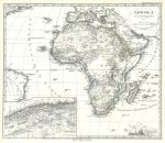
Africa map, 1877

Africa map, 1877.
"Afrika" (Africa) published in Adolf Stieler's Hand Atlas Uber Alle Theile Der Erde ..., 1877. Detailed steel engraved antique map with original hand colour. Centrefold as published, very good condition. Size 36 x 31 cms, plus margins. Ref F8057

 
Germany, Boppart Church, 1832

Germany, Boppart Church, 1832.
"Boppart Church" steel engraved print after a picture by W.Tombleson, published in Tombleson's Views of the Rhine, 1832. Good condition. Size 15 x 11.5 cms including title, plus margins. Ref F8056


Germany, Boppart, 1832

Germany, Boppart, 1832.
"Boppart" steel engraved print after a picture by W.Tombleson, published in Tombleson's Views of the Rhine, 1832. Good condition. Size 16.5 x 10.5 cms including title, plus margins. Ref F8055

 
Germany, Braubach und die Marksburgh, 1832

Germany, Braubach und die Marksburgh, 1832.
"Braubach und die Marksburgh" steel engraved print after a picture by W.Tombleson, published in Tombleson's Views of the Rhine, 1832. Good condition. Size 15.5 x 12.5 cms including title, plus margins. Ref F8054

 
Germany, St.John's Church, near Niederlahnstein, 1832

Germany, St.John's Church, near Niederlahnstein, 1832.
"St.John's Church, near Niederlahnstein" steel engraved print after a picture by W.Tombleson, published in Tombleson's Views of the Rhine, 1832. Good condition. Size 15 x 11.5 cms including title, plus margins. Ref F8053


Germany, Oberlanstein (river view), 1832

Germany, Oberlanstein (river view), 1832.
"Oberlanstein" (river view) steel engraved print after a picture by W.Tombleson, published in Tombleson's Views of the Rhine, 1832. Good condition. Size 15 x 11.5 cms including title, plus margins. (NOTE - this print does have full margins, my scan is badly cropped.) Ref F8052

 
Germany, Oberlanstein, 1832

Germany, Oberlanstein, 1832.
"Oberlanstein" steel engraved print after a picture by W.Tombleson, published in Tombleson's Views of the Rhine, 1832. Good condition. Size 15 x 11.5 cms including title, plus margins. Ref F8051

 
Germany, Lahneck Castle, 1832

Germany, Lahneck Castle, 1832.
"Lahneck Castle" steel engraved print after a picture by W.Tombleson, published in Tombleson's Views of the Rhine, 1832. Good condition. Size 16.5 x 12.5 cms including title, plus margins. Ref F8050

 
« Previous | 1350 | 1351 | 1352 | 1353 | 1354 | 1355 | 1356 | 1357 | 1358 | 1359 | 1360... | Next »


© 2003 - 2020 Website copyright Steve Bartrick
Royalty free stock images of antique prints of interest to historians, students and family history researchers