Home » All prints and maps

 
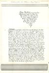
Placitorum Abbreviatio example from Henry III, facsimile of 1819

Placitorum Abbreviatio example from Henry III, facsimile of 1819.
"Placita cora D'no Reg. in crastino B'i Pet. ad Vinc'la, A 21 Hen 3 rot 7" (example of Placitorum Abbreviatio) Copper engraved facsimile published by The Commission on Public Records, 1819. Supplied complete with Latin transcription. Size 22 x 39 cms plus margins. Ref F7481

 
Placitorum Abbreviatio example from Henry III, facsimile of 1819

Placitorum Abbreviatio example from Henry III, facsimile of 1819.
"Placita coram Consilio Domini Regis Anno 27 Henrica III in Domo Capitulari Westmonasteriensi asservata" (example of Placitorum Abbreviatio) Copper engraved facsimile published by The Commission on Public Records, 1819. Supplied complete with Latin transcription. Size 20 x 41 cms plus margins. Ref F7480

 
Liber Frodurum example, Testa de Nevill, facsimile of 1819

Liber Frodurum example, Testa de Nevill, facsimile of 1819.
"Exemplar Libri vocalti Testa de Nevill" (Nevill's Evidence or "Book of Fee Holders" for the Office of the Exchequer) Copper engraved facsimile published by The Commission on Public Records, 1819. Supplied complete with Latin transcription. Size 20 x 36 cms plus margins. Ref F7479


Nonarum Inquisitions example, facsimile of 1819

Nonarum Inquisitions example, facsimile of 1819.
"Exemplaria Inquisitionum Nonarum" (medieval Nonarum Inquisitions for Southampton, Ell' Hundren in Wiltshire and Northampton) Copper engraved facsimile published by The Commission on Public Records, 1819. Supplied complete with Latin transcription. Size 24 x 38 cms plus margins. Ref F7478

 
Tax assessment for ecclesiastical taxation, facsimile of 1819

Tax assessment for ecclesiastical taxation, facsimile of 1819.
"Taxatio Ecclesiastica. P. Nich IV, Vol I. Scacc: 67.b" (ecclesiastical taxation.) Copper engraved facsimile published by The Commission on Public Records, 1819. Supplied complete with Latin transcription. Size 21 x 34 cms plus margins. Ref F7477

 
Act of Parliament, for King William & Queen Mary, facsimile of 1819

Act of Parliament, for King William & Queen Mary, facsimile of 1819.
"Inrollment of the Act 2 William & Mary, Chapter I" (for recognising King William & Queen Mary.) Copper engraved facsimile published by The Commission on Public Records, 1819. Supplied complete with English transcription. Small tear (2 cms) lower right, without loss, two folds as published. Size 31 x 45 cms plus margins. Ref F7476


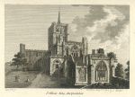
Hertfordshire, St.Albans Abbey, 1786

Hertfordshire, St.Albans Abbey, 1786.
"St.Albans Abbey, Hertfordshire" copper engraved print published in Francis Grose's Antiquities of England and Wales, 1786. Descriptive text beneath and on the verso of the print (not shown in my scan). Good condition with plate mark and good margins. Size 15 x 11.5 cms including title, plus text and margins. Ref F7475

 
Kent map, 1786

Kent map, 1786.
"Kent" published by Francis Grose in his Antiquities of England and Wales, 1786. Originally drawn, engraved and published by John Seller around 1695, this re-issue by Grose has Seller's name removed. Printed on the top half of a page, the rest of which (and the reverse) carries a historical description of the county in letterpress. Copper engraved map with original hand colour. Good condition with plate mark and wide margins. Map size 15 x 12.5 cms plus wide margins. Ref F7474

 
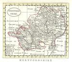
Hertfordshire map, 1786

Hertfordshire map, 1786.
"Hertfordshire" published by Francis Grose in his Antiquities of England and Wales, 1786. Originally drawn, engraved and published by John Seller around 1695, this re-issue by Grose has Seller's name removed. Printed on the top half of a page, the rest of which (and the reverse) carries a historical description of the county in letterpress. Copper engraved map with original hand colour. Good condition with plate mark and wide margins. Map size 15 x 12.5 cms plus wide margins. Ref F7473


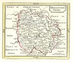
Herefordshire map, 1786

Herefordshire map, 1786.
"Herefordshire" published by Francis Grose in his Antiquities of England and Wales, 1786. Originally drawn, engraved and published by John Seller around 1695, this re-issue by Grose has Seller's name removed. Printed on the top half of a page, the rest of which (and the reverse) carries a historical description of the county in letterpress. Copper engraved map with original hand colour. Good condition with plate mark and wide margins. Map size 15 x 12.5 cms plus wide margins. Ref F7472

 
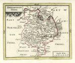
Huntingdonshire map, 1786

Huntingdonshire map, 1786.
"Huntingdonshire" published by Francis Grose in his Antiquities of England and Wales, 1786. Originally drawn, engraved and published by John Seller around 1695, this re-issue by Grose has Seller's name removed. Printed on the top half of a page, the rest of which (and the reverse) carries a historical description of the county in letterpress. Copper engraved map with original hand colour. Good condition with plate mark and wide margins. Map size 15 x 12.5 cms plus wide margins. Ref F7471

 
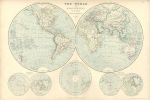
The World in Hemispheres, 1872

The World in Hemispheres, 1872.
"The World in Hemispheres" by Edward Weller, published in The Imperial Atlas of Modern Geography, 1872. Lithographic antique map, with original outline hand colouring. Centrefold as published, noticeable creasing parallel to the fold. Size 50 x 34 cms, plus good margins. Ref F7470


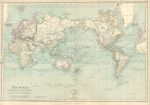
The World on Mercators Projection, 1872

The World on Mercators Projection, 1872.
"The World on Mercators Projection" by J.Bartholomew, published in The Imperial Atlas of Modern Geography, 1872. Lithographic antique map, with original outline hand colouring. Centrefold as published. Size 50 x 34 cms, plus good margins. Ref F7469

 
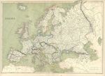
Europe map, 1872

Europe map, 1872.
"Europe" by J.W.Lowry, published in The Imperial Atlas of Modern Geography, 1872. Lithographic antique map, with original outline hand colouring. Centrefold as published, slight soiling in the margins. Size 50 x 34 cms, plus good margins. Ref F7468

 
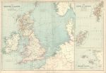
British Isles map, 1872

British Isles map, 1872.
"The British Islands and North Sea" together with the Orkney and Shetland Islands and the Channel Islands. By Edward Weller, published in The Imperial Atlas of Modern Geography, 1872. Lithographic antique map, with original outline hand colouring. Centrefold as published, slight soiling in the margins. Size 50 x 34 cms, plus good margins. Ref F7467


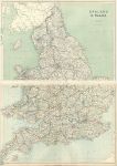
England & Wales map on two sheets, 1872

England & Wales map on two sheets, 1872.
"England & Wales" (on 2 sheets) by Edward Weller, published in The Imperial Atlas of Modern Geography, 1872. Pair of lithographic antique maps, with original outline hand colouring. Centrefolds as published. Size 50 x 34 cms each, plus good margins. Ref F7466

 
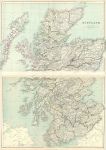
Scotland map on two sheets, 1872

Scotland map on two sheets, 1872.
"Scotland" (on 2 sheets) by Edward Weller, published in The Imperial Atlas of Modern Geography, 1872. Pair of lithographic antique maps, with original outline hand colouring. Centrefolds as published. Size 50 x 34 cms each, plus good margins. Ref F7465

 
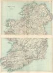
Ireland map on two sheets, 1872

Ireland map on two sheets, 1872.
"Ireland" (on 2 sheets) by Edward Weller, published in The Imperial Atlas of Modern Geography, 1872. Pair of lithographic antique maps, with original outline hand colouring. Centrefolds as published. Size 50 x 34 cms each, plus good margins. Ref F7464

 
« Previous | ...1380 | 1381 | 1382 | 1383 | 1384 | 1385 | 1386 | 1387 | 1388 | 1389 | 1390... | Next »


© 2003 - 2020 Website copyright Steve Bartrick
Royalty free stock images of antique prints of interest to historians, students and family history researchers