Home » All prints and maps

 
Ireland, route map with Dublin, Leixlip, Maynooth and Trim, 1783

Ireland, route map with Dublin, Leixlip, Maynooth and Trim, 1783.
[ The Dublin to Trim route via Killcock ] engraved by G.Terry and published in Taylor and Skinner's Maps of the Roads of Ireland, (2nd edition), 1783. Includes Dublin, Leixlip, Maynooth and Trim. On the verso is part of the Dublin to Ennis route, including Loughrea, Gort, Crusheen and Ennis. Copper engraved map. Size 12 x 21.5 cms plus good margins. Ref F5116

 
Ireland, route map with Loughrea and Athenry, 1783

Ireland, route map with Loughrea and Athenry, 1783.
[ Part of the Dublin to Birr route ] engraved by G.Terry and published in Taylor and Skinner's Maps of the Roads of Ireland, (2nd edition), 1783. Includes Loughrea and Athenry. On the verso is part of the Dublin to Galway route, including Oranmore, Galway and Barracks on Lough Corrib. Copper engraved map. Size 12 x 21.5 cms plus good margins. Ref F5115

 
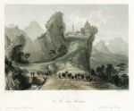
China, The Woo-Tang Mountains, 1849

China, The Woo-Tang Mountains, 1849.
"The Woo-Tang Mountains" engraved by T.A.Prior after a picture by Thomas Allom, published in China Illustrated, 1843. Steel engraved antique print with recent hand colouring. Size 18.5 x 15 cms including title, plus margins. Ref F5114


Lebanon, Baalbec ruins, 1837

Lebanon, Baalbec ruins, 1837.
"Ruins of Balbec" engraved by R.Sands after a picture by W.H.Bartlett. Published in Syria, The Holy Land, Asia Minor &c. Illustrated, 1837. Steel engraved print with recent hand colour. Size 19 x 14 cms including title, plus margins. Ref F5113

 
Syria, Damascus view, 1837

Syria, Damascus view, 1837.
"Damascus, from above Salahyeh" engraved by R.Jorden after a picture by W.H.Bartlett. Published in Syria, The Holy Land, Asia Minor &c. Illustrated, 1837. Steel engraved print with recent hand colour. Very slight soiling in the margins. Size 19 x 14 cms including title, plus margins. Ref F5112

 
Syria, Pilgrims to Mecca near Antioch, 1837

Syria, Pilgrims to Mecca near Antioch, 1837.
"Hadgi or Mecca Pilgrims Encamped near Antioch ..." engraved by H.Adlard after a picture by W.H.Bartlett. Published in Syria, The Holy Land, Asia Minor &c. Illustrated, 1837. Steel engraved print with recent hand colour. Extremely slight soiling. Size 18 x 14.5 cms including title, plus margins. Ref F5111


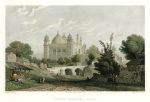
India, Agra, Jumma Musjid, 1831

India, Agra, Jumma Musjid, 1831.
"Jumma Musjid, - Agra" engraved by T.Boys after a picture by W.Purser, published by Fisher, Son & Co., 1831. Steel engraved antique print with recent hand colour. Size 18.5 x 13 cms plus margins. Ref F5110

 
Weymouth harbour, early photo, 1877

Weymouth harbour, early photo, 1877.
[ Weymouth harbour ] early photograph on paper, laid down onto old album card. Inscribed beneath 'Weymouth harbour 1877' in pencil. Size 17 x 11 cms plus backing card. Ref F5109

 
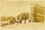
Weymouth street and dock scene, early photo, 1877

Weymouth street and dock scene, early photo, 1877.
[ Weymouth street and dock scene ] early photograph on paper, laid down onto old album card. Inscribed beneath 'Weymouth 1877' in pencil. Size 15 x 10 cms plus backing card. Ref F5108


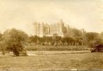
Sussex, Arundel Castle, early Frith photo, c1880

Sussex, Arundel Castle, early Frith photo, c1880.
"Arundel Castle. F.F. & Co." early photograph on thin paper, published by Francis Frith & Co., about 1880. Slight creasing. Size 20.5 x 14 cms. Ref F5107

 
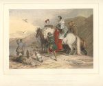
The Hawking Party, Leighton Brothers colour woodblock, 1851

The Hawking Party, Leighton Brothers colour woodblock, 1851.
"The Hawking Party" colour woodblock print by the Leighton Brothers, published in the Art Journal, 1851. Good condition. Size 21.5 x 19 cms including title, plus margins. Ref F5106

 
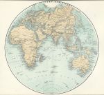
Eastern Hemisphere, 1878

Eastern Hemisphere, 1878.
"Eastern Hemisphere" colour lithographic map published in Illustrated History of The British Empire in India and the East, 1878. Centrefold as published, close cropped to upper and lower margins. Size 25 x 25 cms, plus margins. Ref F5105


Ireland, route map with Birr, Banagher & Eyre Court, 1783

Ireland, route map with Birr, Banagher & Eyre Court, 1783.
[ Part of the Dublin to Galway & Birr route ] engraved by G.Terry and published in Taylor and Skinner's Maps of the Roads of Ireland, (2nd edition), 1783. Includes Birr, Banagher & Eyre Court. On the verso is part of the same route, including Heronsbrooke and Ballydugan. Copper engraved map. Size 12 x 21.5 cms plus good margins. Ref F5103

 
Ireland, route map with Balliboy, Frankford & Cloghan, 1783

Ireland, route map with Balliboy, Frankford & Cloghan, 1783.
[ Part of the Dublin to Galway & Birr route ] engraved by G.Terry and published in Taylor and Skinner's Maps of the Roads of Ireland, (2nd edition), 1783. Includes Balliboy, Frankford & Cloghan. On the verso is part of the same route, including Philipstown, Ballinagar, Killeigh and Tullamore. Copper engraved map. Size 12 x 21.5 cms plus good margins. Ref F5103

 
Ireland, route map with Dublin, Leixlip and Maynooth, 1783

Ireland, route map with Dublin, Leixlip and Maynooth, 1783.
[ Part of the Dublin to Galway route ] engraved by G.Terry and published in Taylor and Skinner's Maps of the Roads of Ireland, (2nd edition), 1783. Includes Dublin, Pulmers Town, Leixlip and Maynooth. On the verso is part of the same route, including Kilcock, Cloncurry, Johnston Bridge, Castlecarbery and Edenderry. Copper engraved map. Size 12 x 21.5 cms plus good margins. Ref F5102


Ireland, route map with Kilbeggan, Clara, and Fearbane, 1783

Ireland, route map with Kilbeggan, Clara, and Fearbane, 1783.
[ Part of the Dublin to Loughrea route ] engraved by G.Terry and published in Taylor and Skinner's Maps of the Roads of Ireland, (2nd edition), 1783. Includes Kilbeggan, Clara, Ballycumber and Fearbane. On the verso is part of the same route, including Ballinasloe, Aghrim and Loughrea. Copper engraved map. Size 12 x 21.5 cms plus good margins. Ref F5101

 
Ireland, route map with Newtown Bellew, Tuam & Hollymount, 1783

Ireland, route map with Newtown Bellew, Tuam & Hollymount, 1783.
[ Part of the Dublin to Castlebar route ] engraved by G.Terry and published in Taylor and Skinner's Maps of the Roads of Ireland, (2nd edition), 1783. Includes Newtown Bellew, Tuam & Hollymount. On the verso is part of the same route, including Athlone, Balliforan and Mt. Bellew. Copper engraved map. Size 12 x 21.5 cms plus good margins. Ref F5100

 
Ireland, route map with Castlebar, Balcarra & Newport, 1783

Ireland, route map with Castlebar, Balcarra & Newport, 1783.
[ Part of the Dublin to Castlebar and Newport route ] engraved by G.Terry and published in Taylor and Skinner's Maps of the Roads of Ireland, (2nd edition), 1783. Includes Castlebar, Balcarra and Newport. On the verso is part of a route from Dublin to Dunmore, including Ballinamore, Ahascragh, Newtown Bellew and Dunmore. Copper engraved map. Size 12 x 21.5 cms plus good margins. Ref F5099

 
« Previous | ...1510 | 1511 | 1512 | 1513 | 1514 | 1515 | 1516 | 1517 | 1518 | 1519 | 1520... | Next »


© 2003 - 2020 Website copyright Steve Bartrick
Royalty free stock images of antique prints of interest to historians, students and family history researchers