Home » All prints and maps

 
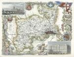
Middlesex, Moule map, 1850

Middlesex, Moule map, 1850.
"Middlesex" by Thomas Moule, published in James Barclay's Complete and Universal Dictionary ..., about 1850. Decorative steel engraved antique map with recent hand colour. The vignettes show Westminster Bridge and Parliament and Buckingham Palace. Good margins. Size 26 x 20 cms plus margins. Ref F3175

 
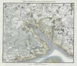
Hampshire, Southampton & vicinity, 1824

Hampshire, Southampton & vicinity, 1824.
"The Country round Southampton" anonymous engraver, published in Patterson's Roads .., 1824. Copper engraved map with recent hand colouring, two (flattened) folds as published. Size 20.5 x 19 cms including title, plus good margins. Ref F3174

 
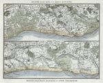
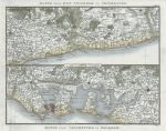
Sussex, route map, 1824

Sussex, route map, 1824.
"Route from Rye to East Bourne" and "Route from East Bourne to New Shoreham" anonymous engraver, published in Patterson's Roads .., 1824. Copper engraved map with recent hand colouring, two (flattened) folds as published. Size 22.5 x 19 cms including title, plus good margins. Ref F3173


Kent, route map, 1824

Kent, route map, 1824.
"Route from Deal to Hythe" and "Route from Hythe to Rye" anonymous engraver, published in Patterson's Roads .., 1824. Copper engraved map with recent hand colouring, two (flattened) folds as published. Size 22.5 x 19 cms including title, plus good margins. Ref F3172

 
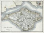
Isle of Wight, 1824

Isle of Wight, 1824.
"Isle of Wight" anonymous engraver, published in Patterson's Roads .., 1824. Copper engraved map with recent hand colouring, two (flattened) folds as published. Size 25 x 18.5 cms including title, plus good margins. Ref F3171

 
Kent, Isle of Thanet, 1824

Kent, Isle of Thanet, 1824.
"Isle of Thanet and Adjacent Country" anonymous engraver, published in Patterson's Roads .., 1824. Copper engraved map with recent hand colouring, two (flattened) folds as published. Size 22 x 19 cms including title, plus good margins with plate mark. Ref F3170


Sussex & Hampshire route map, 1824

Sussex & Hampshire route map, 1824.
"Route from New Shoreham to Chichester" and "Route from Chichester to Fareham" anonymous engraver, published in Patterson's Roads .., 1824. Copper engraved map with recent hand colouring, two (flattened) folds as published. Size 22.5 x 19 cms including title, plus good margins with plate mark. Ref F3169

 
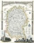
Wiltshire, Moule map, 1850

Wiltshire, Moule map, 1850.
"Wiltshire" by Thomas Moule, published in James Barclay's Complete and Universal Dictionary ..., about 1850. Decorative steel engraved antique map with recent hand colour. The vignettes show Stonehenge ans Salisbury Cathedral. Lower margin close trimmed, with slight loss. Size 21.5 x 27 cms plus margins. Ref F3168

 
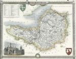
Somerset, Moule map, 1850

Somerset, Moule map, 1850.
"Somerset" by Thomas Moule, published in James Barclay's Complete and Universal Dictionary ..., about 1850. Decorative steel engraved antique map with recent hand colour. The vignette shows Glastonbury Cross. Left and lower margins close trimmed, with slight loss. Size 27 x 21 cms plus margins. Ref F3167


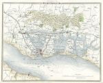
Hampshire, Portsmouth environs, Moule map, 1850

Hampshire, Portsmouth environs, Moule map, 1850.
"Environs of Portsmouth" by Thomas Moule, published in James Barclay's Complete and Universal Dictionary ..., about 1850. Steel engraved antique map with recent hand colour. Good margins. Size 25 x 20.5 cms plus margins. Ref F3166

 
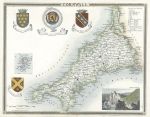
Cornwall, Moule map, 1850

Cornwall, Moule map, 1850.
"Cornwall" by Thomas Moule, published in James Barclay's Complete and Universal Dictionary ..., about 1850. Decorative steel engraved antique map with recent hand colour. The vignette shows Lands End. Good margins. Size 25.5 x 20 cms plus margins. Ref F3165

 
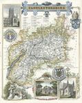
Gloucestershire, Moule map, 1850

Gloucestershire, Moule map, 1850.
"Gloucestershire" by Thomas Moule, published in James Barclay's Complete and Universal Dictionary ..., about 1850. Decorative steel engraved antique map with recent hand colour. The vignettes show Gloucester Cathedral, New Spa in Cheltenham and Tewkesbury Abbey. Good margins. Size 21.5 x 26 cms plus margins. Ref F3164


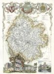
Herefordshire, Moule map, 1850

Herefordshire, Moule map, 1850.
"Herefordshire" by Thomas Moule, published in James Barclay's Complete and Universal Dictionary ..., about 1850. Decorative steel engraved antique map with recent hand colour. The vignettes show Goodrich Castle, Garnstone House and Hereford. Good margins. Size 18.5 x 26.5 cms plus margins. Ref F3163

 
Lake District, 1824

Lake District, 1824.
"A Map of the Lakes in Cumberland, Westmoreland and Lancashire" anonymous engraver, published in Patterson's Roads .., 1824. Copper engraved map with recent hand colouring, three (flattened) folds as published. Size 33 x 18 cms plus margins. Ref F3162

 
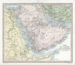
Arabia map, 1847

Arabia map, 1847.
Arabia "Carte De L'Arabie et des Pays Circonvoisins" engraved by Blanchard, published in a volume of L'Univers, Paris, 1847. Steel engraved map with recent hand colouring, two (flattened) folds as published. Size 21.5 x 18 cms plus margins. Ref F3161


Madiera, Estroza Pass, 1846

Madiera, Estroza Pass, 1846.
"Estroza Pass, Madeira" engraved by E.Radclyffe after a picture by J.Drayton, published in Gallery of Nature, 1846. Steel engraved print with recent hand colour. Size 12 x 19.5 cms including title, plus margins. Ref F3160

 
Peru, Banos, 1846

Peru, Banos, 1846.
"Banos, Peru" engraved by E.Radclyffe after a picture by J.Drayton, published in Gallery of Nature, 1846. Steel engraved print with recent hand colour. Size 12 x 19.5 cms including title, plus margins. Ref F3159

 
Cloud types, 1846

Cloud types, 1846.
"Clouds ..." engraved by E.Radclyffe, published in Gallery of Nature, 1846. Steel engraved print with recent hand colour. Size 12.5 x 20 cms including title, plus margins. Ref F3158

 
« Previous | ...1610 | 1611 | 1612 | 1613 | 1614 | 1615 | 1616 | 1617 | 1618 | 1619 | 1620... | Next »


© 2003 - 2020 Website copyright Steve Bartrick
Royalty free stock images of antique prints of interest to historians, students and family history researchers