Home » All prints and maps

 
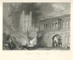
Worcestershire, Malvern Abbey & Gate, after Turner, 1838

Worcestershire, Malvern Abbey & Gate, after Turner, 1838.
"Malvern Abbey and Gate" drawn by J.M.W.Turner, engraved by J.Horsburgh and published in Picturesque Views in England and Wales .. Engraved under the superintendance of Charles Heath, 1838 (print is dated 1832.) Steel engraved print. Partial plate mark and wide margins. Size 24 x 19 cms including title, plus margins. Ref F2904

 
London - Banqueting House, Hampton Court & Treasury and Horse Guards, 1790

London - Banqueting House, Hampton Court & Treasury and Horse Guards, 1790.
"View of the Banqueting House", "View of the Royal Palace & Gardens at Hampton Court" and "View of the Treasury & Horse Guards, in St.James's Park" anonymous engraver, published in Thornton's History of London, about 1790. Copper engraved print, good condition. Size 20.5 x 34.5 cms plus margins. Ref F2903

 
London, St.James's Palace & Buckingham House, 1790

London, St.James's Palace & Buckingham House, 1790.
"View of St.James's Palace from Pall Mall", "View of St.James's Palace from the Park" and "View of the Queen's Palace, formerly Buckingham House, in St.James's Park" anonymous engraver, published in Thornton's History of London, about 1790. Copper engraved print, good condition. Size 18 x 32 cms plus margins. Ref F2902


London, St.Georges, Middlesex & Christs Hospitals, 1790

London, St.Georges, Middlesex & Christs Hospitals, 1790.
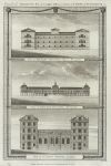
"View of St.Georges Hospital, at Hyde Park Corner", "View of Middlesex Hospital, near Oxford Street" and "View of Christ's Hospital & Church, near Newgate Street" anonymous engraver, published in Thornton's History of London, about 1790. Copper engraved print, good condition. Size 18 x 32 cms plus margins. Ref F2901

 
London, St.Luke's and Bethlem Hospitals & St.Paul's School, 1790

London, St.Luke's and Bethlem Hospitals & St.Paul's School, 1790.
"View of St.Luke's Hospital, Upper Moorefields", "View of Bethlem Hospital, Moorefields" and "View of St.Paul's School, London" engraved by Peltro, published in Thornton's History of London, about 1790. Copper engraved print, good condition. Size 22 x 33.5 cms plus margins. Ref F2900

 
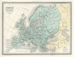
Europe, Barbarian invasions after the collapse of the Roman Empire , 1860

Europe, Barbarian invasions after the collapse of the Roman Empire , 1860.
"Europe apres l'Invasion des Barbares au IC siecle, a la fin du Ve. et pendant une partie du VIe.", published in Malte-Brun's Atlas de la Geographie Universelle ..., about 1860. Steel engraved antique map with original hand colouring. Good condition. Size 29.5 x 22 cms plus good margins. Ref F2899


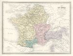
Roman Gaul (France), 1860

Roman Gaul (France), 1860.
"Carte dea Gaules divisee en Provinces Romaines ...", published in Malte-Brun's Atlas de la Geographie Universelle ..., about 1860. Steel engraved antique map with original hand colouring. Good condition. Size 30 x 22.5 cms plus good margins. Ref F2898

 
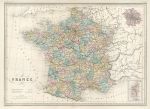
France in 1789, 1860

France in 1789, 1860.
"France en 1789", published in Malte-Brun's Atlas de la Geographie Universelle ..., about 1860. Steel engraved antique map with original hand colouring. Good condition. Size 29.5 x 22 cms plus good margins. Ref F2897

 
The Peutinger Table, 1860

The Peutinger Table, 1860.
"Table Theodosienne dite Carte de Peutinger" (a Medieval copy of an original Roman route map, now lost), by Pierre Sarassin, published in Malte-Brun's Atlas de la Geographie Universelle ..., about 1860. Steel engraved antique map. Centrefold as published, good condition. Size 41 x 26 cms plus good margins. Ref F2896


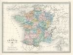
France, 1860

France, 1860.
"France" engraved by S.Jacobs after Fremin, published in Malte-Brun's Atlas de la Geographie Universelle ..., about 1860. Steel engraved antique map with original hand colouring. Centrefold as published, good condition. Size 42.5 x 31 cms plus good margins. Ref F2895

 
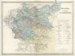
German Empire, 1860

German Empire, 1860.
"Carte Generale de L'Empire D'Allemagne" engraved after Fremin, published in Malte-Brun's Atlas de la Geographie Universelle ..., about 1860. Steel engraved antique map with original hand colouring. Centrefold as published, good condition. Size 42 x 32.5 cms plus good margins. Ref F2894

 
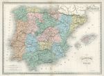
Spain & Portugal, 1860

Spain & Portugal, 1860.
"Espagne et Portugal" engraved by Blanchard, published in Malte-Brun's Atlas de la Geographie Universelle ..., about 1860. Steel engraved antique map with original hand colouring. Centrefold as published, good condition. Size 42.5 x 31 cms plus good margins. Ref F2893


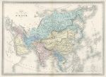
Asia, 1860

Asia, 1860.
"Carte de L'Asie" engraved by S.Jacobs, published in Malte-Brun's Atlas de la Geographie Universelle ..., about 1860. Steel engraved antique map with original hand colouring. Centrefold as published, good condition. Size 42.5 x 31 cms plus good margins. Ref F2892

 
London, Elevation & Plan of the Royal Exchange, 1786

London, Elevation & Plan of the Royal Exchange, 1786.
"An Elevation, Plan, and History of the Royal Exchange of London" anonymous engraver, published in Picturesque Views of the Antiquities of England & Wales, 1786. Copper engraved print. Close trimmed to right margin with slight loss, otherwise good condition. Size 23 x 32.5 cms including title, plus margins. Ref F2891

 
Staffordshire, Dudley Castle, 1786

Staffordshire, Dudley Castle, 1786.
"Dudley Castle in Staffordshire" engraved by Noble, published in Picturesque Views of the Antiquities of England & Wales, 1786. Pair of copper engraved prints on one sheet. Good condition with partial plate mark. Size 19 x 32 cms including title, plus margins. Ref F2890


Kent, St.Martin's Priory at Dover, 1786

Kent, St.Martin's Priory at Dover, 1786.
"St.Martin's Priory at Dover in Kent" engraved by Lowry, published in Picturesque Views of the Antiquities of England & Wales, 1786. Pair of copper engraved prints on one sheet. Good condition with partial plate mark. Size 18 x 32 cms including title, plus margins. Ref F2889

 
Hampshire, South Gate & East Gate at Southampton, 1786

Hampshire, South Gate & East Gate at Southampton, 1786.
"The South Gate & Tower .." and "The East Gate, at Southampton" (Hampshire) engraved by Coote, published in Picturesque Views of the Antiquities of England & Wales, 1786. Pair of copper engraved prints on one sheet. Good condition with partial plate mark. Size 18 x 32 cms including title, plus margins. Ref F2888

 
Sussex, Winchelsea Church & Castle, 1786

Sussex, Winchelsea Church & Castle, 1786.
"Winchelsea Church .." and "Winchelsea Castle, in Sussex" engraved by Page, published in Picturesque Views of the Antiquities of England & Wales, 1786. Pair of copper engraved prints. Good condition with full plate mark. Size 19 x 32 cms including title, plus margins. Ref F2887

 
« Previous | ...1630 | 1631 | 1632 | 1633 | 1634 | 1635 | 1636 | 1637 | 1638 | 1639 | 1640... | Next »


© 2003 - 2020 Website copyright Steve Bartrick
Royalty free stock images of antique prints of interest to historians, students and family history researchers