Home » All prints and maps

 
Botanical, Elaeagnus angustifolia, 1829

Botanical, Elaeagnus angustifolia, 1829.
"Elaeagnus angustifolia" engraved after a drawing by Turpin, published in Dictionnaire des Sciences Naturelles, Paris, 1829. Copper engraved print. Size 10 x 19 cms plus margins. Ref F2508

 
Botanical, Olea europea, 1829

Botanical, Olea europea, 1829.
"Olea europea" engraved after a drawing by Turpin, published in Dictionnaire des Sciences Naturelles, Paris, 1829. Copper engraved print. Size 10 x 19 cms plus margins. Ref F2507

 
Botanical, Fontanesia phillyreoides, 1829

Botanical, Fontanesia phillyreoides, 1829.
"Fontanesia phillyreoides" engraved after a drawing by Turpin, published in Dictionnaire des Sciences Naturelles, Paris, 1829. Copper engraved print. Size 10 x 19 cms plus margins. Ref F2506


Acanthus mollis, 1829

Acanthus mollis, 1829.
"Acanthus mollis" engraved after a drawing by Turpin, published in Dictionnaire des Sciences Naturelles, Paris, 1829. Copper engraved print. Size 10 x 19 cms plus margins. Ref F2505

 
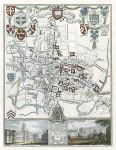
Oxford city plan, Moule map, 1850

Oxford city plan, Moule map, 1850.
"City and University of Oxford" by Thomas Moule, published in James Barclay's Complete and Universal Dictionary ..., about 1850. Decorative steel engraved antique map with recent hand colour. The vignettes show Christ Church College and Oxford from the north. Good margins. Size 19 x 24.5 cms plus margins. Ref F2504

 
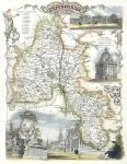
Oxfordshire, Moule map, 1850

Oxfordshire, Moule map, 1850.
"Oxfordshire" by Thomas Moule, published in James Barclay's Complete and Universal Dictionary ..., about 1850. Decorative steel engraved antique map with recent hand colour. The vignettes show Blenheim House, Radcliffe Library and Oxford city. Close trimmed to upper margins, without loss (these maps were very often tightly trimmed by the publishers). Size 20 x 26 cms plus margins. Ref F2503


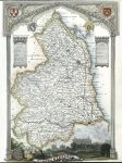
Northumberland, Moule map, 1850

Northumberland, Moule map, 1850.
"Northumberland" by Thomas Moule, published in James Barclay's Complete and Universal Dictionary ..., about 1850. Decorative steel engraved antique map with recent hand colour. The vignette shows Alnwick Castle. Close trimmed to upper and lower margins, with some loss to lower margin (these maps were very often tightly trimmed by the publishers). Size 19.5 x 26.5 cms plus margins. Ref F2502

 
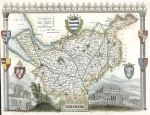
Cheshire, Moule map, 1850

Cheshire, Moule map, 1850.
"Cheshire" by Thomas Moule, published in James Barclay's Complete and Universal Dictionary ..., about 1850. Decorative steel engraved antique map with recent hand colour. The vignettes show Chester Cathedral and Eaton Hall. Close trimmed to left margin (these maps were very often tightly trimmed by the publishers). Size 26 x 19.5 cms plus margins. Ref F2501

 
Worcestershire, Moule map, 1850

Worcestershire, Moule map, 1850.
"Worcestershire" by Thomas Moule, published in James Barclay's Complete and Universal Dictionary ..., about 1850. Decorative steel engraved antique map with recent hand colour. The vignettes show Worcester, Great Malvern and Croom Court. Good margins (these maps were very often tightly trimmed by the publishers). Size 20.5 x 26.5 cms plus margins. Ref F2500


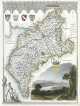
Cumberland, Moule map, 1850

Cumberland, Moule map, 1850.
"Cumberland" by Thomas Moule, published in James Barclay's Complete and Universal Dictionary ..., about 1850. Decorative steel engraved antique map with recent hand colour. The vignette shows Carlisle. Good margins (these maps were very often tightly trimmed by the publishers). Size 20 x 26.5 cms plus margins. Ref F2499

 
Lincolnshire, Moule map, 1850

Lincolnshire, Moule map, 1850.
"Lincolnshire" by Thomas Moule, published in James Barclay's Complete and Universal Dictionary ..., about 1850. Decorative steel engraved antique map with recent hand colour. The vignettes show Lincoln Cathedral and Grimsthorpe Castle. Good margins (these maps were very often tightly trimmed by the publishers). Size 20.5 x 26 cms plus margins. Ref F2498

 
Durham, Moule map, 1850

Durham, Moule map, 1850.
"Durham" by Thomas Moule, published in James Barclay's Complete and Universal Dictionary ..., about 1850. Decorative steel engraved antique map with recent hand colour. The vignettes show Durham and Raby Castle. Good margins (these maps were very often tightly trimmed by the publishers). Size 26.5 x 20.5 cms plus margins. Ref F2497


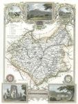
Leicestershire, Moule map, 1850

Leicestershire, Moule map, 1850.
"Leicestershire" by Thomas Moule, published in James Barclay's Complete and Universal Dictionary ..., about 1850. Decorative steel engraved antique map with recent hand colour. The vignettes show Ulverscroft Abbey and Donnington Castle. Good margins (these maps were very often tightly trimmed by the publishers). Size 19.5 x 26.5 cms plus margins. Ref F2496

 
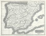
Spain & Portugal, 1825

Spain & Portugal, 1825.
"Spain & Portugal" engraved by R.Scott, published by E.Khull & Co. of Glasgow in The Glasgow Geography, 1825. Copper engraved map. Two (flattened) folds as published. Size 25 x 20 cms plus margins. Ref F2495

 
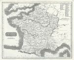
France, 1825

France, 1825.
"France" engraved by R.Scott, published by E.Khull & Co. of Glasgow in The Glasgow Geography, 1825. Copper engraved map. Two (flattened) folds as published. Size 24.5 x 20 cms plus margins. Ref F2494


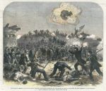
USA, Civil War, Assault on Fort Wagner, Charlseton Harbour, 1863

USA, Civil War, Assault on Fort Wagner, Charlseton Harbour, 1863.
"Assault on Fort Wagner, Charlseton Harbour, on the night of July 18 - the rush of the Garrison to the Parapet" wood engraving published in The Illustrated London News, September 1863, with recent hand colour. Size 24 x 21 cms including title, plus margins. Ref F2493

 
London and environs, 1850

London and environs, 1850.
"The Environs of London" engraved by W.Hughes, published in James Barclay's Complete and Universal Dictionary ..., about 1850. Steel engraved antique map with recent hand colour. Size 21 x 16.5 cms plus margins. Ref F2492

 
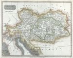
Austrian Dominions, 1825

Austrian Dominions, 1825.
"Austrian Dominions" engraved by R.Scott, published by E.Khull & Co. of Glasgow in The Glasgow Geography, 1825. Copper engraved map with recent hand colour. Two folds as published. Size 25 x 20 cms plus margins. Ref F2491

 
« Previous | ...1650 | 1651 | 1652 | 1653 | 1654 | 1655 | 1656 | 1657 | 1658 | 1659 | 1660... | Next »


© 2003 - 2020 Website copyright Steve Bartrick
Royalty free stock images of antique prints of interest to historians, students and family history researchers