Home » All prints and maps

 
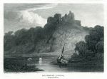
Wales, Kidwelly Castle in Carmarthenshire, 1813

Wales, Kidwelly Castle in Carmarthenshire, 1813.
"Kidwelly Castle, Caermarthenshire" copper engraved print published in The Beauties of England and Wales, 1813. Size 15 x 11 cms including title, plus margins. Ref F2326

 
Wales, Kilgerran Castle in Pembrokeshire, 1813

Wales, Kilgerran Castle in Pembrokeshire, 1813.
"Kilgerran Castle, Pembrokeshire" copper engraved print published in The Beauties of England and Wales, 1813. Size 15 x 11 cms including title, plus margins. Ref F2325

 
Wales, Cil Hepste Waterfall in Brecknockshire, 1812

Wales, Cil Hepste Waterfall in Brecknockshire, 1812.
"Cil Hepste Waterfall, Brecknockshire" copper engraved print published in The Beauties of England and Wales, 1812. Size 15.5 x 11 cms including title, plus margins. Ref F2324


'A Court of Justice at Damascus', etching after Henriette Browne, 1876

'A Court of Justice at Damascus', etching after Henriette Browne, 1876.
[ A Court of Justice at Damascus ] etching by Courtry after Henriette Browne, published in Art Gems, 1876. A very good impression on heavy art paper with full plate mark and good margins. Size 19 x 23.5 cms to plate mark. Ref F2323

 
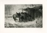
'Cossacks Horses in a Snow Storm', etching after Schreyer, 1876

'Cossacks Horses in a Snow Storm', etching after Schreyer, 1876.
[ Cossacks Horses in a Snow Storm ] etching by Courtry after Adolphe Schreyer, published in Art Gems, 1876. A very good impression on heavy art paper with full plate mark and good margins. Size 23.5 x 16.5 cms to plate mark. Ref F2322

 
'Francesca di Rimini', etching after Ingres, 1876

'Francesca di Rimini', etching after Ingres, 1876.
[ Francesca di Rimini ] etching by Didier after Ingres, published in Art Gems, 1876. A very good impression on heavy art paper with full plate mark and good margins. Size 18.5 x 26 cms to plate mark. Ref F2321


'The Pond', etching by J. Michelin, 1876

'The Pond', etching by J. Michelin, 1876.
[ The Pond ] etching by J. Michelin, published in Art Gems, 1876. A very good impression on heavy art paper with full plate mark and good margins. Size 23 x 17 cms to plate mark. Ref F2320

 
'The Plan', etching after E. Detaille, 1876

'The Plan', etching after E. Detaille, 1876.
[ The Plan ] etching by Rajon after E. Detaille, published in Art Gems, 1876. A very good impression on heavy art paper with full plate mark and good margins. Size 11 x 16 cms to plate mark. Ref F2319

 
The Philosopher in Thought, etching after Rembrandt, 1876

The Philosopher in Thought, etching after Rembrandt, 1876.
[ The Philosopher in Thought ] etching by G. Greux after Rembrandt, published in Art Gems, 1876. A very good impression on heavy art paper with full plate mark and good margins. Size 25.5 x 20.5 cms to plate mark. Ref F2318


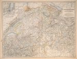
Switzerland & The Alps of Savoy & Piedmont, 1861

Switzerland & The Alps of Savoy & Piedmont, 1861.
"Switzerland & The Alps of Savoy & Piedmont" by Keith Johnston. Lithographic map with hand colored outlines and printed blue for water. Published in Keith Johnston's The Royal Atlas of Modern Geography, 1861. Inset map of the Geneva area. Diffuse stain upper left, otherwise good condition. Size 58 x 44 cms. (NOTE - this image is from a digital camera and is not as clear as a scan.) Ref F2317

 
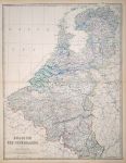
Belgium & The Netherlands, large map, 1861

Belgium & The Netherlands, large map, 1861.
"Belgium and The Netherlands" by Keith Johnston. Lithographic map with hand colored outlines and printed blue for water. Published in Keith Johnston's The Royal Atlas of Modern Geography, 1861. Good condition. Size 44 x 58 cms. (NOTE - this image is from a digital camera and is not as clear as a scan.) Ref F2316

 
England & Wales, large map on 2 sheets, 1861

England & Wales, large map on 2 sheets, 1861.
"England and Wales" by Keith Johnston. Pair of lithographic maps with hand colored outlines and printed blue for water. Published in Keith Johnston's The Royal Atlas of Modern Geography, 1861. Good condition. Size 58 x 45 cms each. (NOTE - this image is from a digital camera and is not as clear as a scan.) Ref F2315


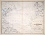
Basin of the North Atlantic Ocean, 1861

Basin of the North Atlantic Ocean, 1861.
"Basin of the North Atlantic Ocean" by Keith Johnston. Lithographic map with hand colored outlines and printed blue for water. Published in Keith Johnston's The Royal Atlas of Modern Geography, 1861. Good condition. Size 58 x 45 cms. (NOTE - this image is from a digital camera and is not as clear as a scan.) Ref F2314

 
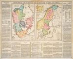
Scandinavia, 1830

Scandinavia, 1830.
"Geographical, Statistical and Historical Map of Denmark, Sweden an Norway" engraved by J.Walker after C.Gros and published in Lavoisne's Complete ... Geographical Atlas, 1830 (map dated 1828.) Copper engraved antique map with original hand colouring. Centrefold as published, slight stain to top of fold and slight paper cockling. Size 53 x 42 cms plus margins. (NOTE - this image is from a digital camera and is not as clear as a scan.) Ref F2313

 
'Rounding the Point', etching by John McNulty, about 1990

'Rounding the Point', etching by John McNulty, about 1990.
"Rounding the Point" fine large coloured etching with aquatint by John McNulty, published about 1990. Signed, titled and numbered (38/350) in pencil below the image. On heavy art paper, strong plate mark and good margins. Very slight creasing upper left. Size 55 x 40 cms including title, plus margins. Ref F2312


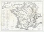
France, physical, 1860

France, physical, 1860.
"Carte Physique de la France" by L.Dussieux, published in Atlas General de Geographie ..., 1860 (dated 1845). Steel engraved map. Centrefold as published, some staining. Size 39 x 28 cms plus good margins. Ref F2311

 
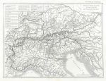
The Alps, 1860

The Alps, 1860.
"Carte de la Chaine des Alpes" by L.Dussieux, published in Atlas General de Geographie ..., 1860 (dated 1846). Steel engraved map with original hand colouring. Centrefold as published, small stain upper left. Size 39 x 30 cms plus good margins. Ref F2310

 
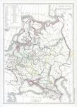
Russia in Europe & Poland, 1860

Russia in Europe & Poland, 1860.
"Carte Physique & Politique de la Russie et de la Pologne" by L.Dussieux, published in Atlas General de Geographie ..., 1860 (dated 1846). Steel engraved map with original hand colouring. Centrefold as published, stain to centrefold centre right. Size 27.5 x 38.5 cms plus good margins. Ref F2309

 
« Previous | ...1660 | 1661 | 1662 | 1663 | 1664 | 1665 | 1666 | 1667 | 1668 | 1669 | 1670... | Next »


© 2003 - 2020 Website copyright Steve Bartrick
Royalty free stock images of antique prints of interest to historians, students and family history researchers