Home » All prints and maps

 
Egypt, Sinai, Mount Serbal from Wady Feiran, 1875

Egypt, Sinai, Mount Serbal from Wady Feiran, 1875.
"Mount Serbal - From Wady Feiran" engraved by S.Bradshaw after a picture by J.D.Woodward, published in Picturesque Palestine, about 1875. Steel engraved print with recent hand colour. Good condition. Size 25.5 x 18 cms including title, plus margins. Ref F350

 
Lebanon / Syria, Mount Hermon, 1875

Lebanon / Syria, Mount Hermon, 1875.
"Mount Hermon" engraved by S.Bradshaw after a picture by H.A.Harper, published in Picturesque Palestine, about 1875. Steel engraved print with recent hand colour. Good condition. Size 26 x 19 cms including title, plus margins. (Note - the banding in the sky area is due to the scanning process and does not exist on the actual print.) Ref F349

 
Syria, Caesarea Philippi, 1875

Syria, Caesarea Philippi, 1875.
"Caesarea Philippi" engraved by C.Bertrand after a picture by Harry Fenn, published in Picturesque Palestine, about 1875. Steel engraved print with recent hand colour. Good condition. Size 25 x 19.5 cms including title, plus margins. Ref F348


Israel, Sea of Galilee, 1875

Israel, Sea of Galilee, 1875.
"Sea of Galilee" engraved by C.Cousen after a picture by H.A.Harper, published in Picturesque Palestine, about 1875. Steel engraved print with recent hand colour. Good condition. Size 25.5 x 19 cms including title, plus margins. (Note - the banding in the sky area is due to the scanning process and does not exist on the actual print.) Ref F347

 
Israel, Tiberias, 1875

Israel, Tiberias, 1875.
"Tiberias" engraved by E.Brandard after a picture by H.Fenn, published in Picturesque Palestine, about 1875. Steel engraved print with recent hand colour. Good condition. Size 25 x 18 cms including title, plus margins. (Note - the banding in the sky area is due to the scanning process and does not exist on the actual print.) Ref F346

 
Jordan, Petra, Tombs in eastern Cliff, 1875

Jordan, Petra, Tombs in eastern Cliff, 1875.
"Tombs in the Eastern Cliffs of Petra" anonymous artist/engraver, published as a titlepage to Picturesque Palestine, about 1875. Steel engraved print with recent hand colour. Good condition. Size 18 x 29 cms including all text, plus margins. Ref F345


Israel, Well at Nazareth, 1875

Israel, Well at Nazareth, 1875.
"Well at Nazareth" anonymous artist/engraver, published as a titlepage to Picturesque Palestine, about 1875. Steel engraved print with recent hand colour. Good condition. Size 19 x 28 cms including all text, plus margins. Ref F344

 
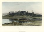
Egypt, Great Temple at Karnak, 1875

Egypt, Great Temple at Karnak, 1875.
"The Great Temple at Karnak" engraved by J.C.Armytage after a picture by H.Fenn, published in Picturesque Palestine, about 1875. Steel engraved print with recent hand colour. Very slight foxing, otherwise good condition. Size 27 x 18.5 cms including title, plus margins. Ref F343

 
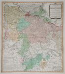
Germany, British Dominions (Brunswick-Luneburg), 1789

Germany, British Dominions (Brunswick-Luneburg), 1789.
"A New Map of the King of Great Britain's Dominions in Germany, or the Electorate of Brunswick-Luneburg and its Dependencies" by Thomas Jefferys, published by William Faden in 1789. Large and detailed copper engraved map with full original hand colour. Includes Hamburg, Luneburg, Hannover, Bremen, Brunswick etc. On thick paper and in good condition with full plate mark and good margins, centrefold as published. Size 53 x 60 cms plus margins. Ref F342


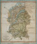
Wiltshire, geological map by W.Smith, 1821 or later

Wiltshire, geological map by W.Smith, 1821 or later.
"Geological Map of Wiltshire by W.Smith, Mineral Surveyor". William Smith's geological map based on a large county map by John Cary published in 1821. With full wash hand colour to indicate the different strata and extra engraved text explaining the various layers. Dissected into 15 panels and laid down on old thin green card, trimmed almost to left and right neatlines, some age browning and soiling. Size 48 x 57 cms including title. Ref F341

 
United States on 2 large sheets, Andriveau-Goujon, 1865

United States on 2 large sheets, Andriveau-Goujon, 1865.
"Carte Generale Des Etats-Unis Et Du Mexique .." by Andriveau-Goujon, published in Atlas Universel, 1866. Pair of detailed lithographic maps with original full hand colouring, small inset maps showing the North Atlantic, Long Island, lesser Antilles and Central America. Each has a centrefold as published, very sligh foxing. Size 47 x 63 cms each plus margins. Ref F340

 
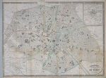
France, Paris plan, 1839

France, Paris plan, 1839.
"Galignani's Plan of Paris and Environs" engraved by Haeq after Achin and published in a guide book, 1839. Detailed lithographic plan with original hand colouring. Several folds as published, age browned on a few folds, close trimmed to image edge on left side and three small closed tears into map on fold lines (no loss). Size 55.5 x 42 cms plus margins on three sides. Ref F339


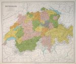
Switzerland, large map, 1867

Switzerland, large map, 1867.
"Switzerland" by J.Bartholomew, published in Philip's General Atlas of the World, 1867. Large colour lithographic map with centrefold as published, good condition with good margins. Size 61 x 51 cms. (NOTE - this image is from a digital camera and is not as clear as a scan.) Ref F338

 
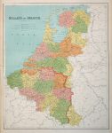
Holland & Belgium, large map, 1867

Holland & Belgium, large map, 1867.
"Holland & Belgium" by J.Bartholomew, published in Philip's General Atlas of the World, 1867. Large colour lithographic map with centrefold as published, very slight soiling upper left, otherwise good condition with good margins. Size 51 x 61 cms. (NOTE - this image is from a digital camera and is not as clear as a scan.) Ref F337

 
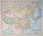
China and Japan, large map, 1867

China and Japan, large map, 1867.
"Chinese Empire and Japan" by J.Bartholomew, published in Philip's General Atlas of the World, 1867. Large colour lithographic map with centrefold as published, good condition with good margins. Size 63 x 51 cms. (NOTE - this image is from a digital camera and is not as clear as a scan.) Ref F336


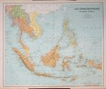
East Indies, large map, 1867

East Indies, large map, 1867.
"East Indian Archipelago, Burmah, Siam &c." by J.Bartholomew, published in Philip's General Atlas of the World, 1867. Large colour lithographic map with centrefold as published, good condition with good margins. Size 61 x 51 cms. (NOTE - this image is from a digital camera and is not as clear as a scan.) Ref F335

 
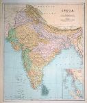
India, large map, 1867

India, large map, 1867.
"India" by J.Bartholomew, published in Philip's General Atlas of the World, 1867. Large colour lithographic map with centrefold as published, good condition with good margins. Size 51 x 61 cms. (NOTE - this image is from a digital camera and is not as clear as a scan.) Ref F334

 
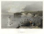
Greece, Nicopoli, 1842

Greece, Nicopoli, 1842.
"Nicopoli" engraved by R.Wallis after W.H.Bartlett. Published in The Danube: It's History, Scenery, and Topography, 1842. Steel engraved print with recent hand colour. Good condition. Size 18 x 14 cms including title, plus margins. Ref F333

 
« Previous | ...1770 | 1771 | 1772 | 1773 | 1774 | 1775 | 1776 | 1777 | 1778 | 1779 | 1780... | Next »


© 2003 - 2020 Website copyright Steve Bartrick
Royalty free stock images of antique prints of interest to historians, students and family history researchers