Home » All prints and maps

 
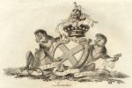
Heraldry, Leinster, 1790

Heraldry, Leinster, 1790.
"Leinster" copper engraved heraldic coat of arms by Charles Catton and engraved by Francis Chesham, published in Catton's English Peerage, 1790. Slight foxing. Size about 16 x 12 cms plus margins. Ref E7820

 
Heraldry, Leigh, 1790

Heraldry, Leigh, 1790.
"Leigh" copper engraved heraldic coat of arms by Charles Catton and engraved by Francis Chesham, published in Catton's English Peerage, 1790. Slight foxing. Size about 16 x 12 cms plus margins. Ref E7818

 
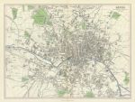
Yorkshire, Leeds plan, 1866

Yorkshire, Leeds plan, 1866.
"Leeds" by J.Bartholomew, published by A. Fullarton & Co. in The Imperial Gazetteer of England & Wales, 1866. Lithographic map with original hand colour. Centrefold as published. Size 32 x 24 cms plus margins. Ref E7817


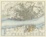
Liverpool & Birkenhead plan, 1866

Liverpool & Birkenhead plan, 1866.
"Plan of the Town & Borough of Liverpool with Birkenhead ..." by J.Bartholomew, published by A. Fullarton & Co. in The Imperial Gazetteer of England & Wales, 1866. Lithographic map with original hand colour. Centrefold as published, some foxing. Size 29 x 23 cms plus margins. Ref E7815

 
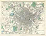
Birmingham plan, 1866

Birmingham plan, 1866.
"Birmingham" published by A. Fullarton & Co. in The Imperial Gazetteer of England & Wales, 1866. Lithographic map with original hand colour. Centrefold as published, slight foxing. Size 31.5 x 24.5 cms plus margins. Ref E7813

 
Bristol plan, 1866

Bristol plan, 1866.
"Bristol" published by A. Fullarton & Co. in The Imperial Gazetteer of England & Wales, 1866. Lithographic map with original hand colour. Extremely slight foxing. Size 23 x 14 cms plus margins. Ref E7811


England, East Coast Ports, 1866

England, East Coast Ports, 1866.
"Ports & Harbours on the East Coast of England" published by A. Fullarton & Co. in The Imperial Gazetteer of England & Wales, 1866. With plans of Grimsby, Harwich, Sunderland, Scarborough and Goole. Lithographic map with original hand colour. Size 23 x 15.5 cms plus margins. Ref E7809

 
Scilly Isles & Portland, 1866

Scilly Isles & Portland, 1866.
"Scilly Isles" and "Portland" published by A. Fullarton & Co. in The Imperial Gazetteer of England & Wales, 1866. Lithographic map with original hand colour. Size 23 x 13.5 cms plus margins. Ref E7808

 
Devon, Plymouth Sound, 1866

Devon, Plymouth Sound, 1866.
"Plymouth Sound" (with Devonport) published by A. Fullarton & Co. in The Imperial Gazetteer of England & Wales, 1866. Lithographic map with original hand colour. Size 14 x 23.5 cms plus margins. Ref E7807


Yorkshire, Hartlepool & Whitby, 1866

Yorkshire, Hartlepool & Whitby, 1866.
"Hartlepool & Whitby" published by A. Fullarton & Co. in The Imperial Gazetteer of England & Wales, 1866. Pair of lithographic maps on one sheet, with original hand colour. Size 23 x 13.5 cms plus margins. Ref E7806

 
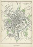
Norfolk, Plan of Norwich, 1866

Norfolk, Plan of Norwich, 1866.
"Norwich" published by A. Fullarton & Co. in The Imperial Gazetteer of England & Wales, 1866. Lithographic plan with original hand colour. Size 17 x 23 cms plus margins. Ref E7805

 
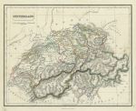
Switzerland, 1846

Switzerland, 1846.
"Switzerland" drawn and engraved by J. Gellatly, published in Chambers Atlas for the People .., 1846. Steel engraved map with original hand colouring. Light age browning. Size 25.5 x 21 cms plus good margins. Ref E7802


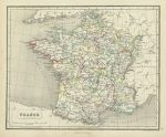
France in Provinces, 1846

France in Provinces, 1846.
"France in Provinces" drawn and engraved by J. Gellatly, published in Chambers Atlas for the People .., 1846. Steel engraved map with original hand colouring. Light age browning. Size 25.5 x 21 cms plus good margins. Ref E7801

 
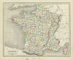
France in Departments, 1846

France in Departments, 1846.
"France in Departments" drawn and engraved by J. Gellatly, published in Chambers Atlas for the People .., 1846. Steel engraved map with original hand colouring. Light age browning. Size 25.5 x 21 cms plus good margins. Ref E7800

 
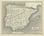
Spain & Portugal, 1846

Spain & Portugal, 1846.
"Spain & Portugal" drawn and engraved by J. Gellatly, published in Chambers Atlas for the People .., 1846. Steel engraved map with original hand colouring. Light age browning. Size 25.5 x 21 cms plus good margins. Ref E7799


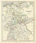
Germany, 1846

Germany, 1846.
"Germany" drawn and engraved by J. Gellatly, published in Chambers Atlas for the People .., 1846. Steel engraved map with original hand colouring. Light age browning. Size 21 x 25.5 cms plus good margins. Ref E7798

 
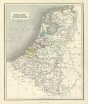
Holland & Belgium, 1846

Holland & Belgium, 1846.
"Holland & Belgium" drawn and engraved by J. Gellatly, published in Chambers Atlas for the People .., 1846. Steel engraved map with original hand colouring. Light age browning. Size 21 x 25.5 cms plus good margins. Ref E7796

 
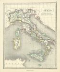
Ancient Italy, 1846

Ancient Italy, 1846.
"Ancient Italy" drawn and engraved by J. Gellatly, published in Chambers Atlas for the People .., 1846. Steel engraved map with original hand colouring. Light age browning. Size 21 x 25.5 cms plus good margins. Ref E7795

 
« Previous | 1880 | 1881 | 1882 | 1883 | 1884 | 1885 | 1886 | 1887 | 1888 | 1889 | 1890... | Next »


© 2003 - 2020 Website copyright Steve Bartrick
Royalty free stock images of antique prints of interest to historians, students and family history researchers