Please see my main site ANTIQUEPRINTS.COM For original antique prints and maps
Charing Cross - 1837
Home » All prints and maps
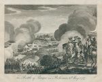
Battle of Prague in Bohemia, in 1757. "The Battle of Prague in Bohemia, 6th May 1757" anonymous artist/engraver, published about 1798. Copper engraved antique print, good condition. Size 19 x 15.5 cms plus margins with full plate mark. Ref G9972
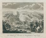
Battle of Minden in Westphalia, in 1759. "The Battle of Minden in Westphalia, 1st Aug. 1759" anonymous artist/engraver, published about 1798. Copper engraved antique print, good condition. Size 19 x 15.5 cms plus margins with full plate mark. Ref G9971
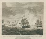
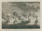
Defeat of the French Fleet by Admiral Lord Rodney, in 1782. "Defeat of the French Fleet under the Command of Admiral Count de Grasse, by Admiral Lord Rodney on the 12th of April, 1782" engraved by J.Pass after a picture by Godefroy, published in 1796. Copper engraved antique print, slight foxing in the margins, otherwise good condition. Size 19.5 x 14.5 cms plus margins with full plate mark. Ref G9970
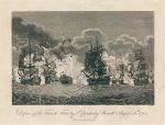
Defeat of the French Fleet by Sir Cloudesley Shovell, in 1704. "Defeat of the French Fleet, by Sr. Cloudesley Shovell August 13th 1704" engraved by J.Pass, published in 1796. Copper engraved antique print, good condition. Size 19 x 14 cms plus margins with full plate mark. Ref G9969
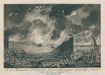
Toulon, burning of the Arsenel and blowing up of the French ships, in 1793. "An Exact Representation of burning the Arsenel & blowing up the French Ships of War in the Harbour of Toulon" engraved by J.Pass after a picture by Crystal, published in 1794. Copper engraved antique print, good condition. Size 20 x 14.5 cms plus margins with full plate mark. Ref G9968
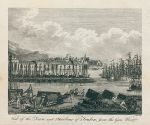
France, view of Toulon fron Gun Wharf, in 1793. "View of the Town and Harbour of Toulon, from the Gun Wharf" engraved by J.Pass after a picture by J.Vernet, published in 1794. Copper engraved antique print, vertical crease with small closed tear to lower 1cm in title area, otherwise good condition. Size 17 x 14 cms plus margins with partial plate mark. Ref G9967
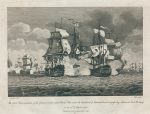
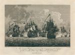
Defeat of the Dutch Fleet by Admiral Lord Duncan, in 1797. "An Exact Representation of the Engagement & Defeat of the Dutch Fleet, by Admiral Lord Duncan" engraved by Pass after a picture by Godefroy, published in 1798. Copper engraved antique print, vertical printer's crease in sky area, otherwise good condition. Size 19 x 14.5 cms plus margins with full plate mark. Ref G9966
Defeat of the Spanish Fleet off Cape St.Mary, Spain, in 1780. "The Defeat of the Spanish Fleet under the Command of Don Langara, off Cape St.Mary, on the Coast of Spain, by Admiral Sir George Rodney, Jan 16th 1780" anonymous engraver, published in a naval & military history, dated 1780. Copper engraved antique print, slight soiling in the margins, otherwise good condition. Size 18.5 x 16.5 cms plus margins with full plate mark. Ref G9965
Naval Battle near Rock of Lisbon with the Flamborough & Biddeford in 1760. "Engagement between the Flamborough & Biddeford, & two French Frigates near the Rock of Lisbon" anonymous engraver, published in a naval & military history, about 1800. Copper engraved antique print, slight soiling in the margins, otherwise good condition. Size 22 x 16.5 cms plus margins. Ref G9964
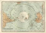
South Polar Chart, 1886. "South Polar Chart" by J.Bartholomew, published by the Royal Geographical Society in Gazetteer of the World, 1886. Colour lithographic map. Good condition. Size 20.5 x 15 cms plus margins. Ref G9963
Tasmania & Spitzbergen Islands map, 1886. "Tasmania" and "Spitzbergen Islands" by J.Bartholomew, published by the Royal Geographical Society in Gazetteer of the World, 1886. Colour lithographic map. Good condition. Size 23 x 14.5 cms plus margins. Ref G9962
Estuary of the Thames and Medway, 1886. "Estuary of the Thames and the Medway" by J.Bartholomew, published by the Royal Geographical Society in Gazetteer of the World, 1886. Colour lithographic map. Good condition. Size 23 x 13.5 cms plus margins. Ref G9961
Trinidad map, 1886. "Island of Trinidad" published by the Royal Geographical Society in Gazetteer of the World, 1886. Colour lithographic map. Good condition. Size 23 x 14 cms plus margins. Ref G9960
Canada, Vancouver Island map, 1886. "Vancouver Island" published by the Royal Geographical Society in Gazetteer of the World, 1886. Colour lithographic map. Good condition. Size 23 x 14 cms plus margins. Ref G9959
West Australia map, 1886. "West Australia" by J.Bartholomew, published by the Royal Geographical Society in Gazetteer of the World, 1886. Colour lithographic map. Good condition. Size 15 x 23.5 cms plus margins. Ref G9958
West Indies map, 1886. "West Indies" by J.Bartholomew, published by the Royal Geographical Society in Gazetteer of the World, 1886. Colour lithographic map. Good condition. Size 24 x 15 cms plus margins. Ref G9957
Grecian Archipelago map, 1886. "The Grecian Archipelago" by A.Petermann, published by the Royal Geographical Society in Gazetteer of the World, 1886. Colour lithographic map. Good condition. Size 14 x 23.5 cms plus margins. Ref G9956
Channel Islands map, 1886. "Guernsey and Sark" with "Jersey" by J.Bartholomew, published by the Royal Geographical Society in Gazetteer of the World, 1886. Colour lithographic map. Good condition. Size 13.5 x 23.5 cms plus margins. Ref G9955
© 2003 - 2020 Website copyright Steve Bartrick Royalty free stock images of antique prints of interest to historians, students and family history researchers