Please see my main site ANTIQUEPRINTS.COM For original antique prints and maps
Charing Cross - 1837
Home » All prints and maps
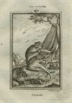
Talapoin monkey, after Buffon, 1785. "Talapoin" (monkey) engraved by A.Bell, published in William Smellie's translation of Natural History ... by the Count de Buffon, 1785. Copper engraved print, good condition with good margins. Size about 9 x 15 cms including title, plus margins. Ref G9719
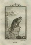
Mustax monkey, after Buffon, 1785. "Mustax" (monkey) engraved by A.Bell, published in William Smellie's translation of Natural History ... by the Count de Buffon, 1785. Copper engraved print, good condition with good margins. Size about 9 x 15 cms including title, plus margins. Ref G9718
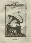
Callithrix monkey, after Buffon, 1785. "Callitrix" (Callithrix monkey) engraved by A.Bell, published in William Smellie's translation of Natural History ... by the Count de Buffon, 1785. Copper engraved print, good condition with good margins. Size about 9 x 15 cms including title, plus margins. Ref G9717
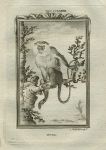
Mona monkey, after Buffon, 1785. "Mona" (monkey) engraved by A.Bell, published in William Smellie's translation of Natural History ... by the Count de Buffon, 1785. Copper engraved print, good condition with good margins. Size about 9 x 15 cms including title, plus margins. Ref G9716
Central Africa map, 1886. "Central Africa" by J.Bartholomew, published by the Royal Geographical Society in Gazetteer of the World, 1886. Colour lithographic map. Good condition. Size 24 x 14.5 cms plus margins. Ref G9715
Boston Harbour map, 1886. "Boston Harbour and Vicinity" by J.Bartholomew, published by the Royal Geographical Society in Gazetteer of the World, 1886. Colour lithographic map. Good condition. Size 23.5 x 14 cms plus margins. Ref G9714
Brazil map, 1886. "East Coast of Brazil; Bahia, Sergipe, Alagoas and part of Pernambuco" by J.Bartholomew, published by the Royal Geographical Society in Gazetteer of the World, 1886. Colour lithographic map. Good condition. Size 14 x 23 cms plus margins. Ref G9713
Bristol Channel map, 1886. "Bristol Channel" published by the Royal Geographical Society in Gazetteer of the World, 1886. Colour lithographic map. Good condition. Size 24 x 14.5 cms plus margins. Ref G9712
Sri Lanka (Ceylon) map, 1886. "Ceylon" published by the Royal Geographical Society in Gazetteer of the World, 1886. Colour lithographic map. Good condition. Size 14 x 24 cms plus margins. Ref G9711
Chile map, 1886. "Chile" by J.Bartholomew, published by the Royal Geographical Society in Gazetteer of the World, 1886. Colour lithographic map. Good condition. Size 23.5 x 14.5 cms plus margins. Ref G9710
Scotland, Upper Estuary of the Clyde map, 1886. "Upper Estuary of the Clyde and Adjoining Country" by J.Bartholomew, published by the Royal Geographical Society in Gazetteer of the World, 1886. Colour lithographic map. Good condition. Size 25 x 14 cms plus margins. Ref G9709
Turkey, Constantinople map, 1886. "Constantinople" published by the Royal Geographical Society in Gazetteer of the World, 1886. Colour lithographic map. Good condition. Size 23.5 x 14 cms plus margins. Ref G9708
Crimea map, 1886. "Crimea" (with small inset of Sebastopol) by J.Bartholomew, published by the Royal Geographical Society in Gazetteer of the World, 1886. Colour lithographic map. Good condition. Size 23.5 x 14 cms plus margins. Ref G9707
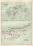
Fiji Islands and Cyprus maps, 1886. "Fiji Islands" with "Cyprus" by J.Bartholomew, published by the Royal Geographical Society in Gazetteer of the World, 1886. Colour lithographic map. Good condition. Size 14.5 x 20.5 cms plus margins. Ref G9706
Dublin environs map, 1886. "Environs of Dublin" by J.Bartholomew, published by the Royal Geographical Society in Gazetteer of the World, 1886. Colour lithographic map. Good condition. Size 23 x 13.5 cms plus margins. Ref G9705
Belfast & Cork maps, 1886. "Belfast & Environs" with "Cork Harbour & Environs" by J.Bartholomew, published by the Royal Geographical Society in Gazetteer of the World, 1886. Colour lithographic map. Good condition. Size 14 x 23.5 cms plus margins. Ref G9704
Egypt map, 1886. "Egypt" by J.Bartholomew, published by the Royal Geographical Society in Gazetteer of the World, 1886. Colour lithographic map. Crease across lower right corner, otherwise good condition. Size 14 x 23.5 cms plus margins. Ref G9703
Faroe Islands map, 1886. "Faroe Islands" published by the Royal Geographical Society in Gazetteer of the World, 1886. Colour lithographic map. Good condition. Size 14 x 23.5 cms plus margins. Ref G9702
© 2003 - 2020 Website copyright Steve Bartrick Royalty free stock images of antique prints of interest to historians, students and family history researchers