Home » All prints and maps

 
Oxfordshire & Buckinghamshire maps, 1784

Oxfordshire & Buckinghamshire maps, 1784.
"A New Map of Oxfordshire, Drawn from the Latest & Best Authorities" and "A New Map of Buckinghamshire, Drawn from the Latest & Best Authorities" by Thomas Conder, published in Walpoole's New and Complete British Traveller, about 1784. Pair of copper engraved maps on one sheet, with recent hand colouring. Upper margin close trimmed, otherwise good condition. Size 35 x 22.5 cms including title, plus margins. Ref G7474

 
Shropshire & Staffordshire maps, 1784

Shropshire & Staffordshire maps, 1784.
"A New Map of Shropshire, Drawn from the Latest Authorities" and "A New Map of Staffordshire, Drawn from the Latest Authorities" by Thomas Conder, published in Walpoole's New and Complete British Traveller, about 1784. Pair of copper engraved maps on one sheet, with recent hand colouring. Good condition. Size 34.5 x 22.5 cms including title, plus margins. Ref G7473

 
Herefordshire & Monmouthshire maps, 1784

Herefordshire & Monmouthshire maps, 1784.
"A New Map of Monmouthshire, Drawn from the Latest Authorities" and "A New Map of Herefordshire, Drawn from the Latest Authorities" by Thomas Conder, published in Walpoole's New and Complete British Traveller, about 1784. Pair of copper engraved maps on one sheet, with recent hand colouring. Good condition. Size 32 x 20 cms including title, plus margins. Ref G7472


Cambridgeshire map, 1784

Cambridgeshire map, 1784.
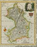
"A New Map of Cambridgeshire, Drawn from the Latest Authorities" by Thomas Conder, published in Walpoole's New and Complete British Traveller, about 1784. Copper engraved map, with recent hand colouring. Trimmed to neatline on left side, otherwise good condition. Size 16 x 20 cms including title, plus margins. Ref G7471

 
Northamptonshire map, 1784

Northamptonshire map, 1784.
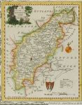
"A New Map of Northamptonshire , Drawn from the Latest Authorities" by Thomas Conder, published in Walpoole's New and Complete British Traveller, about 1784. Copper engraved map, with recent hand colouring. Trimmed to neatline on right side, otherwise good condition. Size 16 x 20 cms including title, plus margins. Ref G7470

 
Kent map, 1784

Kent map, 1784.
"A New Map of Essex, Drawn from the Latest Authorities" by Thomas Conder, published in Walpoole's New and Complete British Traveller, about 1784. Copper engraved map, with recent hand colouring. Trimmed to neatline on right, upper and lower sides, otherwise good condition. Size 22.5 x 12 cms including title, plus margins. Ref G7469


Essex map, 1784

Essex map, 1784.
"A New Map of Essex, Drawn from the Latest Authorities" by Thomas Conder, published in Walpoole's New and Complete British Traveller, about 1784. Copper engraved map, with recent hand colouring. Trimmed to neatline on right, upper and lower sides, otherwise good condition. Size 22.5 x 12 cms including title, plus margins. Ref G7468

 
Leicestershire map, 1784

Leicestershire map, 1784.
"A New Map of the Counties of Leicester & Rutland, Drawn from the Latest Authorities" by Thomas Conder, published in Walpoole's New and Complete British Traveller, about 1784. Copper engraved map, with recent hand colouring. Trimmed to neatline on right and lower sides, otherwise good condition. Size 22.5 x 12 cms including title, plus margins. Ref G7467

 
Huntingdonshire map, 1784

Huntingdonshire map, 1784.
"A New Map of Huntingdonshire, Drawn from the Latest Authorities" by Thomas Conder, published in Walpoole's New and Complete British Traveller, about 1784. Copper engraved map, with recent hand colouring. Trimmed to neatline on left and upper sides, otherwise good condition. Size 11 x 18 cms including title, plus margins. Ref G7466


Wiltshire map, 1784

Wiltshire map, 1784.
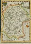
"A New Map of Wiltshire, Drawn from the Latest Authorities" by Thomas Conder, published in Walpoole's New and Complete British Traveller, about 1784. Copper engraved map, with recent hand colouring. Trimmed to neatline on left, right and upper sides, otherwise good condition. Size 11 x 18 cms including title, plus margins. Ref G7465

 
Worcestershire map, 1784

Worcestershire map, 1784.
"A New Map of Worcestershire, Drawn from the Latest Authorities" by Thomas Conder, published in Walpoole's New and Complete British Traveller, about 1784. Copper engraved map, with recent hand colouring. Trimmed to neatline on left and lower sides, otherwise good condition. Size 11 x 18 cms including title, plus margins. Ref G7464

 
Warwickshire map, 1784

Warwickshire map, 1784.
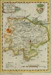
"A New Map of Warwickshire, Drawn from the Latest Authorities" by Thomas Conder, published in Walpoole's New and Complete British Traveller, about 1784. Copper engraved map, with recent hand colouring. Trimmed to neatline on left, right and lower sides, otherwise good condition. Size 11 x 18 cms including title, plus margins. Ref G7463


Dorset map, 1784

Dorset map, 1784.
"A New Map of Dorsetshire, Drawn from the Latest Authorities" by Thomas Conder, published in Walpoole's New and Complete British Traveller, about 1784. Copper engraved miniature map, with recent hand colouring. Trimmed to neatline on right and upper sides, otherwise good condition. Size 17.5 x 11 cms including title, plus margins. Ref G7462

 
Sussex map, 1784

Sussex map, 1784.
"A New Map of Sussex, Drawn from the Latest Authorities" by Thomas Conder, published in Walpoole's New and Complete British Traveller, about 1784. Copper engraved miniature map, with recent hand colouring. Trimmed to neatline on left and upper sides, otherwise good condition. Size 17.5 x 11 cms including title, plus margins. Ref G7461

 
Surrey map, 1784

Surrey map, 1784.
"A New Map of Surrey, Drawn from the Latest Authorities" by Thomas Conder, published in Walpoole's New and Complete British Traveller, about 1784. Copper engraved miniature map, with recent hand colouring. Trimmed to neatline on left and lower sides, otherwise good condition. Size 17.5 x 11 cms including title, plus margins. Ref G7460


Middlesex map, 1784

Middlesex map, 1784.
"A New Map of Middlesex, Drawn from the Latest Authorities" by Thomas Conder, published in Walpoole's New and Complete British Traveller, about 1784. Copper engraved miniature map, with recent hand colouring. Trimmed to neatline on right and lower sides, otherwise good condition. Size 17.5 x 11 cms including title, plus margins. Ref G7459

 
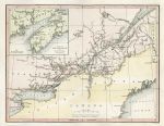
Canada map, 1841

Canada map, 1841.
"Canada" engraved by W.Hughes, published in Canadian Scenery, 1842. Steel engraved antique map with recent hand colouring. Good condition. Size 24.5 x 19 cms including title, plus margins. Ref G7458

 
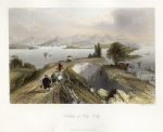
Hong Kong Harbour, 1843

Hong Kong Harbour, 1843.
"Harbour of Hong Kong" engraved by S.Bradshaw after a picture by Thomas Allom, published in China Illustrated, 1843. Steel engraved print with recent hand colouring. Good condition. Size 19 x 15 cms including title, plus margins. Ref G7457

 
« Previous | ...830 | 831 | 832 | 833 | 834 | 835 | 836 | 837 | 838 | 839 | 840... | Next »


© 2003 - 2020 Website copyright Steve Bartrick
Royalty free stock images of antique prints of interest to historians, students and family history researchers