Please see my main site ANTIQUEPRINTS.COM For original antique prints and maps
Charing Cross - 1837
Home » Antique maps » All prints and maps
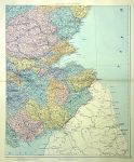
Scotland on 4 large sheets, 1887. "Scotland" by Stanford's Geographical Establishment, published in Stanford's London Atlas of Universal Geography, 1887. Four large chromolithographic antique maps showing Scotland in detail. Each has a centrefold as published. Slight soiling. Size 47 x 57 cms each plus good margins. These maps could be joined to make one very large map. (Note - Only one map is shown in my image, this is a digital camera image with uneven lighting that accentuates the slight browning on the fold.) Ref E5447
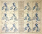
British Isles, monthly rainfall map, 1887. "Monthly Rainfall and Temperature of the British Isles" by Stanford's Geographical Establishment, published in Stanford's London Atlas of Universal Geography, 1887. Large chromolithographic antique map. Centrefold as published. Slight soiling. Size 61 x 50 cms plus good margins. (Note - this is a digital camera image with uneven lighting that accentuates the slight browning on the fold.) Ref E5445
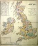
British Isles, large hydrographical map, 1887. "Hydrographical Map of the British Isles" (river catchment areas) by Stanford's Geographical Establishment, published in Stanford's London Atlas of Universal Geography, 1887. Large chromolithographic antique map. Centrefold as published. Very slight soiling. Size 53 x 63 cms plus good margins. (Note - this is a digital camera image with uneven lighting that accentuates the slight browning on the fold.) Ref E5442
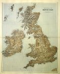
British Isles, large map of relief, 1887. "Stereographical Map of the British Isles" by Stanford's Geographical Establishment, published in Stanford's London Atlas of Universal Geography, 1887. Large chromolithographic antique map. Centrefold as published. Very slight soiling. Size 48 x 64 cms plus good margins. (Note - this is a digital camera image with uneven lighting that accentuates the slight browning on the fold.) Ref E5441
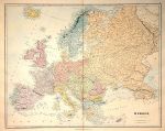
Europe, large map, 1887. "Europe" by J.Arrowsmith, published in Stanford's London Atlas of Universal Geography, 1887. Large chromolithographic antique map. Centrefold as published. Very slight soiling. Size 61 x 48 cms plus good margins. (Note - this is a digital camera image with uneven lighting that accentuates the slight browning on the fold.) Ref E5440
Saxon England, 1790. "Saxon England according to the Saxon Chronicle" engraved by A.Bell and published in History of Great Britain, about 1790. Copper engraved map with recent hand colour. Several (flattened) folds, as published. Close trimmed and re-edged to upper right margin (no loss), otherwise very good condition. Size 22.5 x 34 cms including text below map, plus margins. Ref E5423
USA, Maps relating to war in 1776-7, published 1863. "Battle Field of Saratoga 1777" with "White Plains 1776" and "Upper Hudson 1776-7" Lithographic antique map published in History of the United States of America, 1863. Recent hand colouring. Size 14 x 23 cms plus good margins. Ref E5397
USA, Maps relating to 1754-59, published 1863. [ Maps relating to several forts and Braddock's Defeat in 1755 ] Lithographic antique map published in History of the United States of America, 1863. Recent hand colouring. Size 14 x 23 cms plus good margins. Ref E5394
USA, Maps relating to early exploration of America, published 1863. "America, 1566" and "America, Scandinavian and other Voyages ..." Lithographic antique map published in History of the United States of America, 1863. Recent hand colouring. Size 14 x 23 cms plus good margins. Ref E5392
USA, Maps relating to the war in 1778-9, published 1863. [ Three maps relating to war in 1778-9 (Military Expeditions) ] Lithographic antique map published in History of the United States of America, 1863. Recent hand colouring. Size 14 x 23 cms plus good margins. Ref E5391
USA, Maps relating to war with Mexico in 1846, published 1863. [ Three maps relating to war with Mexico in 1846 ] comprising Invasion of Northern Mexico by the American Army, Central Mexico Invasion and Siege of Vera Cruz. Lithographic antique map published in History of the United States of America, 1863. Recent hand colouring. Size 14 x 23 cms plus good margins. Ref E5390
USA, Upper Ohio in 1782, published 1863. "Upper Ohio 1782, Forts, Army Tracks and Battle Fields" lithographic antique map published in History of the United States of America, 1863. Recent hand colouring. Size 23 x 14 cms plus good margins. Ref E5387
USA, 2 Maps relating to the War of Independance, published 1863. [ Two maps relating to the War of Independance ] comprising District of Yorktown in 1781 and Siege of Yorktown in 1781. Lithographic antique map published in History of the United States of America, 1863. Recent hand colouring. Size 14 x 23 cms plus good margins. Ref E5386
USA, 4 maps relating to the War of 1812, 1863. [ Four maps relating to the War of 1812 ] comprising Niagara District, St.Lawrence River, Wabash Valley and Western Frontier. Lithographic antique map published in History of the United States of America, 1863. Recent hand colouring. Size 14 x 23 cms plus good margins. Ref E5383
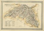
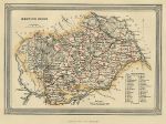
Scotland, Edinburgh shire, 1865. "Edinburgh shire" published by A.Fullarton & Co. in The Imperial Gazetteer of Scotland, 1865. Lithographic antique map with original hand colour. Size 17.5 x 12.5 cms plus good margins. Ref E5353
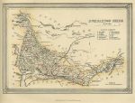
Scotland, Dumbartonshire, 1865. "Dumbartonshire" published by A.Fullarton & Co. in The Imperial Gazetteer of Scotland, 1865. Lithographic antique map with original hand colour. Size 17.5 x 12.5 cms plus good margins. Ref E5351
Scotland, Caithnesshire, 1865. "Caithnesshire" published by A.Fullarton & Co. in The Imperial Gazetteer of Scotland, 1865. Lithographic antique map with original hand colour. Size 12.5 x 17.5 cms plus good margins. Ref E5350
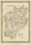
Scotland, Berwickshire, 1865. "Berwickshire" published by A.Fullarton & Co. in The Imperial Gazetteer of Scotland, 1865. Lithographic antique map with original hand colour. Size 17.5 x 12.5 cms plus good margins. Ref E5348
© 2003 - 2020 Website copyright Steve Bartrick Royalty free stock images of antique prints of interest to historians, students and family history researchers