Please see my main site ANTIQUEPRINTS.COM For original antique prints and maps
Charing Cross - 1837
Home » Antique maps » All prints and maps
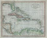
West Indies, 1807. "West Indies from the Best Authorities" engraved by B.Baker, copper engraved antique map published in The General Gazetteer, 1807. Recent hand colouring, good condition. Size 23.5 x 19 cms plus margins. Ref H6304
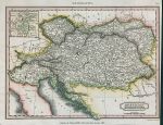
Austrian Dominions, 1817. "Austrian Dominions" engraved by A.Findlay, published in an encyclopedia, 1817. Copper engraved antique map with recent hand colour. Very narrow right margin. Size 25 x 19 cms including title, plus margins. Ref H6303
Asia map, 1817. "Asia" engraved by A.Findlay, published in an encyclopedia, 1817. Copper engraved antique map with recent hand colour. Size 24.5 x 19.5 cms including title, plus margins. Ref H6303
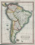
South America, 1817. "South America" engraved by A.Findlay, published in an encyclopedia, 1817. Copper engraved antique map with recent hand colour. Size 19 x 25 cms including title, plus margins (narrow lower margin). Ref H6301
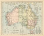
Australia, William McKenzie, c1880. "Australia" chromolithograph published by William McKenzie, about 1880. Shows area divisions by colour with ‘West Australia’, ‘The North Territory’, ‘Alexandra Land’, ‘Queensland’, ‘New South Wales’, ‘Victoria’ and ‘South Australia’. List of counties given in the sea area. Centrefold as published. Good condition. Size 28.5 x 23.5 cms plus margins. Ref H6297
North Wales map on two sheets, by Walker, 1846. "North Wales" by John & Charles Walker, published in their British Atlas, about 1846. Pair of steel engraved antique maps with original hand colouring. Each has a centrefold as published. Some splitting and weakness along the fold of the left hand (west) map, otherwise good condition with good margins. Size 32.5 x 39 cms each, plus margins. Ref H6296
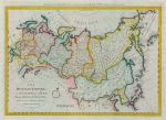
Russian Empire, by Thomas Bowen, 1785. "The Russian Empire, in Europe & Asia, with the Northern Discoveries between Asia & North America" by Thomas Bowen, published in Bankes's New System of Universal Geography, c1785. Copper engraved antique map with recent hand colouring. Two vertical folds as published, one small pinhole otherwise good condition with full plate mark and good margins. Size 46.5 x 34 cms to plate mark, plus margins. Ref H6295
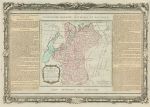
Russia in Europe, Desnos map, 1770. "La Russie Européenne ..." map by Louis Brion de la Tour, published by Louis Charles Desnos in his Atlas Général et Élémentaire pour l'Etude de la Géographie et de l'Histoire moderne, c1770. Copper engraved antique map with original hand colouring. Centre fold as published, very good condition with full plate mark and wide margins. Size 52 x 36 cms to plate mark, plus good margins. Ref H6294
Portugal map, 1820. "Portugal" engraved by Lowry after Arrowsmith, published in Rees's Cyclopedia; or, Universal Dictionary ..., 1820. Copper engraved antique map with recent hand colouring, centrefold as published, good condition. Size 22 x 40.5 cms, plus margins. Ref H6143
Switzerland map, 1820. "Switzerland" engraved by John Cooke after Arrowsmith, published in Rees's Cyclopedia; or, Universal Dictionary ..., 1820. Copper engraved antique map with recent hand colouring, centrefold as published, good condition. Size 39 x 25.5 cms, plus margins. Ref H6142
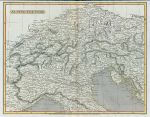
North Italy & The Alps map, 1820. "Alpine Country" engraved by J.Russell after Arrowsmith, published in Rees's Cyclopedia; or, Universal Dictionary ..., 1820. Copper engraved antique map with recent hand colouring, centrefold as published, narrow upper margin, otherwise good condition. Size 32.5 x 25.5 cms, plus margins. Ref H6141
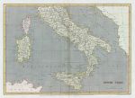
Southern Italy map, 1820. "South Italy" engraved by Sidney Hall after Arrowsmith, published in Rees's Cyclopedia; or, Universal Dictionary ..., 1820. Copper engraved antique map with recent hand colouring, centrefold as published, good condition. Size 33.5 x 24 cms, plus margins. Ref H6140
Spain & Portugal map, 1820. "Spain and Portugal" engraved by J.Bye after Arrowsmith, published in Rees's Cyclopedia; or, Universal Dictionary ..., 1820. Copper engraved antique map with recent hand colouring, centrefold as published, good condition. Size 40 x 25.5 cms, plus margins. Ref H6139
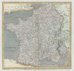
France map, 1820. "France" engraved by Edward Jones after Arrowsmith, published in Rees's Cyclopedia; or, Universal Dictionary ..., 1820. Copper engraved antique map with recent hand colouring, centrefold as published, good condition. Size 26 x 25 cms, plus margins. Ref H6138
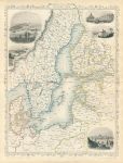
Baltic Sea, Tallis/Rapkin map, 1860. "Baltic Sea" classic decorative Tallis/Rapkin map published by The London Printing and Publishing Company, about 1860. Steel engraved map with original outline hand colour. The decorative vignettes show Kronstadt, Revel, St.Petersburg, Abo and Helsingfors. Centrefold as published, good condition. Size 25 x 33 cms including decorative border, plus margins. Ref H6087
Germany, Mainz, plan of defenses (Nine Years' War), c1701. [ Mainz, Germany. Plan of fortifications, Nine Year's War ] by Herman Moll(?), published in an edition of Timothy Childe's A System of Geography ..., about 1701. Copper engraved plan of the fortifications set in a page of text, and with text on the reverse. Good condition for the age with full plate mark to plan. Scarce. Size of plan 16.5 x 13.5 cms, size of page 20 x 32 cms. Ref H6036
Germany, Freiburg and Brisach plans of defenses (Nine Years' War), c1701. [ Freiburg and Brisach, Germany. Plans of fortifications, Nine Year's War ] by Herman Moll(?), published in an edition of Timothy Childe's A System of Geography ..., about 1701. Pair of copper engraved plans of the fortifications set in a page of text, and with text on the reverse. Good condition for the age with full plate mark to plan. Scarce. Size of each plan about 13.5 x 9.5 cms, size of page 20 x 32 cms. Ref H6035
Germany, Saarlouis, plan of defenses (Nine Years' War), c1701. [ Saarlouis, Germany. Plan of fortifications, Nine Year's War ] by Herman Moll(?), published in an edition of Timothy Childe's A System of Geography ..., about 1701. Copper engraved plan of the fortifications set in a page of text, and with text on the reverse. Good condition for the age with full plate mark to plan. Scarce. Size of plan 13.5 x 9 cms, size of page 20 x 32 cms. Ref H6034
© 2003 - 2020 Website copyright Steve Bartrick Royalty free stock images of antique prints of interest to historians, students and family history researchers