Home » Antique maps » All prints and maps

 
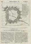
Belgium, Ath, plan of defenses (Nine Years' War), c1701

Belgium, Ath, plan of defenses (Nine Years' War), c1701.
[ Ath (Aeth), Belgium. Plan of fortifications, Nine Year's War ] by Herman Moll(?), published in an edition of Timothy Childe's A System of Geography ..., about 1701. Copper engraved plan of the fortifications set in a page of text, and with text on the reverse. Good condition for the age with full plate mark to plan. Scarce. Size of plan 16.5 x 14 cms, size of page 20 x 32 cms. Ref H6033

 
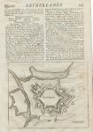
Belgium, Charleroi, plan of defenses (Nine Years' War), c1701

Belgium, Charleroi, plan of defenses (Nine Years' War), c1701.
[ Charleroi, Belgium. Plan of fortifications, Nine Year's War ] by Herman Moll(?), published in an edition of Timothy Childe's A System of Geography ..., about 1701. Copper engraved plan of the fortifications set in a page of text, and with text on the reverse. Good condition for the age with full plate mark to plan. Scarce. Size of plan 16.5 x 14 cms, size of page 20 x 32 cms. Ref H6032

 
Germany, Cologne, plan of defenses (Nine Years' War), c1701

Germany, Cologne, plan of defenses (Nine Years' War), c1701.
[ Cologne, Germany. Plan of fortifications, Nine Year's War ] by Herman Moll(?), published in an edition of Timothy Childe's A System of Geography ..., about 1701. Copper engraved plan of the fortifications set in a page of text, and with text and a similar plan of Bonne on the reverse. Good condition for the age with full plate mark to plan. Scarce. Size of plan 13.5 x 9 cms, size of page 20 x 32 cms. Ref H6031


Germany, Trier, plan of defenses (Nine Years' War), c1701

Germany, Trier, plan of defenses (Nine Years' War), c1701.
[ Trier, Germany. Plan of fortifications, Nine Year's War ] by Herman Moll(?), published in an edition of Timothy Childe's A System of Geography ..., about 1701. Copper engraved plan of the fortifications set in a page of text, and with text and a similar plan of Rheineberk on the reverse. Good condition for the age with full plate mark to plan. Scarce. Size of plan 13.5 x 9 cms, size of page 20 x 32 cms. Ref H6030

 
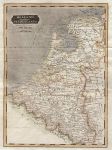
Holland & the Netherlands (Belgium), 1825

Holland & the Netherlands (Belgium), 1825.
"Holland and the Netherlands" engraved by R.Scott, published by E.Khull & Co. of Glasgow in The Glasgow Geography, 1825. Copper engraved map with recent hand colour. Two (flattened) folds as published. Size 17.5 x 24 cms plus margins. Ref H5829

 
Netherlands map, 1820

Netherlands map, 1820.
"The Seven United Provinces" engraved by Cooper after Arrowsmith, published in Rees's Cyclopedia; or, Universal Dictionary ..., 1820. Copper engraved antique map with recent hand colouring, centrefold as published, good condition. Size 39 x 25 cms, plus margins. Ref H5771


Ancient France (Gallia or Gaul), 1820

Ancient France (Gallia or Gaul), 1820.
"Galliae, sicut ab Augusto divisae pars septentrionalis" with inset map "Gallia, qualis suit ineunte seculo quinto aerae Christianae, in 17 provincias dispertita" engraved by J.Russell after D.Mcpherson, published in Rees's Cyclopedia; or, Universal Dictionary ..., 1820. Copper engraved antique map with recent hand colouring, centrefold as published, good condition. Size 40 x 26 cms, plus margins. Ref H5770

 
Rhaetia and Noricum (Roman period), 1820

Rhaetia and Noricum (Roman period), 1820.
"Rhaetia et Noricum, Provinciae Romanorum" engraved by Cooper after D.Mcpherson, published in Rees's Cyclopedia; or, Universal Dictionary ..., 1820. Copper engraved antique map with recent hand colouring, centrefold as published, good condition. Size 40.5 x 25.5 cms, plus margins. Ref H5769

 
Germania Magna (Roman period), 1820

Germania Magna (Roman period), 1820.
"Germania Magna quoe ninquam Romanis paruit" engraved by Cooper after W.W.Mcpherson, published in Rees's Cyclopedia; or, Universal Dictionary ..., 1820. Copper engraved antique map with recent hand colouring, centrefold as published, good condition. Size 40 x 25.5 cms, plus margins. Ref H5768


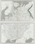
Russia in Europe, on 2 maps, 1820

Russia in Europe, on 2 maps, 1820.
"... Russia in Europe" engraved by Cooper after Arrowsmith, published in Rees's Cyclopedia; or, Universal Dictionary ..., 1820. Pair of copper engraved antique maps, with centrefolds as published, good condition. Size of each 40 x 24.5 cms, plus margins. Ref H5767

 
Russian Empire (Russia in Asia), 1820

Russian Empire (Russia in Asia), 1820.
"Russian Empire" engraved by Cooper after Arrowsmith, published in Rees's Cyclopedia; or, Universal Dictionary ..., 1820. Copper engraved antique map, centrefold as published, good condition. Size 40.5 x 24.5 cms, plus margins. Ref H5766

 
Ancient Judea (Israel/Palestine), 1820

Ancient Judea (Israel/Palestine), 1820.
"Judaea et Regiones Finitimae circiter initium Aerae Christianae" and "Terra Filiorum Israelis, antequam in duo regna dispertita fuit, cum Terra Philistaeorum, parte Phoenices &c." engraved by J.Russell after Arrowsmith, published in Rees's Cyclopedia; or, Universal Dictionary ..., 1820. Copper engraved antique map, centrefold as published, good condition. Size 40 x 26 cms, plus margins. Ref H5765


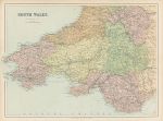
South Wales map, c1867

South Wales map, c1867.
"South Wales" by J.Bartholomew, published by George Philip & Son in a county atlas, about 1867. Early colour lithographic map with centrefold as published, very slight soiling, otherwise good condition. Size 46 x 33 cms plus margins. Ref H5763

 
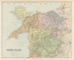
North Wales map, c1867

North Wales map, c1867.
"North Wales" by J.Bartholomew, published by George Philip & Son in a county atlas, about 1867. Early colour lithographic map with centrefold as published, very slight soiling, otherwise good condition. Size 41.5 x 33.5 cms plus margins. Ref H5762

 
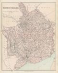
Monmouthshire map, c1867

Monmouthshire map, c1867.
"Monmouthshire" by Edward Weller, published by George Philip & Son in a county atlas, about 1867. Early colour lithographic map with centrefold as published, very slight soiling and the reverse has several pasted down descriptions of WW2 aircraft, this not affecting the map as it is on thick paper. Size 33.5 x 42 cms plus margins. Ref H5746


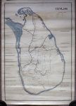
Sri Lanka (Ceylon), manuscript map of the railways, dated 1948

Sri Lanka (Ceylon), manuscript map of the railways, dated 1948.
"Ceylon, Government Railways". Hand drawn map in pen with blue colouring for the coast. All railways and rivers marked (rivers green), many places of interest indicated as well as all railway stations or stops. A key upper right indicates broad guage lines shown in heavy black, narrow guage in thin black, roads in a slightly thicker black, rivers in green and some heights marked in red. Monogrammed lower right, with 'Trincomalee' and dated 20 Jan 1948 (independance was proclaimed 4th Feb 1948). Drawn on the the back of part of a British admiralty chart of the coast of China. On thick paper, some staining and creasing due to being rolled badly for many years. Size 44 x 63 cms, plus margins. Ref H5719

 
Roman Empire map, published 1745

Roman Empire map, published 1745.
"A General Map of the Roman Empire shewing the situation of all it's Provinces & seats of ye Barbarous Nations on their Frontiers" engraved by J.Basire, published in the Universal History ..., about 1745. Copper engraved antique map with recent hand colour. Several (flattened) folds as published, left and right margins very close trimmed with some loss to left side, otherwise good condition. Size 50.5 x 25.5 cms, plus margins. Ref H5373

 
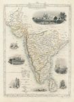
Southern India, Tallis/Rapkin map, 1858

Southern India, Tallis/Rapkin map, 1858.
"Southern India" classic decorative Tallis/Rapkin map published by The London Printing and Publishing Company, about 1858. Steel engraved map with original outline hand colour, the more desirable version without a centrefold and with good margins. The decorative vignettes include Shuhur at Jeypoor, Tomb of Sultan Mahomed Shah in Bejapoor and Government House in Calcutta. Good condition. Size 23 x 32.5 cms including decorative border, plus margins. Ref H5258

 
« Previous | ...30 | 31 | 32 | 33 | 34 | 35 | 36 | 37 | 38 | 39 | 40... | Next »


© 2003 - 2020 Website copyright Steve Bartrick
Royalty free stock images of antique prints of interest to historians, students and family history researchers