Please see my main site ANTIQUEPRINTS.COM For original antique prints and maps
Charing Cross - 1837
Home » Antique maps » All prints and maps
World - Zoological and Plants Charts, 1867. "Zoological Chart of The World ..." and "Chart of the World shewing the distribution of Principal Plants" by J.Bartholomew, chromolithographic map published in Black's General Atlas of the World ..., 1867. Good condition. Size 25 x 40.5 cms plus margins. Ref H580
World - Ocean Currents, and Ethnographic Chart, 1867. "Chart of The World Exhibiting it's Chief Physiocal Features, Currents of the Ocean &c." and "Ethnographical Chart of the World..." by J.Bartholomew, chromolithographic map published in Black's General Atlas of the World ..., 1867. Good condition. Size 25 x 41 cms plus margins. Ref H579
Palestine map, 1880. "A Map of Palestine" sepia lithographic map published in Picturesque Palestine, about 1880. Centrefold as published, good condition. Size 25.5 x 43 cms including title, plus margins. Ref H572
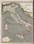
Italy map, 1811. "Italy" drawn and engraved by Cooper, published in A System of Modern Geography, 1811. Copper engraved antique map with recent hand colouring. Close trimmed to right margin, just to neatline, otherwise good condition. Size 19 x 24.5 cms including title, plus margins. Ref H571
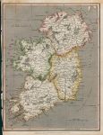
Ireland map, 1811. "Ireland" drawn and engraved by Cooper, published in A System of Modern Geography, 1811. Copper engraved antique map with recent hand colouring. Close trimmed (with slight loss) and creasing to left margin, otherwise good condition. Size 19 x 24.5 cms including title, plus margins. Ref H570
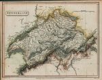
Switzerland map, 1811. "Switzerland" engraved by Cooper after W.W.Macpherson, published in A System of Modern Geography, 1811. Copper engraved antique map with recent hand colouring. Close trimmed along upper margin almost to neatline, otherwise good condition. Size 24.5 x 19 cms including title, plus margins. Ref H569
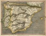
Spain and Portugal map, 1811. "Spain and Portugal" engraved by Cooper after W.W.Macpherson, published in A System of Modern Geography, 1811. Copper engraved antique map with recent hand colouring. Slight age browning, otherwise good condition. Size 25 x 18.5 cms including title, plus margins. Ref H418
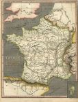
France in Departments map, 1811. "France in Departments" engraved by Cooper after W.W.Macpherson, published in A System of Modern Geography, 1811. Copper engraved antique map with recent hand colouring. Slight age browning, otherwise good condition. Size 24.5 x 19 cms including title, plus margins. Ref H417
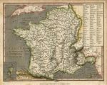
France in Provinces map, 1811. "France in Provinces" drawn and engraved by Cooper, published in A System of Modern Geography, 1811. Copper engraved antique map with recent hand colouring. Right margin trimmed to neatline, otherwise good condition. Size 19 x 24.5 cms including title, plus margins. Ref H416
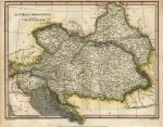
Austria map, 1811. "Austrian Dominions" engraved by Cooper after Alex Macpherson, published in A System of Modern Geography, 1811. Copper engraved antique map with recent hand colouring. Upper margin very close trimmed, otherwise good condition. Size 25 x 20 cms including title, plus margins. Ref H415
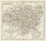
France, Berri, Nivernois, Bourbonois, Lyonois .... map, 1795. "Berri, Nivernois, Bourbonois, Lyonois, Bourgogne, Bresse et Franche-Comté ..." by Robert Vaugondy, published in Nouvel Atlas Portatif, 1795. Copper engraved antique map with original hand colouring, centrefold as published, good condition with full plate mark. Size 27 x 24.5 cms, plus good margins. Ref H254
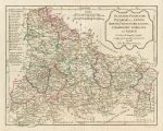
France, French Flanders, Picardy et Artois.... map, 1795. "Flandre françoise, Picardie et Artois, Isle de France, Orléanois, Champagne, Lorraine, et Alsace ..." by Robert Vaugondy, published in Nouvel Atlas Portatif, 1795. Copper engraved antique map with original hand colouring, centrefold as published, closed tear in lower margin, no loss and not affecting image area, otherwise good condition with full plate mark. Size 31 x 24 cms, plus good margins. Ref H253
The World, on Mercator's Projection, 1811. "The World on Mercator's Projection" engraved by Cooper after Alex MacPherson, published in A System of Modern Geography, 1811. Copper engraved antique map with recent hand colouring. Several flattened vertical folds and some creasing, lower margin close trimmed to about 5mm, otherwise good condition. Size 41 x 25 cms including title, plus margins. Ref H252
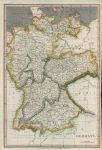
Germany map, 1811. "Germany" engraved by Cooper after Alex MacPherson, published in A System of Modern Geography, 1811. Copper engraved antique map with recent hand colouring. Two flattened horizontal folds, right margin close trimmed to about 5mm, otherwise good condition. Size 25 x 37 cms including title, plus margins. Ref H251
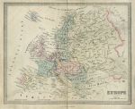
Europe map, 1850. "Europe" engraved by Stockley after James Wyld, published in an atlas about 1850. Steel engraved antique map, with original hand colouring. Centrefold as published, slight soiling and fading. Size 24 x 19.5 cms, plus margins. Ref H48
Dutch Guayana map, 1886. "Colonised Portions of Dutch Guayana or Surinam ..." by J.Bartholomew, published by the Royal Geographical Society in Gazetteer of the World, 1886. Colour lithographic map. Good condition. Size 23 x 14 cms plus margins. Ref H39
USA, New York Harbour chart, 1886. "New York Harbour and Vicinity" by J.Bartholomew, published by the Royal Geographical Society in Gazetteer of the World, 1886. Colour lithographic map. Good condition. Size 14 x 23.5 cms plus margins. Ref H38
Africa, Morocco, Liberia and Mauritius maps, 1886. "Morocco" with "Liberia ... West Africa" and "Mauritius" by J.Bartholomew, published by the Royal Geographical Society in Gazetteer of the World, 1886. Colour lithographic map. Good condition. Size 14.5 x 23.5 cms plus margins. Ref H37
© 2003 - 2020 Website copyright Steve Bartrick Royalty free stock images of antique prints of interest to historians, students and family history researchers