Please see my main site ANTIQUEPRINTS.COM For original antique prints and maps
Charing Cross - 1837
Home » Antique maps » All prints and maps
Wales, Milford Haven chart, 1886. "Milford Haven" by J.Bartholomew, published by the Royal Geographical Society in Gazetteer of the World, 1886. Colour lithographic map. Good condition. Size 23.5 x 14 cms plus margins. Ref H36
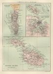
Gibraltar, Malta & Heligoland maps, 1886. "Gibraltar" with "Maltese Islands" and "Malta Harbour" and "Heligoland" by J.Bartholomew, published by the Royal Geographical Society in Gazetteer of the World, 1886. Colour lithographic map. Good condition. Size 14.5 x 21 cms plus margins. Ref H34
Island of Madeira map, 1886. "Island of Madeira" published by the Royal Geographical Society in Gazetteer of the World, 1886. Colour lithographic map. Good condition. Size 24 x 14 cms plus margins. Ref H33
Mississippi Delta & Leeward Islands map, 1886. "Delta of the Mississippi & Environs of New Orleans" with "Leeward Islands" by J.Bartholomew, published by the Royal Geographical Society in Gazetteer of the World, 1886. Colour lithographic map. Good condition. Size 24.5 x 14.5 cms plus margins. Ref H31
Kamchatka map, 1886. "Kamchatka" by A.Petermann, published by the Royal Geographical Society in Gazetteer of the World, 1886. Colour lithographic map. Good condition. Size 14 x 24 cms plus margins. Ref H30
Java map, 1886. "Java" by A.Petermann, published by the Royal Geographical Society in Gazetteer of the World, 1886. Colour lithographic map. Good condition. Size 25 x 14 cms plus margins. Ref H29
Japan map, 1886. "Japan" published by the Royal Geographical Society in Gazetteer of the World, 1886. Colour lithographic map. Good condition. Size 14.5 x 25 cms plus margins. Ref H28
Jamaica map, 1886. "Jamaica" published by the Royal Geographical Society in Gazetteer of the World, 1886. Colour lithographic map. Good condition. Size 24.5 x 14 cms plus margins. Ref H27
Iceland map, 1886. "Iceland" by A.Petermann, published by the Royal Geographical Society in Gazetteer of the World, 1886. Colour lithographic map. Good condition. Size 23.5 x 14 cms plus margins. Ref H26
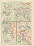
Hong Kong & other British settlements in Asia, 1886. "Hong Kong & other British settlements in Asia" (Perim Island, Labuan Island, Penang, Aden and Malacca & Nanning) by J.Bartholomew, published by the Royal Geographical Society in Gazetteer of the World, 1886. Colour lithographic map. Good condition. Size 14.5 x 21 cms plus margins. Ref H25
New Guinea map, 1886. "New Guinea" by J.Bartholomew, published by the Royal Geographical Society in Gazetteer of the World, 1886. Colour lithographic map. Good condition. Size 23.5 x 14 cms plus margins. Ref H24
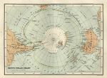
South Polar Chart, 1886. "South Polar Chart" by J.Bartholomew, published by the Royal Geographical Society in Gazetteer of the World, 1886. Colour lithographic map. Good condition. Size 20.5 x 15 cms plus margins. Ref G9963
Trinidad map, 1886. "Island of Trinidad" published by the Royal Geographical Society in Gazetteer of the World, 1886. Colour lithographic map. Good condition. Size 23 x 14 cms plus margins. Ref G9960
Canada, Vancouver Island map, 1886. "Vancouver Island" published by the Royal Geographical Society in Gazetteer of the World, 1886. Colour lithographic map. Good condition. Size 23 x 14 cms plus margins. Ref G9959
West Indies map, 1886. "West Indies" by J.Bartholomew, published by the Royal Geographical Society in Gazetteer of the World, 1886. Colour lithographic map. Good condition. Size 24 x 15 cms plus margins. Ref G9957
Sardinia & Sicily, 1886. "Sardinia" and "Sicily" by J.Bartholomew, published by the Royal Geographical Society in Gazetteer of the World, 1886. Colour lithographic map. Good condition. Size 14 x 23 cms plus margins. Ref G9841
Italy, Rome and environs, 1886. "Rome with it's Environs, according the the Surveys of Baron Moltke in 1845 & 1846. Drawn by Augustus Petermann ..." published by the Royal Geographical Society in Gazetteer of the World, 1886. Colour lithographic map. Good condition. Size 14 x 24 cms plus margins. Ref G9839
Brazil, Province of Rio De Janeiro, 1886. "Province of Rio De Janeiro, Brazil" after a map by H.Mahlmann, published by the Royal Geographical Society in Gazetteer of the World, 1886. Colour lithographic map. Good condition. Size 23.5 x 14 cms plus margins. Ref G9838
© 2003 - 2020 Website copyright Steve Bartrick Royalty free stock images of antique prints of interest to historians, students and family history researchers