Please see my main site ANTIQUEPRINTS.COM For original antique prints and maps
Charing Cross - 1837
Home » Antique maps » All prints and maps
France, Cherbourg, Dieppe & Boulogne, 1865. "Ports and Harbours on the coast of France" with Cherbourg, Dieppe & Boulogne, drawn and engraved by G.H.Swanston, published in A Gazetteer of the World ..., 1856. Lithographic antique map, with original hand colouring. Good condition. Size 14 x 23.5 cms including title, plus good margins. Ref G8076
Central America, Panama & Guatimala, 1865. "Central America shewing the proposed junctions of Atlantic and Pacific Oceans" with Guatimala and Panama, drawn and engraved by G.H.Swanston, published in A Gazetteer of the World ..., 1856. Lithographic antique map, with original hand colouring. Good condition. Size 14 x 24 cms including title, plus good margins. Ref G8075
The Caucasus map, 1865. "The Caucasus" engraved by G.H.Swanston after Augustus Petermann, published in A Gazetteer of the World ..., 1856. Lithographic antique map, with original hand colouring. Good condition. Size 23.5 x 14.5 cms including title, plus good margins. Ref G8074
Cape Verde Islands, 1865. "Cape Verd Islands" drawn and engraved by J.Bartholomew, published in A Gazetteer of the World ..., 1856. Lithographic antique map, with original hand colouring. Good condition. Size 23.5 x 14 cms including title, plus good margins. Ref G8073
British Guiana map, 1865. "British Guiana ..." engraved by G.H.Swanston after Augustus Petermann, published in A Gazetteer of the World ..., 1856. Lithographic antique map, with original hand colouring. Good condition. Size 14 x 24 cms including title, plus good margins. Ref G8072
Ukraine, Crimea with Sebastopol, 1865. "Crimea ..." drawn and engraved by J.Bartholomew, published in A Gazetteer of the World ..., 1856. Lithographic antique map, with original hand colouring. Good condition. Size 23.5 x 13.5 cms including title, plus good margins. Ref G8071
Canada, Ports & Cities, 1865. "Principal Cities & Ports in Canada" with Kingston, Totonto, Montreal abd Quebec, engraved by G.H.Swanston, published in A Gazetteer of the World ..., 1856. Lithographic antique map, close trimmed to upper title, otherwise good condition. Size 13 x 23 cms including title, plus good margins. Ref G8070
Scotland, plans of ports & harbours, 1865. "Ports and Harbours on the West coast of Scotland" with Rothesay, Largs, Ardrossan, Irvive, Troon and Campbelltown Bay & Harbour, engraved by G.H.Swanston, published in A Gazetteer of the World ..., 1856. Lithographic antique map, good condition. Size 13 x 23 cms including title, plus good margins. Ref G8069
Glasgow plan, 1865. "Glasgow" engraved by G.H.Swanston, published in A Gazetteer of the World ..., 1856. Lithographic antique map, with original hand colouring. Slight sloling lower left, otherwise good condition. Size 22.5 x 14 cms including title, plus good margins. Ref G8068
Jamaica map, 1865. "Island of Jamaica" engraved by G.H.Swanston, published in A Gazetteer of the World ..., 1856. Lithographic antique map, with original hand colouring. Good condition. Size 24 x 13.5 cms including title, plus good margins. Ref G8067
Iceland map, 1865. "Iceland" engraved by G.H.Swanston after a map by Augustus Petermann and Gunnlaugsson, published in A Gazetteer of the World ..., 1856. Lithographic antique map, with original hand colouring. Good condition. Size 23 x 14 cms including title, plus good margins. Ref G8066
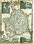
Monmouthshire, Moule, 1850. "Monmouthshire" by Thomas Moule, published in James Barclay's Complete and Universal Dictionary ..., about 1850. Decorative steel engraved antique map with recent hand colour. The vignettes show Chepstow Castle, Tintern Abbey and Monmouth Town Hall. Close trimmed to lower and left margins, with slight loss (these maps were very often tightly trimmed by the publishers). Size 20 x 27 cms, plus margins. Ref G7888
Monmouthshire, Owen/Bowen, c1736. "Monmouthshire" by Emanuel Bowen published by John Owen between 1720 and 1764. Details of the road from Monmouth to Lanbeder are contained in the cartouche above the map. The reverse shows a route from Monmouth through Abervagenny. Copper engraved map with recent hand colour. Size 12 x 18.5 cms plus margins. Ref G7887
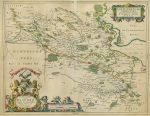
Scotland, Stirlingshire, Blaeu, 1672. "Sterlinensis Praefectura. Sterlin-Shyr / Auct. Timoth. Pont." (Stirlingshire) by Joan Blaeu, after a manuscript map by Timothy Pont, published about 1672. Impressive copper engraved map with original hand colouring. Centrefold as published, with slight damage to paper surface to upper part of fold area, very slight age browning. Spanish text on reverse, full plate mark and wide margins. Size 52 x 41 cms plus margins. Ref G7774
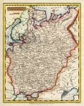
Russia in Europe map, 1814. "Russia in Europe" engraved by Neele, published in a gazetteer, 1814. Copper engraved map with recent hand colour. Good condition. Size 18 x 23 cms, plus margins. Ref G7701
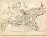
Prussia map, 1855. "Prussia" anonymous artist/engraver, published in an atlas, about 1855. Steel engraved map with simple original outline hand colour. Slightly soiled. Size 26 x 20 cms, plus margins. Ref G7700
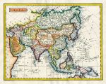
Asia, 1823. "Asia" drawn and engraved by J.Russell, published in Barclay's Universal Dictionary, 1823. Copper engraved map with recent hand colouring. Good condition. Size 23 x 18 cms plus margins. Ref G7628
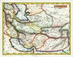
Persia, 1823. "Persia" engraved by J.Russell, published in Barclay's Universal Dictionary, 1823. Copper engraved map with recent hand colouring. Good condition. Size 22.5 x 17.5 cms plus margins. Ref G7627
© 2003 - 2020 Website copyright Steve Bartrick Royalty free stock images of antique prints of interest to historians, students and family history researchers