Home » Antique maps » All prints and maps

 
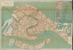
Italy, plan of Venice, c1885

Italy, plan of Venice, c1885.
"Venezia" by by Wagner and Debes, colour lithographic plan published about 1885. On thin paper and several folds as published, close cropped to right side. Size 35 x 24 cms, plus narrow margins. Ref I0493

 
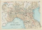
Italy, map of north Italy, c1865

Italy, map of north Italy, c1865.
"The States of Upper Italy" colour lithographic map printed and published by A.H.Payne, about 1865. Centre fold as published with some creasing along fold, otherwise good condition. Size 35 x 25 cms, plus margins. Ref I0492

 
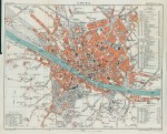
Italy, Plan of Florence, c1890

Italy, Plan of Florence, c1890.
"Florence" by L.Thuillier, colour lithographic plan published by Hachette & Co. in a guide book, about 1890. On thin paper and several folds as published, otherwise good condition. Size 30 x 25 cms, plus margins. Ref I0491


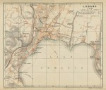
Italy, Plan of Lugano, c1895

Italy, Plan of Lugano, c1895.
"Lugano" colour lithographic plan published in a guide book, about 1895. On thin paper, with one fold as published, good condition. Size 17 x 14.5 cms, plus margins. Ref I0490

 
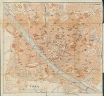
Italy, Plan of Firenze, c1895

Italy, Plan of Firenze, c1895.
"Firenze" colour lithographic plan published in a guide book, about 1895. On thin paper and several folds as published, some creasing and tear to lower 3 cms of one fold. Size 29.5 x 28 cms, plus narrow margins. Ref I0489

 
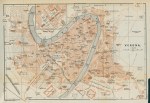
Italy, Plan of Verona, c1895

Italy, Plan of Verona, c1895.
"Verona" colour lithographic plan published in a guide book, about 1895. On thin paper and several folds as published, otherwise good condition. Size 26.5 x 18 cms, plus narrow margins. Ref I0488


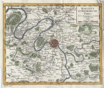
Paris and Environs map, Vaugondy, 1748

Paris and Environs map, Vaugondy, 1748.
"Banlieue et Environs de Paris ..." by Robert Vaugondy, published in Atlas Portratif Universel et Militaire, dated 1748. Copper engraved antique map with recent hand colouring. Vertical fold as published, slight creasing and narrow right margin with slight damage. Size 20 x 16.5 cms, plus margins. Ref I0457

 
Carthaginian Empire, D'Anville, 1738

Carthaginian Empire, D'Anville, 1738.
"The Carthaginian Empire in Africa, drawn for Rollin's Antient History by Mr. D'Anville ... 1738" anonymous engraver, published in the English translation of Rollin's Antient History, 1738. Copper engraved antique map with recent hand colouring, several (flattened) folds as published, trimmed to neatline lower left and re-edged, otherwise good condition. Size 45 x 22.5 cms, plus margins. Ref I0383

 
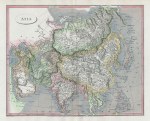
Asia map, 1820

Asia map, 1820.
"Asia" engraved by Edward Jones after Arrowsmith, published in Rees's Cyclopedia; or, Universal Dictionary ..., 1820. Copper engraved antique map with recent hand colouring, centrefold as published, good condition. Size 30.5 x 25 cms, plus margins. Ref I0382


Roman Spain (Hispania) map, 1820

Roman Spain (Hispania) map, 1820.
"Hispania Romana" engraved by J.Russell after W.H.MacPherson, published in Rees's Cyclopedia; or, Universal Dictionary ..., 1820. Copper engraved antique map with recent hand colour. Centrefold as published, good condition. Size 40 x 25.5 cms including title, plus margins. Ref I0381

 
Spain & Portugal map, 1820

Spain & Portugal map, 1820.
"Spain and Portugal" engraved by J.Bye after Arrowsmith, published in Rees's Cyclopedia; or, Universal Dictionary ..., 1820. Copper engraved antique map with recent hand colouring, centrefold as published. Good condition. Size 40 x 25.5 cms, plus margins. Ref I0380

 
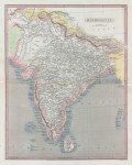
India (Hindoostan) map, 1820

India (Hindoostan) map, 1820.
"Hindoostan" engraved by J.Russell after Arrowsmith, published in Rees's Cyclopedia; or, Universal Dictionary ..., 1820. Copper engraved antique map with recent hand colouring, centrefold as published. Good condition. Size 26 x 32.5 cms, plus margins. Ref I0379


Ancient North Africa map, 1820

Ancient North Africa map, 1820.
"Libyae, vel Africae ora borealis" engraved by J.Russell after W.W.MacPherson, published in Rees's Cyclopedia; or, Universal Dictionary ..., 1820. Copper engraved antique map with recent hand colouring. Centrefold as published, good condition. Size 40 x 26 cms including title, plus margins. Ref I0378

 
Prussia map, 1820

Prussia map, 1820.
"Prussia" engraved by Lowry after Arrowsmith, published in Rees's Cyclopedia; or, Universal Dictionary ..., 1820. Copper engraved antique map with recent hand colouring, centrefold as published, good condition. Size 37.5 x 24.5 cms, plus margins. Ref I0377

 
Russian Empire (Russia in Asia) map, 1820

Russian Empire (Russia in Asia) map, 1820.
"Russian Empire" engraved by Cooper after Arrowsmith, published in Rees's Cyclopedia; or, Universal Dictionary ..., 1820. Copper engraved antique map, centrefold as published, good condition. Size 40.5 x 24.5 cms, plus margins. Ref I0376


Scandinavia map, 1820

Scandinavia map, 1820.
"Sweden, Denmark and Norway" engraved by Cooper after Arrowsmith, published in Rees's Cyclopedia; or, Universal Dictionary ..., 1820. Copper engraved antique map with recent hand colour, centrefold as published, good condition. Size 25 x 40 cms, plus margins. Ref I0375

 
Egypt map, 1820

Egypt map, 1820.
"Egypt" engraved by Lowry(?) after Arrowsmith, published in Rees's Cyclopedia; or, Universal Dictionary ..., 1820. Copper engraved antique map with recent hand colouring, centrefold as published. Good condition. Size 25 x 40 cms, plus margins. Ref I0374

 
Mediterranean Sea, 1843

Mediterranean Sea, 1843.
"The Mediterranean, and Turkish Empire" engraved by Alex Findlay and published by Fisher, Son & Co. in 1843. Steel engraved map with recent hand colouring. Several flattened vertical folds, good condition. Size 40 x 19.5 cms. Ref I0373

 
« Previous | 1 | 2 | 3 | 4 | 5 | 6 | 7 | 8 | 9 | 10... | Next »


© 2003 - 2020 Website copyright Steve Bartrick
Royalty free stock images of antique prints of interest to historians, students and family history researchers