Please see my main site ANTIQUEPRINTS.COM For original antique prints and maps
Charing Cross - 1837
Home » Antique maps » World and other maps
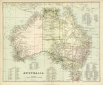
Australia, 1880. "Australia" chromolithograph published by William McKenzie, about 1880. Shows area divisions by colour with ‘West Australia’, ‘The North Territory’, ‘Alexandra Land’, ‘Queensland’, ‘New South Wales’, ‘Victoria’ and ‘South Australia’. List of counties given in the sea area. Centrefold as published. Very slight soiling. Size 27.5 x 22.5 cms plus margins. Ref E3708
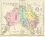
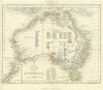
Australia, 1868. "Australia" (and New Zealand) drawn and engraved by John Archer, published in The National Encyclopedia Atlas, 1868. Lithographic map with full original hand colouring, centrefold as published. Good condition. Size 28.5 x 23 cms plus margins. Ref E3198
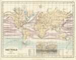
The World, Isotherms and Currents, 1868. "Physical Map of The World" by Stanford's Geographical Establishment, published in The National Encyclopedia Atlas, 1868. Lithographic map with full original hand colouring, centrefold as published. Good condition. Size 29 x 23 cms plus margins. Ref E3016
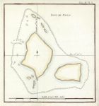
Pacific, Wallis Island, 1773. "Isles de Wallis" copper engraved map after Bowen & Gibson?, published about 1773. One (flattened) vertical fold as published, plate mark and good margins. Size 19 x 20 cms. Ref E2944
Australia, The College Atlas, 1850. " Australia " drawn and engraved by J.Archer, published in The College Atlas, about 1850. Steel engraved map with original outline hand colour. Small inset showing New Zealand. Centrefold as published, good condition with good margins. Size 29 x 23 cms. Ref E1977
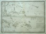
Polynesia, Brue, 1825. " Carte Particuliere de la Polynesie (Partie de L'Oceanie " (Polynesia) by A.H.Brue, published in the Atlas Universel, about 1826 (map dated 1826.) Detailed copper engraved map with original hand colouring. Centrefold as published. Plate mark and wide margins. Size of engraved area 50 x 36 cms. Ref E1816. (Please note this is a digital camera image - the tonal variation is due to uneven lighting, for a more accurate representation of the colour and detail, click here to see scanned detail from the Brue map of the Low Countries.)
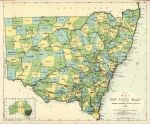
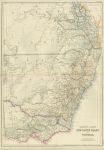
Australia, NSW map, 1888. " Sketch map of New South Wales ... " chromolithographic map published in The Aldine Centennial History of New South Wales, Sydney, 1888. Indistinct printing, see this detail of the Sydney area. Centrefold as published, fox mark in sea area. Size 31.5 x 26 cms. Ref E1353
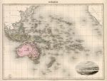
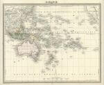
Oceana, Migeon, 1880. " Oceanie " engraved by L.Smith after A.Biset, published by J.Migeon in Paris, about 1880. Steel engraved map with original hand colour. Vignette of Noumea lower right. Detail showing part of Australia. Centre-fold as published, wide margins, slight soiling upper right. Size 42 x 31.5 cms. Ref E1031
Oceania, Furne, 1840. " Oceanie " published by Furne in Paris, about 1840. Steel engraved map with original hand colour coded to indicate the European colonies. Detail showing part of Australia. Centre-fold as published, plate mark and wide margins. Size 42.5 x 34 cms. Ref E1023
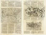
Asia, page from Universus Terrarum Orbis, 1713. " Asia " copper engraved map published in Universus Terrarum Orbis, 1713. A weak impression with some lack of detail, see this close-up. The reverse carries two prints, one of Castel Novo in Dalmatia, the other of Ascoli in Italy, both in good condition with plate marks. Page size 22 x 34 cms. Ref E1009 (this is a single page.)
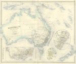
Australia, Swanston/Fullarton, 1858. " Australia and New Zealand " engraved by G.H.Swanston and published by A.Fullarton & Co. in The Companion Atlas to The Gazetteer of the World, about 1858. Steel engraved map with original hand colour in pastel shades. Several insets with the gold fields picked out in yellow. Detail showing the Sidney area, further detail showing the Adelaide area, more detail showing part of Victoria. On thick paper, with plate mark and good margins. Centre-fold as published, very good condition. Size 50 x 41 cms. Ref E445
Australia, Queensland, NSW & Victoria, Blackie & Son, 1865. " Queen's Land, New South Wales and Victoria " drawn and engraved by J.Bartholomew, published by Blackie & Son, Glasgow, Edinburgh & London, about 1865. Lithographic map with original hand colour. Detail showing the Sydney area.. Centrefold as published, some paper cockling along the fold. Size 34.5 x 50 cms. Ref D9046
Pacific (Oceana), French Colonies, 1866. " Carte des Etablissements Francais de L'Oceanie ... " engraved by Pepin-Malherbe and published in Chasseloup-Laubat's Atlas des Colonies Francaises, Paris, 1866 (map dated 1865.) Steel engraved map, with recent hand colour and original hand colour to the flags. Detail showing part of the map. Centrefold as published, good condition with good margins. Size 41 x 27.5 cms. Ref D6890
New Caledonia, French Colonies, 1866. " Carte de la Nouvelle Caledonie... " engraved by Pepin-Malherbe and published in Chasseloup-Laubat's Atlas des Colonies Francaises, Paris, 1866 (map dated 1863.) Steel engraved map, with recent hand colour. Detail showing part of the map. Centrefold as published, good condition with wide margins. Size 40 x 29 cms. Ref D6888
Asia in several maps, Diderot, 1780. " Nouvelle Representation des Cotes Nord et Est de L'Asie .." by Didier Robert de Vaugondy. Published in the 'Vaugondy Supplement' to Diderot's Encyclopedia, 1772 or 79. Composite of three maps - the largest showing the then current knowledge of the north and east coasts of Asia including Japan. Large inset map is taken from a tracing of a map in Histoire des Tartares by d'Abulgasi-Bayadur Chan, Leyden, 1726. Small inset shown as a reduction of a map published in Nuremburg. Detail showing part of the map. Slightly weak impression. Several folds as published, margins of about 1 cm or more. (Ref: Belle et Utile, Mary Pedley, No. 402.) Size 37.7 x 29.3 cms. Ref D6330
© 2003 - 2020 Website copyright Steve Bartrick Royalty free stock images of antique prints of interest to historians, students and family history researchers