Home » Antique maps » Europe maps >>> » All prints and maps

 
Scotland, Ports and Harbours on the north east coast, 1856

Scotland, Ports and Harbours on the north east coast, 1856.
"Ports and Harbours on the North East coast of Scotland" drawn and engraved by G.H.Swanston, published by A. Fullarton & Co. in a gazetteer, about 1856. Shows Peterhead, Boddam and Aberdeen. Steel engraved map with original hand colour. Uniform age browning. Size 13 x 22 cms. Ref E4308

 
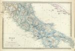
South Italy, 1830

South Italy, 1830.
"Italy II" (modern) engraved by J. & C. Walker, published by The Society for the Diffusion of Useful Knowledge (SDUK), 1830. Steel engraved map with original hand colour. Slight soiling, otherwise good condition with good margins, including small folding tab lower right. Size 38 x 25.5 cms plus margins. Ref E4294

 
Ancient south Italy, 1830

Ancient south Italy, 1830.
"Ancient Italy II" engraved by J. & C. Walker, published by The Society for the Diffusion of Useful Knowledge (SDUK), 1832. Steel engraved map with original hand colour. Good condition with good margins, including small folding tab lower right. Size 39 x 25 cms plus margins. Ref E4293


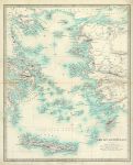
Ancient Grecian Archipelago, 1843

Ancient Grecian Archipelago, 1843.
"Grecian Archipelago (ancient)" engraved by J. & C. Walker after a map by William Smith, published by The Society for the Diffusion of Useful Knowledge (SDUK), 1843. Steel engraved map with original hand colour, centrefold as published. Overall slight age browning, closed tears(no loss) to each side of fold, extending about 2cm into map area. Size 31 x 39 cms plus margins. Ref E4287

 
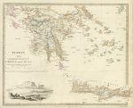
Greece (Turkey III), dated 1829

Greece (Turkey III), dated 1829.
"Turkey III. Containing the Southern part of Greece and Candia" engraved by J. & C. Walker, published by The Society for the Diffusion of Useful Knowledge (SDUK), 1829. Steel engraved map with original hand colour. Vignette of the Acropolis lower left. Overal slight soiling and age browning, closed tear (no loss) to left side extending about 1cm into map area. Size 38 x 29 cms plus margins. Ref E4286

 
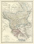
Turkey in Europe (including Greece, Macedonia, Albania, Bulgaria, Romania etc.), 1818

Turkey in Europe (including Greece, Macedonia, Albania, Bulgaria, Romania etc.), 1818.
"Turquie d'Europe et Grece Modern" engraved by Chamouin after P.Lapie, copper engraved map with original hand colouring, published in Lapie's Atlas Classique et Universel..., about 1815. Very good condition, with good margins. Size 22.5 x 29.5 cms plus margins. Ref E4271


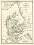
Denmark, 1818

Denmark, 1818.
"Danemark" engraved by Chamouin after P.Lapie, copper engraved map with original hand colouring, published in Lapie's Atlas Classique et Universel..., about 1815. Very good condition, with good margins. Size 22.5 x 30 cms plus margins. Ref E4269

 
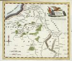
Europe, Seat of War from 1792 to 1796, published 1817

Europe, Seat of War from 1792 to 1796, published 1817.
"Frontiers of France, Germany and Holland, Exhibiting the Seat of War from 1792 to 1796" anonymous engraver, published in The History of the Wars of the French Revolution, 1817. Simple wood engraved map with recent hand colouring. Size 22.5 x 19 cms plus margins. Ref E4215

 
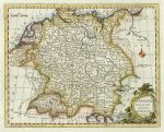
Germany, by Bowen, 1780

Germany, by Bowen, 1780.
"Germany from the Best Authorities" by Thomas Bowen, published about 1780. Copper engraved map with recent hand colour. Patched worm hole of about 2mm in map area, otherwise good condition with plate mark and good margins. Size 22.5 x 17.5 cms. Ref E4184


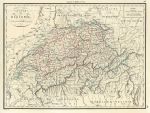
Switzerland, 1818

Switzerland, 1818.
"Suisse ou Helvetie" engraved by Chamouin after P.Lapie, copper engraved map with original hand colouring, published in Lapie's Atlas Classique et Universel..., about 1815. Slight age browning, otherwise very good condition, on thick paper with good margins. Size 30 x 22.5 cms plus margins. Ref E4164

 
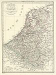
Netherlands & Belgium, 1818

Netherlands & Belgium, 1818.
"Royaume de la Hollande et Belgique" engraved by Chamouin after P.Lapie, copper engraved map with original hand colouring, published in Lapie's Atlas Classique et Universel..., about 1815. Very good condition, on thick paper with good margins. Size 22 x 30 cms plus margins. Ref E4163

 
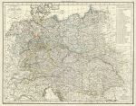
Germany (Central Europe), 1818

Germany (Central Europe), 1818.
"Allemagne" engraved by Chamouin after P.Lapie, copper engraved map with original hand colouring, published in Lapie's Atlas Classique et Universel..., about 1815. Covers central and part of eastern Europe, including germany, Poland and Austria. Centrefold as published, very good condition, on thick paper with good margins. Size 47 x 37 cms plus margins. Ref E4162


Spain & Portugal, 1818

Spain & Portugal, 1818.
"Espagne et Portugal" engraved by Chamouin after P.Lapie, copper engraved map with original hand colouring, published in Lapie's Atlas Classique et Universel..., about 1815. Very good condition, on thick paper with good margins. Size 29.5 x 22.5 cms plus margins. Ref E4045

 
France, 1818

France, 1818.
"Royaume de France par Departmens et Divisions" engraved by Chamouin after P.Lapie, copper engraved map with original hand colouring, published in Lapie's Atlas Classique et Universel..., about 1815. Centrefold as published, small stain in lower left margin, otherwise very good condition, on thick paper with good margins. Size 46.5 x 37 cms plus margins. Ref E4044

 
France between 1789 and 1815, published about 1818

France between 1789 and 1815, published about 1818.
"Carte Comparative del la France et des Etats Voisons en 1789 et 1813" engraved by Chamouin after P.Lapie, copper engraved map with original hand colouring, published in Lapie's Atlas Classique et Universel..., about 1815. Centrefold as published, very good condition, on thick paper with good margins. Size 47.5 x 37 cms plus margins. Ref E4042


Ancient Greece, 1818

Ancient Greece, 1818.
"Grece Ancienne" engraved by Chamouin after P.Lapie, copper engraved map with original hand colouring, published in Lapie's Atlas Classique et Universel..., about 1818. Very good condition, on thick paper with good margins. Size 29.5 x 22.5 cms plus margins. Ref E4037

 
Ancient Germany, 1818

Ancient Germany, 1818.
"Germanie Ancienne" engraved by Chamouin after P.Lapie, copper engraved map with original hand colouring, published in Lapie's Atlas Classique et Universel..., about 1818. Very good condition, on thick paper with good margins. Size 31 x 22.5 cms plus margins. Ref E4035

 
Europe, published about 1818

Europe, published about 1818.
"Europe" engraved by Chamouin after P.Lapie, copper engraved map with original hand colouring, published in Lapie's Atlas Classique et Universel..., about 1818. Centrefold as published, light crease across upper right corner, otherwise very good condition, on thick paper with with good margins. Size 46 x 36.5 cms plus margins. Ref E4034

 
« Previous | ...80 | 81 | 82 | 83 | 84 | 85 | 86 | 87 | 88 | 89 | 90... | Next »


© 2003 - 2020 Website copyright Steve Bartrick
Royalty free stock images of antique prints of interest to historians, students and family history researchers