Please see my main site ANTIQUEPRINTS.COM For original antique prints and maps
Charing Cross - 1837
Home » Antique maps » Europe maps >>> » Scandinavia, antique maps
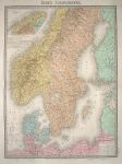
Scandinavia (Sweden, Norway & Denmark), 1873. "Etats Scandinaves" engraved after E.Andriveau-Goujon, published in Andriveau-Goujon's Atlas Classique et Universel de Geographie .., 1873. Large steel engraved map with high quality original hand colouring. Centrefold as published, good margins. Very good condition. Size 46 x 63 cms plus title and margins. Ref E4782
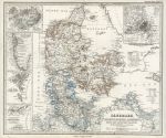
Denmark, 1869. "Danemark, Schleswig, Holstein u. Launburg ..." published in Adolf Stieler's Hand Atlas Uber Alle Theile Der Erde ..., 1869. Extremely detailed steel engraved map with original hand colour, centrefold as published. Inset maps of Copenhagen, Iceland, Greenland, the Faroes and part of the West Indies. Good condition. Size 40.5 x 33.5 cms, plus margins. Ref E4405
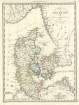
Denmark, 1818. "Danemark" engraved by Chamouin after P.Lapie, copper engraved map with original hand colouring, published in Lapie's Atlas Classique et Universel..., about 1815. Very good condition, with good margins. Size 22.5 x 30 cms plus margins. Ref E4269
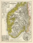
Norway (southern), 1852. "Sudliches Norwegen 1849" by Joseph Meyer, published in his Neuster Zeitungs Atlas..., 1852. Steel engraved map with original hand colour. Inset plans of the Trondheim, Christiania and Bergen areas. Slightly age browned, otherwise good condition with plate mark and good margins. Size 18.5 x 25 cms plus margins. Ref E3902
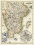
Sweden (southern), 1852. "Sudliches Schweden 1849" by Joseph Meyer, published in his Neuster Zeitungs Atlas..., 1852. Steel engraved map with original hand colour. Inset plan of Stockholm. Slightly age browned, otherwise good condition with plate mark and good margins. Size 18.5 x 25 cms plus margins. Ref E3901
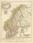
Scandinavia, 1852. "Schweden, Norwegen und Danemark" by Joseph Meyer, published in his Neuster Zeitungs Atlas..., 1852. Steel engraved map with original hand colour. Small inset maps of Iceland and the Faroes. Slightly age browned, otherwise good condition with plate mark and good margins. Size 18.5 x 24 cms plus margins. Ref E3900
Sweden, Plan of the Canal of Stroemsholm, 1790. "Plan of the Canal of Stroemsholm which Joins the Lake Sodra Barke ... to the Lake Maeler" engraved by W.Palmer and published in Travels into Poland, Russia, Sweden and Denmark, about 1790. Copper engraved map with recent hand colouring. Several folds as published, good condition. Size 19 x 34 cms. Ref E3462
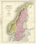
Sweden and Norway, 1868. "Sweden and Norway" drawn and engraved by John Archer, published in The National Encyclopedia Atlas, 1868. Lithographic map with full original hand colouring, centrefold as published. Good condition. Size 23 x 28.5 cms plus margins. Ref E3172
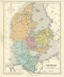
Denmark, 1868. "Denmark" drawn and engraved by John Archer, published in The National Encyclopedia Atlas, 1868. Lithographic map with full original hand colouring, centrefold as published. Good condition. Size 29 x 23 cms plus margins. Ref E3170
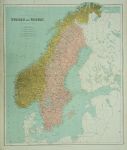
Sweden and Norway, 1864. " Sweden and Norway " by J.Bartholomew, published in Philips' Imperial Library Atlas (edited by William Hughes), London, 1864. Large chromo-lithographic map, with a centrefold as published. Slight soiling and edge browning. Size 51 x 62 cms. Ref E2716
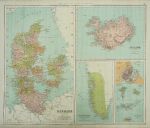
Denmark, Iceland and Danish Posessions, 1864. [ Denmark, Iceland, Greenland, Danish posessions and plan of Copenhagen ] by J.Bartholomew, published in Philips' Imperial Library Atlas (edited by William Hughes), London, 1864. Large chromo-lithographic map, with a centrefold as published. Slight soiling and edge browning. Size 61 x 50 cms. Ref E2715
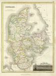
Denmark map, 1823. " Denmark " drawn by J. Wyld, engraved by N.R. Hewitt and published in Edinburgh by John Thompson & Co. in A General Atlas ... of the Several Empires, Kingdoms and States in the World, about 1823. Copper engraved map with original outline hand colour. Small vignette of Copenhagen lower right. Slight offsetting, soiling and age browning, good margins. Size 22 x 29.5 cms. Ref E1156
Scandinavia map, Dufour Atlas Classique & Universal, 1842. " .. Scandinave et Danemark " published in Dufour and Picquet's Atlas Classique et Universal de Geographie, Paris, 1842. Small inset showing Iceland. Detail showing part of Sweden. Steel engraved map with original hand colour. Good condition with good margins. Size 19.5 x 25.5 cms. Ref D7516
Sweden & Norway map, 1813. " Sweden and Norway " drawn and engraved by J.C.Russell, published in Ostell's New General Atlas, 1813. Copper engraved map with original hand colour. Detail showing part of the map. Some staining lower right, plate mark and good margins. Size 18.5 x 22 cms. Ref D6791
Denmark map, 1813. " Denmark " drawn and engraved by J.C.Russell, published in Ostell's New General Atlas, 1813. Copper engraved map with original hand colour. Detail showing part of the map. Good condition, plate mark and good margins. Size 18.5 x 22 cms. Ref D6790
Scandinavia map, 1863. " Sweden & Norway " by A.K.Johnston, colour lithographic map published by William Blackwood in Johnston's School Atlas of General & Descriptive Geography, 1863. Centrefold as published. Size 23.5 x 30.5 cms. Ref D6422
Sweden & Norway map, 1858. " Sweden and Norway with Russian Finland by G.H.Swanston Edinr. " engraved by G.H.Swanston and published by A.Fullarton & Co. in The Companion Atlas to The Gazetteer of the World, about 1858. Steel engraved map with original hand colour in delicate pastel shades. On thick paper, with plate mark and good margins. Small inset map showing the environs of Stockholm. Detail showing part of the map. Centre-fold as published, good condition. Size 40 x 50 cms. Ref D6034
Sweden & Norway map, 1853. " Sweden & Norway " engraved by Sidney Hall and published in Butler's Atlas of Modern Geography, 1853. Steel engraved map with original hand colour. Centrefold as published, slight soiling. Size 20 x 26 cms. Ref D5988
© 2003 - 2020 Website copyright Steve Bartrick Royalty free stock images of antique prints of interest to historians, students and family history researchers