Please see my main site ANTIQUEPRINTS.COM For original antique prints and maps
Charing Cross - 1837
Home » Antique maps » Europe maps >>> » Europe, antique maps
Mediterranean, Map of the Travels of the Apostles etc. 1759. "An Accurate Map of the Travels of the Apostles with St. Paul's Voyage to Rome" anonymous engraver, copper engraved map with recent hand colouring. Good condition with margins of about 1 cm or more. Size 35.5 x 21 cms. Ref F1151
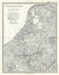
Holland (Netherlands) & Belgium, 1879. "Niederlande und Belgien" after C.Vogel, published in Adolf Stieler's Hand Atlas Uber Alle Theile Der Erde ..., 1879. Very detailed lithographic map with original hand colour, centrefold as published. Small inset plan of the Antwerp area. Good condition. Size 32.5 x 42.5 cms, plus margins. Ref F754
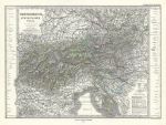
Austria, 1879. "Oesterreich Sud Westlicher Theil" by Berghaus, published in Adolf Stieler's Hand Atlas Uber Alle Theile Der Erde ..., 1879. Extremely detailed steel engraved antique map with original hand colour. Centrefold as published. Good condition. Size 40.5 x 29.5 cms, plus margins. Ref F751
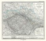
Czech Republic, Eastern Germany, 1879. "Ostliches Deutschland sowie Bohmen, Mahren und Oesterreichisch Schlesien" by Berghaus, published in Adolf Stieler's Hand Atlas Uber Alle Theile Der Erde ..., 1879. Extremely detailed steel engraved antique map (centered on Bohemia) with original hand colour, land elevation shown in cross section aling the lower edge. Centrefold as published. Good condition. Size 35 x 30.5 cms, plus margins. Ref F750
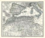
Mediterranean Sea (West) & part of north Africa, 1879. "Das Mittellandische Meer und Nord-Afrika .. (Westliches Blatt)" published in Adolf Stieler's Hand Atlas Uber Alle Theile Der Erde ..., 1879. Extremely detailed steel engraved map with original hand colour, centrefold as published. Two small inset maps showing Gibraltar and Malta. Good condition with good margins. Size 38 x 33.5 cms, plus margins. Ref F747
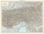
Austrian Alps, 1895. "The Austrian Alps" colour lithographic map published in The Times Atlas, 1895. Centrefold as published. Size 48 x 37 cms plus margins. Ref F589
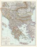
Balkan Peninsula, 1895. "The Balkan Peninsula" colour lithographic map published in The Times Atlas, 1895. Centrefold as published. Size 38 x 47 cms plus margins. Ref F583
Bohemia, Moravia & Austrian Silesia (Czech Republic), 1895. "Bohemia, Moravia & Austrian Silesia" colour lithographic map published in The Times Atlas, 1895. Inset map of the Prague area. Size 36 x 24 cms plus margins. Ref F580
Hungary, 1895. "Hungary" colour lithographic map published in The Times Atlas, 1895. Size 38 x 24 cms plus margins. Ref F579
The Alps (Physical), 1895. "General Map of the Alps" colour lithographic map published in The Times Atlas, 1895. Size 37 x 24 cms plus margins. Ref F578
The Caucasus, 1895. "The Caucasus" colour lithographic map published in The Times Atlas, 1895. Size 37 x 24 cms plus margins. Ref F569
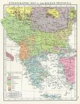
Balkan Peninsula Ethnographic Map, 1895. "Ethnographic Map of the Balkan Peninsula" colour lithographic map published in The Times Atlas, 1895. Size 18.5 x 24 cms plus margins. Ref F566
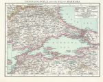
Turkey, Constantinople & Sea of Marmara, 1895. "Constantinople and the Sea of Marmara" colour lithographic map published in The Times Atlas, 1895. Size 23 x 18.5 cms plus margins. Ref F565
Eastern Mediterranean Sea, 1895. "Eastern Mediterranean Sea" colour lithographic map published in The Times Atlas, 1895. Inset map of the Nile Delta and Suez Canal. Size 37 x 24 cms plus margins. Ref F563
Western Mediterranean Sea, 1895. "Western Mediterranean Sea" colour lithographic map published in The Times Atlas, 1895. Inset map of the Strait of Gibraltar. Size 37 x 24 cms plus margins. Ref F562
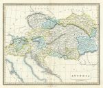
Austria, 1839. "Austria" anonymous engraver, published by Allan Bell & Co. 1815. Copper engraved map with full original hand colouring. Centrefold as published. Good condition. Size 34.5 x 29 cms plus margins with full plate mark. Ref F377
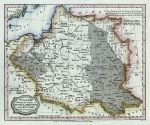
Poland, 1806. "Poland from the Best Authorities" engraved by Barlow and published by C.Brightly & E.Kinnersley, Bungay in Suffolk, May 1st 1806 in A General View of the World by Rev. E. Blomfield. Copper engraved map with recent hand colour. Good condition. Size 21.5 x 18 cms plus margins. Ref F362
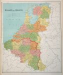
Holland & Belgium, large map, 1867. "Holland & Belgium" by J.Bartholomew, published in Philip's General Atlas of the World, 1867. Large colour lithographic map with centrefold as published, very slight soiling upper left, otherwise good condition with good margins. Size 51 x 61 cms. (NOTE - this image is from a digital camera and is not as clear as a scan.) Ref F337
© 2003 - 2020 Website copyright Steve Bartrick Royalty free stock images of antique prints of interest to historians, students and family history researchers