Home » Antique maps » Africa antique maps

 
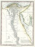
Egypt map, 1828

Egypt map, 1828.
"Egypt" anonymous engraver, published in London by Thomas Kelly in New System of Universal Geography, 1828. Copper engraved map with recent hand colour. Good condition. Size 18 x 24 cms plus margins. Ref F7699

 
Cape Verde Islands, 1856

Cape Verde Islands, 1856.
"Cape Verd Islands" drawn and engraved by J.Bartholomew, published by A. Fullarton & Co. in a gazetteer, about 1856. Steel engraved map with original hand colour. Size 23 x 14 cms plus margins. Ref F7695

 
West Africa coast, from Straits of Gibraltar to Cape Verde, 1803

West Africa coast, from Straits of Gibraltar to Cape Verde, 1803.
"Coast of Africa from the Straits of Gibraltar to Cabo Verde ..." engraved by S.J.Neele after a map by A.Arrowsmith. Published in The Progress of Maritime Discovery, 1803. Copper engraved map with recent hand colour. Two (flattened) folds as published. Faults - slight sloiling and three library blind stamps (embossed). Size 25.5 x 41 cms. Ref F6795


South Africa coast, 1803

South Africa coast, 1803.
"Southern Coast of Africa ..." engraved by S.J.Neele after a map by A.Arrowsmith. Published in The Progress of Maritime Discovery, 1803. Inset charts of Table Bay and False Bay. Copper engraved map with recent hand colour. Two (flattened) folds as published. Faults - slight sloiling and three library blind stamps (embossed). Size 41 x 26.5 cms. Ref F6794

 
Africa, west coast from Cape Verde to Nigeria, 1803

Africa, west coast from Cape Verde to Nigeria, 1803.
"Coast of Africa from Cabo Verde to Cabo Formosa ..." engraved by S.J.Neele after a map by A.Arrowsmith. Published in The Progress of Maritime Discovery, 1803. Copper engraved map with recent hand colour. Two (flattened) folds as published. Faults - slight sloiling and two library blind stamps (embossed). Size 41 x 26 cms. Ref F6793

 
Africa, west coast from Nigeria to Cape of Good Hope, 1803

Africa, west coast from Nigeria to Cape of Good Hope, 1803.
"Coast of Africa from Cabo Formosa to the Cabo Boa Esperaca ..." engraved by S.J.Neele after a map by A.Arrowsmith. Published in The Progress of Maritime Discovery, 1803. Copper engraved map with recent hand colour. Two (flattened) folds as published. Faults - three library blind stamps (embossed) in sea area. Size 25.5 x 41 cms. Ref F6792


Ethiopia map (Abyssinia), 1811

Ethiopia map (Abyssinia), 1811.
"Part of Abyssinia as laid down by Ludolf" engraved by Cooper, published in George Viscount Valentia's Voyages and Travels to India, Ceylon, The Red Sea, Abyssinia and Egypt, 1811. Copper engraved map with recent hand colour. Good condition with wide margins. Size 37.5 x 22 cms, plus margins. Ref F6708

 
Egypt, two small maps, 1856

Egypt, two small maps, 1856.
"Map of the Coast and Environs of Alexandria" and "Lower Egypt" by Swanston, published by A. Fullarton & Co. in Gazetteer of the World, 1856. Steel engraved map. Size 14.5 x 24 cms plus margins. Ref F6395

 
Central Africa map, 1856

Central Africa map, 1856.
"Central Africa" (mainly Lake Chad & Nigeria) by Swanston, published by A. Fullarton & Co. in Gazetteer of the World, 1856. Steel engraved map with delicate original hand colour. Size 24 x 15 cms plus margins. Ref F6394


Ethiopia map, 1856

Ethiopia map, 1856.
"Abessinia and the Adjacent Countries" (Ethiopia) drawn and engraved by Peterman & Swanston, published by A. Fullarton & Co. in Gazetteer of the World, 1856. Steel engraved map with delicate original hand colour. Size 23 x 14 cms plus margins. Ref F6393

 
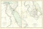
Egypt & Ethiopia maps, 1872

Egypt & Ethiopia maps, 1872.
"The Nile Valley ... including Egypt and Part of Nubia" and "The Nile Valley from the Second Cataract Upards including the chief part of Nubia with Abyssinia and the Adjacent Lands" by W.Hughes, published in The Imperial Atlas of Modern Geography, 1872. Lithographic antique map, with original outline hand colouring. Centrefold as published. Size 50 x 34 cms plus good margins. Ref F6383

 
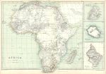
Africa map, 1872

Africa map, 1872.
"Africa" by Edward Weller, published in The Imperial Atlas of Modern Geography, 1872. Lithographic antique map, with original outline hand colouring. Inset maps of Mauritius, Bourbon and Natal. Two small tears in lower margin, one just into map area (no loss). Centrefold as published. Size 50 x 34 cms plus good margins. Ref F6329


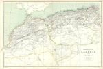
Morocco, Algieria and Tunisia map, 1872

Morocco, Algieria and Tunisia map, 1872.
"Marocco, Algeria and Tunis" by Edward Weller, published in The Imperial Atlas of Modern Geography, 1872. Lithographic antique map, with original outline hand colouring. Centrefold as published. Size 50 x 34 cms plus good margins. Ref F6328

 
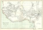
Western Africa map, 1872

Western Africa map, 1872.
"Western Africa" by Edward Weller, published in The Imperial Atlas of Modern Geography, 1872. Lithographic antique map, with original outline hand colouring. Very slight soiling in the sea area. Centrefold as published. Size 50 x 34 cms plus good margins. Ref F6327

 
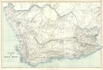
South Africa, Cape of Good Hope, 1872

South Africa, Cape of Good Hope, 1872.
"Cape of Good Hope" by Edward Weller, published in The Imperial Atlas of Modern Geography, 1872. Lithographic antique map, with original outline hand colouring. Centrefold as published. Size 50 x 34 cms plus good margins. Ref F6326


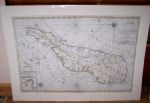
Madagascar, large map by Mortier, 1720

Madagascar, large map by Mortier, 1720.
" Carte particuliere de L'Isle Dauphine ou Madagascar..." by P. Mortier, published in his Neptune François, Amsterdam about 1720. With east to the top, includes the islands of I. De Bourbon, Santa Apolonia, I. De Ioan de Lisboa and Isles de Comorre. Lower left hand corner has an inset map of Bay St.Augustin. Click here to see further images of this map.Copper engraved map or sea chart, with recent outline hand colour. Several small closed edge tears (no loss), larger professional repair to the lower part of the centrefold, including replacement of very small area of the map (1.5 x 0.5cm) in the sea area lower centre. Size 85 x 57 cms plus good margins with full plate mark. (NOTE - my images are from a digital camera and the map is no longer in a mount.) Ref F6125

 
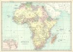
Africa, 1885

Africa, 1885.
"Africa" by J.Bartholomew, colour lithographic map published in The Popular Atlas of the World, 1885. Small inset map of the Suez Canal area. Centrefold as published, good condition. Size 41 x 29 cms plus good margins. Ref F5723

 
Africa, 1855

Africa, 1855.
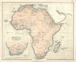
"Africa" colour lithographic map published in Chambers Atlas, 1855. Some soiling. Size 27 x 22.5 cms plus margins. Ref F5575

 
« Previous | 1 | 2 | 3 | 4 | 5 | 6 | 7 | 8 | 9 | 10... | Next »


© 2003 - 2020 Website copyright Steve Bartrick
Royalty free stock images of antique prints of interest to historians, students and family history researchers