Please see my main site ANTIQUEPRINTS.COM For original antique prints and maps
Charing Cross - 1837
Home » Antique maps » America, antique maps
USA, Oregon & California map, 1856. "Oregon and California" engraved by G.H.Swanston, published by A. Fullarton & Co. in Gazetteer of the World, 1856. Steel engraved map, with original hand colour. Size 15 x 23.5 cms plus margins. Ref F9584
Peru-Bolivian Tablelands map, 1856. "Peru-Bolivian Tablelands" engraved by G.H.Swanston after A.Petermann, published by A. Fullarton & Co. in Gazetteer of the World, 1856. Steel engraved map, with original hand colour. Size 14 x 23.5 cms plus margins. Ref F9582
Brazil, Province of Rio de Janeiro map, 1856. "Province of Rio de Janeiro" engraved by G.Swanston, published by A. Fullarton & Co. in Gazetteer of the World, 1856. Steel engraved map, with original hand colour. Lower left corner missing and repaired some time in the distant past. Size 23.5 x 14 cms plus margins. Ref F9579
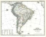
South America, 1877. "Sud-America" published in Adolf Stieler's Hand Atlas Uber Alle Theile Der Erde ..., 1879. Very detailed steel engraved map with original hand colour, centrefold as published. Good condition with good margins. Size 36.5 x 30 cms, plus margins with plate mark. Ref F9051
South America on two maps, 1877. "Sud-America in zwei Blattern" published in Adolf Stieler's Hand Atlas Uber Alle Theile Der Erde ..., 1879. Pair of very detailed steel engraved maps with original hand colour, centrefolds as published. Inset map of the Rio area, and plan of Rio. Good condition with good margins. Size 40 x 33 cms each, plus margins with plate mark. Ref F9050
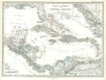
West Indies map, 1877. "West-Indien und Central-Amerika" published in Adolf Stieler's Hand Atlas Uber Alle Theile Der Erde ..., 1879. Very detailed steel engraved map with original hand colour, centrefold as published. Inset maps of the isthmus of Nicaragua and of Panama. Good condition with good margins. Size 41 x 31 cms, plus margins with plate mark. Ref F8412
United States, large map on six sheets, 1877. "Die Vereinigten Staaten von Nord-Amerika in 6 Blattern" (United States in six maps) published in Adolf Stieler's Hand Atlas Uber Alle Theile Der Erde ..., 1877. Set of 6 very detailed steel engraved maps with original hand colour, all with a centrefold as published. Inset maps of parts of Florida and Texas, small plans of Boston and New York. Good condition with good margins. Size about 41 x 34 cms each, plus good margins with plate marks. Ref F8411
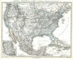
United States & Mexico map, 1877. "Verein-Staaten von Nord America, Mexico, Yucatan" published in Adolf Stieler's Hand Atlas Uber Alle Theile Der Erde ... ..., 1877. Inset map of the Mexico City area. Detailed steel engraved antique map with original hand colour, centrefold as published. Good condition. Size 40 x 32.5 cms, plus margins. Ref F8410
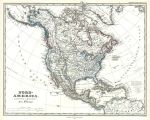
North America map, 1877. "Nord-America" published in Adolf Stieler's Hand Atlas Uber Alle Theile Der Erde ... ..., 1877. Detailed steel engraved antique map with original hand colour, centrefold as published. Good condition. Size 39 x 31 cms, plus margins. Ref F8409
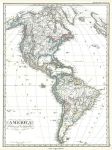
North & South America map, 1877. "America" published in Adolf Stieler's Hand Atlas Uber Alle Theile Der Erde ... ..., 1877. Very detailed steel engraved antique map with original hand colour, centrefold as published. Good condition. Size 30.5 x 41 cms, plus margins. Ref F8408
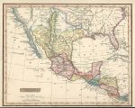
Mexico (and Texas), 1831. "Mexico" (including what is now Texas) drawn and engraved by J.Russell, published in Barclay's Universal Dictionary, 1831. Copper engraved map with full original hand colouring. Slight soiling and lower margin close trimmed to just outside neatline. Size 23.5 x 19 cms plus margins. Ref F7668
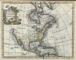
North America, 1772. "North America" by Thomas Jefferys, pubished in A New Geographical and Historical Grammar ..., 1772. Copper engraved map with recent hand colour. Two (flattened) folds as published. Close trimmed to upper margin (no loss), otherwise good condition. Size 23 x 18.5 cms plus margins. Ref F6674
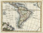
South America, 1772. "South America" by Thomas Jefferys, pubished in A New Geographical and Historical Grammar ..., 1772. Copper engraved map with recent hand colour. Two (flattened) folds as published. Good condition. Size 23.5 x 18.5 cms plus margins. Ref F6673
West Indies, 1772. "West Indies" by Thomas Jefferys, pubished in A New Geographical and Historical Grammar ..., 1772. Copper engraved map with recent hand colour. Two (flattened) folds as published. Good condition. Size 30 x 18.5 cms plus margins. Ref F6671
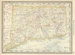
USA, Connecticut map, Hardesty, 1884. "Map of Connecticut" colour lithographic map published by H.Hardesty & Co., about 1884. Letterpress on the reverse. Good condition. Size 33 x 24.5 cms including, plus margins. Ref F6351
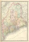
USA, Maine map, Hardesty, 1884. "Map of Maine" colour lithographic map published by H.Hardesty & Co., about 1884. Centrefold as published, letterpress on the reverse. Good condition. Size 50 x 35 cms including, plus margins. Ref F6350
USA, New Hampshire map, Hardesty, 1884. "Map of New Hampshire" colour lithographic map published by H.Hardesty & Co., about 1884. Centrefold as published, letterpress on the reverse. Good condition. Size 50 x 35 cms including, plus margins. Ref F6349
USA, Massachusetts map, Hardesty, 1884. "Map of Massachusetts" colour lithographic map published by H.Hardesty & Co., about 1884. Inset map of the Boston area and plan of Boston. Centrefold as published, illustrations on the reverse. Good condition. Size 50 x 35 cms including, plus margins. Ref F6348
© 2003 - 2020 Website copyright Steve Bartrick Royalty free stock images of antique prints of interest to historians, students and family history researchers