Home » Antique maps » America, antique maps

 
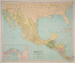
Mexico & Central America, large map, 1864

Mexico & Central America, large map, 1864.
"Mexico & Central America" by W.Hughes, published in Philips' Imperial Library Atlas (edited by William Hughes), London, 1864. Inset map of the Isthmus of Panama. Large chromo-lithographic antique map, centrefold as published. Moderate soiling and edge browning. Size 61 x 51 cms plus margins of 2 cms or more. Ref E5514

 
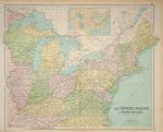
United States (north eastern), large map, 1864

United States (north eastern), large map, 1864.
"United States of North America (North Eastern Division)" by J.Bartholomew, published in Philips' Imperial Library Atlas (edited by William Hughes), London, 1864. Large chromo-lithographic antique map, centrefold as published. Moderate soiling and edge browning. Size 61 x 51 cms plus margins of 2 cms or more. Ref E5511

 
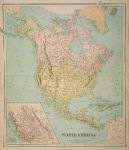
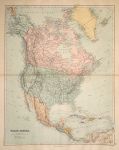
North America, large map, 1864

North America, large map, 1864.
"North America" by Edward Weller, published in Philips' Imperial Library Atlas (edited by William Hughes), London, 1864. Large antique chromo-lithographic map, centrefold as published. Inset map of British Columbia. Moderate soiling and edge browning. Size 51 x 61 cms plus margins. Ref E5508


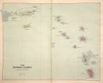
Leeward Islands, large map, 1887

Leeward Islands, large map, 1887.
"The Leeward Islands" published in Stanford's London Atlas of Universal Geography, 1887. Large chromolithographic antique map with centrefold as published. Size 55 x 47 cms plus good margins. (Note - this is a digital camera image with uneven lighting that accentuates the slight browning on the fold.) Ref E5490

 
North America, large map, 1887

North America, large map, 1887.
"North America" published in Stanford's London Atlas of Universal Geography, 1887. Large chromolithographic antique map with centrefold as published. Size 47 x 60 cms plus good margins. (Note - this is a digital camera image with uneven lighting that accentuates the slight browning on the fold.) Ref E5483

 
USA, Maps relating to war in 1776-7, published 1863

USA, Maps relating to war in 1776-7, published 1863.
"Battle Field of Saratoga 1777" with "White Plains 1776" and "Upper Hudson 1776-7" Lithographic antique map published in History of the United States of America, 1863. Recent hand colouring. Size 14 x 23 cms plus good margins. Ref E5397


USA, Maps relating to 1754-59, published 1863

USA, Maps relating to 1754-59, published 1863.
[ Maps relating to several forts and Braddock's Defeat in 1755 ] Lithographic antique map published in History of the United States of America, 1863. Recent hand colouring. Size 14 x 23 cms plus good margins. Ref E5394

 
USA, Maps relating to early exploration of America, published 1863

USA, Maps relating to early exploration of America, published 1863.
"America, 1566" and "America, Scandinavian and other Voyages ..." Lithographic antique map published in History of the United States of America, 1863. Recent hand colouring. Size 14 x 23 cms plus good margins. Ref E5392

 
USA, Maps relating to the war in 1778-9, published 1863

USA, Maps relating to the war in 1778-9, published 1863.
[ Three maps relating to war in 1778-9 (Military Expeditions) ] Lithographic antique map published in History of the United States of America, 1863. Recent hand colouring. Size 14 x 23 cms plus good margins. Ref E5391


USA, Maps relating to war with Mexico in 1846, published 1863

USA, Maps relating to war with Mexico in 1846, published 1863.
[ Three maps relating to war with Mexico in 1846 ] comprising Invasion of Northern Mexico by the American Army, Central Mexico Invasion and Siege of Vera Cruz. Lithographic antique map published in History of the United States of America, 1863. Recent hand colouring. Size 14 x 23 cms plus good margins. Ref E5390

 
USA, Upper Ohio in 1782, published 1863

USA, Upper Ohio in 1782, published 1863.
"Upper Ohio 1782, Forts, Army Tracks and Battle Fields" lithographic antique map published in History of the United States of America, 1863. Recent hand colouring. Size 23 x 14 cms plus good margins. Ref E5387

 
USA, 2 Maps relating to the War of Independance, published 1863

USA, 2 Maps relating to the War of Independance, published 1863.
[ Two maps relating to the War of Independance ] comprising District of Yorktown in 1781 and Siege of Yorktown in 1781. Lithographic antique map published in History of the United States of America, 1863. Recent hand colouring. Size 14 x 23 cms plus good margins. Ref E5386


USA, 4 maps relating to the War of 1812, 1863

USA, 4 maps relating to the War of 1812, 1863.
[ Four maps relating to the War of 1812 ] comprising Niagara District, St.Lawrence River, Wabash Valley and Western Frontier. Lithographic antique map published in History of the United States of America, 1863. Recent hand colouring. Size 14 x 23 cms plus good margins. Ref E5383

 
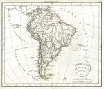
South America, Delamarche, 1828

South America, Delamarche, 1828.
"Amerique Meridionale" by F.Delamarche, published in Atlas de la Geographie, 1828 (map dated 1827.) Copper engraved antique map with original hand colour and centrefold as published. Slight soiling, damage in the sea area off Brasil. Size 33 x 28 cms plus good margins. Ref E5276

 
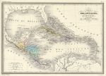
West Indies & Central America, 1860

West Indies & Central America, 1860.
"Carte des Antilles, du Golfe du Mexique et des Etats de L'Amerique Centrale" engraved after A.Veillemain, published in Malte-Brun's Atlas de la Geographie Universelle ..., about 1860. Steel engraved antique map with original hand colouring. Good condition with wide margins. Size 30.5 x 21.5 cms plus margins. Ref E5205


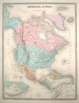
North America, 1873

North America, 1873.
"Amerique du Nord" engraved after E.Andriveau-Goujon, published in Andriveau-Goujon's Atlas Classique et Universel de Geographie .., 1873. Large steel engraved map with original hand colour, centrefold as published, good margins with partial plate mark. Very good condition. Size 46.5 x 62 cms plus title and margins. Ref E5051

 
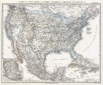
USA & Mexico, 1869

USA & Mexico, 1869.
"Verein-Staaten von Nord America, Mexico, Yucatan .." published in Adolf Stieler's Hand Atlas Uber Alle Theile Der Erde ..., 1869. Detailed steel engraved map with original hand colour. Inset map of the Mexico City area. Centrefold as published, good condition with plate mark and good margins. Size 40 x 31.5 cms plus margins. Ref E4813

 
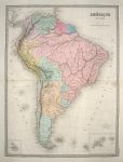
South America, 1873

South America, 1873.
"Amerique du Sud" engraved after E.Andriveau-Goujon, published in Andriveau-Goujon's Atlas Classique et Universel de Geographie .., 1873. Large steel engraved map with high quality original hand colouring. Centrefold as published, partial plate mark and good margins. Very good condition. Size 47 x 63 cms plus margins. Ref E4773

 
« Previous | ...20 | 21 | 22 | 23 | 24 | 25 | 26 | 27 | 28 | 29 | Next »


© 2003 - 2020 Website copyright Steve Bartrick
Royalty free stock images of antique prints of interest to historians, students and family history researchers