Home » Antique maps » Europe maps >>> » Wales, antique maps

 
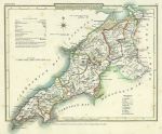
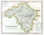
Wales, Caernarvonshire, Cole & Roper, 1809

Wales, Caernarvonshire, Cole & Roper, 1809.
"Caernarvonshire" engraved by J.Roper from a drawing by G.Cole, published in The British Atlas, 1810 (map dated 1809.) Copper engraved map with original hand colour. Some foxing, good margins. Size 22.5 x 18 cms plus margins. Ref E7227

 
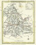
Wales, Brecknockshire, Cole & Roper, 1809

Wales, Brecknockshire, Cole & Roper, 1809.
"Brecknockshire" engraved by J.Roper from a drawing by G.Cole, published in The British Atlas, 1810 (map dated 1808.) Copper engraved map with original hand colour. Some foxing, good margins. Size 18 x 23 cms plus margins. Ref E7226

 
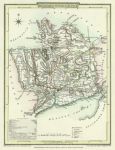
Monmouthshire, 1808

Monmouthshire, 1808.
"Monmouthshire" engraved by J.Roper from a drawing by G.Cole, published in The British Atlas, 1810 (map dated 1807.) Copper engraved map with original hand colour. Good condition with good margins. Size 17.5 x 23.5 cms. Ref E6803


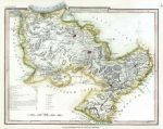
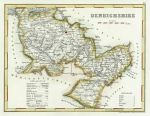
Denbighshire, 1848

Denbighshire, 1848.
"Denbighshire" engraved by J.Roper from a drawing by G.Cole, published Dugdale's England and Wales Delineated, about 1848. A late example of a map originally published about 1808. Steel engraved map with recent hand colour. Centrefold as published, some offsetting, good margins. Size 23 x 18 cms. Ref E5553

 
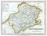
Montgomeryshire, 1848

Montgomeryshire, 1848.
"Montgomeryshire" engraved by John Archer, published Dugdale's England and Wales Delineated, about 1848. Steel engraved map with recent hand colour. Centrefold as published, good condition with good margins. Size 24 x 17.5 cms. Ref E5552

 
Radnorshire, 1848

Radnorshire, 1848.
"Radnorshire" engraved by John Archer, published Dugdale's England and Wales Delineated, about 1848. Steel engraved map with recent hand colour. Centrefold as published, good condition with good margins. Size 23 x 18 cms. Ref E5551


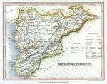
Merionethshire, 1848

Merionethshire, 1848.
"Merionethshire" engraved by John Archer, published Dugdale's England and Wales Delineated, about 1848. Steel engraved map with recent hand colour. Centrefold as published, good condition with good margins. Size 23 x 18 cms. Ref E5550

 
Wales, Denbighshire, 1848

Wales, Denbighshire, 1848.
" Denbighshire " drawn and engraved by John Archer, published in Dugdale's England and Wales Delineated ..., about 1850. Steel engraved map with recent hand colour. Centrefold as published. Size 23 x 17.5 cms. Ref D9949

 
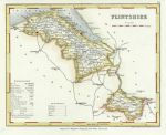
Wales, Flintshire, 1848

Wales, Flintshire, 1848.
" Flintshire " drawn and engraved by John Archer, published in Dugdale's England and Wales Delineated ..., about 1850. Steel engraved map with recent hand colour. Centrefold as published. Size 23 x 18 cms. Ref D9947


Wales, Milford Haven chart, 1856

Wales, Milford Haven chart, 1856.
" Milford Haven " drawn and engraved by J.Bartholomew, published by A. Fullarton & Co. in a gazetteer, about 1856. Lithographic map with original hand colour. Size 23 x 14 cms. Ref D2808

 
Wales, Denbighshire, 1848

Wales, Denbighshire, 1848.
" Denbighshire " drawn and engraved by John Archer, published in Dugdale's England and Wales Delineated ..., 1848. Steel engraved map with recent hand colour. Very slight foxing. Size 23 x 17.5 cms. Ref 8924

 
Wales, Radnorshire, 1789

Wales, Radnorshire, 1789.
" Radnorshire " published by Francis Grose in his Antiquities of England and Wales, 1787. Originally drawn, engraved and published by John Seller around 1695, this re-issue by Grose has Seller's name removed. Printed on the top half of a page, the rest of which (and the reverse) carries a historical description of the county in letterpress. Copper engraved map with original outline hand colour, very good condition with plate mark and wide margins. Size 14.5 x 12 cms. Ref 8748


Wales, Merionethshire, 1789

Wales, Merionethshire, 1789.
" Merionethshire " published by Francis Grose in his Antiquities of England and Wales, 1787. Originally drawn, engraved and published by John Seller around 1695, this re-issue by Grose has Seller's name removed. Printed on the top half of a page, the rest of which (and the reverse) carries a historical description of the county in letterpress. Copper engraved map with original outline hand colour, very good condition with plate mark and wide margins. Size 14.5 x 12 cms. Ref 8745

 
Wales, Brecknockshire, 1789

Wales, Brecknockshire, 1789.
" Brecknockshire " published by Francis Grose in his Antiquities of England and Wales, 1787. Originally drawn, engraved and published by John Seller around 1695, this re-issue by Grose has Seller's name removed. Printed on the top half of a page, the rest of which (and the reverse) carries a historical description of the county in letterpress. Copper engraved map with original outline hand colour, very good condition with plate mark and wide margins. Size 14.5 x 12 cms. Ref 8738


« Previous | 1 | 2 | 3 | 4 | 5 | 6 | Next »


© 2003 - 2020 Website copyright Steve Bartrick
Royalty free stock images of antique prints of interest to historians, students and family history researchers