Please see my main site ANTIQUEPRINTS.COM For original antique prints and maps
Charing Cross - 1837
Home » All prints and maps
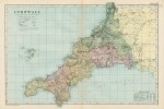
Cornwall map, 1901. "Cornwall", published in Bacon's Popular Atlas of the British Isles, 1901. Large colour lithographic map. Centrefold as published, slight age browning on fold, otherwise good condition. Size 47 x 32 cms, plus margins. Ref I1128
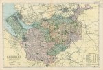
Cheshire map, 1901. "Cheshire", published in Bacon's Popular Atlas of the British Isles, 1901. Large colour lithographic map. Centrefold as published, slight age browning on fold, otherwise good condition. Size 46 x 30.5 cms, plus margins. Ref I1127
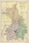
Cambridgeshire map, 1901. "Cambridgeshire", published in Bacon's Popular Atlas of the British Isles, 1901. Large colour lithographic map. Centrefold as published, slight age browning on fold, otherwise good condition. Size 31 x 47 cms, plus margins. Ref I1126
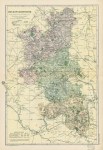
Buckinghamshire map, 1901. "Buckinghamshire", published in Bacon's Popular Atlas of the British Isles, 1901. Large colour lithographic map. Centrefold as published, slight age browning on fold, otherwise good condition. Size 31.5 x 46 cms, plus margins. Ref I1125
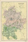
Berkshire map, 1901. "Berkshire", published in Bacon's Popular Atlas of the British Isles, 1901. Large colour lithographic map. Centrefold as published, slight age browning on fold, otherwise good condition. Size 47 x 30.5 cms, plus margins. Ref I1124
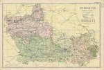
Bedfordshire map, 1901. "Bedfordshire", published in Bacon's Popular Atlas of the British Isles, 1901. Large colour lithographic map. Centrefold as published, slight age browning on fold, otherwise good condition. Size 31.5 x 46 cms, plus margins. Ref I1123
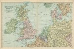
British Isles, with connections to the Continent, 1901. "British Isles, showing the connections with the Continent", published in Bacon's Popular Atlas of the British Isles, 1901. Large colour lithographic map. Centrefold as published, slight age browning on fold, otherwise good condition. Size 48 x 32 cms, plus margins. Ref I1122
World map, 1901. "The World on Mercator's Projection", published in Bacon's Popular Atlas of the British Isles, 1901. Large colour lithographic map. Centrefold as published, slight age browning on fold, otherwise good condition. Size 49.5 x 31 cms, plus margins. Ref I1121
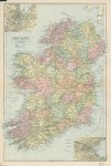
Ireland map, 1901. "Ireland", published in Bacon's Popular Atlas of the British Isles, 1901. Large colour lithographic map. Centrefold as published, slight age browning on fold, otherwise good condition. Size 31 x 47 cms, plus margins. Ref I1120
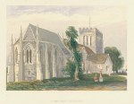
Herefordshire, Madley, St.Mary's Church, 1869. "St.Mary's, Madley, Herefordshire" after a picture by Sidney Corner, published in Rural Churches, 1869. Colour woodblock print, good condition. Size 21 x 17 cms including title, plus margins. Ref I1119
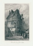
France, Joigny, House of the Tree of Jesse, 1872. "House of the Tree of Jesse, Joigny" engraved by J.J.Crew after a picture by L.J.Wood, published in Picturesque Europe, about 1875. Steel engraved print, good condition with full plate mark. Size 15 x 24 cms including title, plus margins. Ref I1118
Africa, Men & Women of Cape Verde Islands, 1775. "Men and Women of the Cape de Verd Islands in their Respective Habits" anonymous artist / engraver, copper engraved print published in Middleton's Complete System of Geography, about 1775. Some age browning and staining, full plate mark. Size 17 x 29.5 cms to plate mark, plus margins. Ref I1117
Africa, Methods of travelling in Congo, 1775. "Different methods of Travelling in Congo" engraved by Taylor after a picture by Wale, copper engraved print published in Middleton's Complete System of Geography, about 1775. Some age browning and staining, full plate mark. Size 17 x 30.5 cms to plate mark, plus margins. Ref I1116
Africa, Senegal, Negro circumcision ceremony, 1775. "Circumcision of the Negroes at Senegal" anonymous artist / engraver, copper engraved print published in Middleton's Complete System of Geography, about 1775. Some age browning and staining, full plate mark. Size 17 x 29 cms to plate mark, plus margins. Ref I1115
Russia, Kamchatka, sledges, 1779. "Mode of Travelling at Kamtschatka in Winter" and "The Ostiacks method of travelling in Winter" engraved by Grignion, published in Thomas Bankes's New .. System of Universal Geography, London, about 1788. Copper engraved antique print. Some age browning and staining, damaged to left side, Size 17.5 x 30 cms including inscription, plus margins. Ref I1114
Russian Women, Bankes Geography, 1779. "Russian Women. 1.A Woman of Livonia. 2... of Ingria. 3.Winter Dress of a Woman of Petersburg" and "... 1.A Woman of Valday. 2... of Moscow. 3... of Archangel" engraved by Grignion, published in Thomas Bankes's New .. System of Universal Geography, London, about 1779. Copper engraved antique print. Some age browning and staining, full plate mark. Size 21 x 33 cms to plate mark, plus margins. Ref I1113
Russia, various example of national dress, 1779. "Russian Dresses. 1.A Boor that sells live fish. 2.A Market Woman of Octha. 3.A Market Woman of Moscow" and "... 1.A Peasant's Wife. 2.A Peasant. 3.A Fortune Teller" engraved by Tookey, published in Thomas Bankes's New .. System of Universal Geography, London, about 1779. Copper engraved antique print. Some age browning and staining, full plate mark. Size 21 x 32.5 cms to plate mark, plus margins. Ref I1112
Russia, Women of Kamchatka, 1775. "Dress of the Women of Kamtschatka ..." anonymous artist / engraver, copper engraved print published in Middleton's Complete System of Geography, about 1775. Some age browning and staining, full plate mark. Size 17 x 29.5 cms to plate mark, plus margins. Ref I1111
© 2003 - 2020 Website copyright Steve Bartrick Royalty free stock images of antique prints of interest to historians, students and family history researchers