Please see my main site ANTIQUEPRINTS.COM For original antique prints and maps
Charing Cross - 1837
Home » All prints and maps
London, Strand Bridge, 1810. "Strand Bridge" copper engraved print published in The Beauties of England and Wales, 1810. Very slight age browning. Size 15.5 x 11.5 cms including title, plus margins. Ref F422
London, St.Martin's Church, Westminster, 1810. "St. Martin's Church, Westminster" copper engraved print published in The Beauties of England and Wales, 1810. Very slight age browning. Size 10.5 x 17 cms including title, plus margins. Ref F421
France, Blois, 1840. "Blois" engraved by R.Brandard after a picture by J.M.W.Turner, published in Turners Rivers of France, about 1840. Steel engraved print with recent hand colour. Size 14 x 11.5 cms including title, plus margins. Ref F420
France, Orleans, 1840. "Orleans" engraved by T.Higham after a picture by J.M.W.Turner, published in Turners Rivers of France, about 1840. Steel engraved print with recent hand colour. Size 14.5 x 11.5 cms including title, plus margins. Ref F419
France, Canal near Tours, 1840. "The Canal of the Loire and Cher, near Tours" engraved by T.Jeavons after a picture by J.M.W.Turner, published in Turners Rivers of France, about 1840. Steel engraved print with recent hand colour. Size 14 x 11 cms including title, plus margins. Ref F418
France, Tours, 1840. "Tours" engraved by R.Brandard after a picture by J.M.W.Turner, published in Turners Rivers of France, about 1840. Steel engraved print with recent hand colour. Size 14 x 11 cms including title, plus margins. Ref F417
France, Tours, St.Julian's, 1840. "St. Julian's, Tours" engraved by W.Radclyffe after a picture by J.M.W.Turner, published in Turners Rivers of France, about 1840. Steel engraved print with recent hand colour. Size 14.5 x 11.5 cms including title, plus margins. Ref F416
France, Tours, 1840. "Tours" engraved by R.Wallis after a picture by J.M.W.Turner, published in Turners Rivers of France, about 1840. Steel engraved print with recent hand colour. Size 14.5 x 11.5 cms including title, plus margins. Ref F415
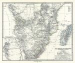
Southern Africa & Madagascar, 1879. "Sud-Afrika & Madagaskar" (Southern Africa & Madagascar) published in Adolf Stieler's Hand Atlas Uber Alle Theile Der Erde ..., 1879. Very detailed steel engraved map with original hand colour, centrefold as published. Inset map of the Table Bay and False Bay area. Good condition. Size 41 x 33.5 cms, plus margins. Ref F414
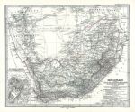
South Africa, 1879. "Das Capland" (South Africa) published in Adolf Stieler's Hand Atlas Uber Alle Theile Der Erde ..., 1879. Very detailed steel engraved map with original hand colour, centrefold as published. Inset plan of Cape Town area. Good condition. Size 40.5 x 33.5 cms, plus margins. Ref F413
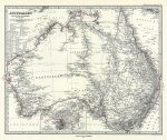
Australia, 1879. "Australien" (Australia) published in Adolf Stieler's Hand Atlas Uber Alle Theile Der Erde ..., 1879. Very detailed steel engraved map with original hand colour, centrefold as published. Inset plan of Sydney and Port Jackson. Good condition. Size 41 x 33.5 cms, plus margins. Ref F412
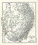
South East Australia, 1879. "Sud-Ost Australien" (Australia) published in Adolf Stieler's Hand Atlas Uber Alle Theile Der Erde ..., 1879. Extremely detailed steel engraved map with original hand colour, centrefold as published. Very good condition. Size 34.5 x 41cms, plus margins. Ref F411
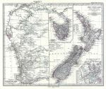
New Zealand & Western Australia, 1879. "Neu-Seeland" and "West-Australien" published in Adolf Stieler's Hand Atlas Uber Alle Theile Der Erde ..., 1879. Extremely detailed steel engraved map with original hand colour, centrefold as published. Insets showing Tasmania and Isthmus of Auckland. Very good condition. Size 41 x 34 cms, plus margins. Ref F410
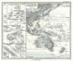
Pacific Ocean (Western half), 1879. "Polynesien und der Grosse Ocean ..." published in Adolf Stieler's Hand Atlas Uber Alle Theile Der Erde ..., 1879. Extremely detailed steel engraved map with original hand colour, centrefold as published. Many insets showing Pacific Islands including Samoa, Fiji, New Caledonia etc. Very good condition. Size 40.5 x 33 cms, plus margins. Ref F409
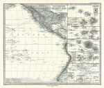
Pacific Ocean (Eastern half), 1879. "Polynesien und der Grosse Ocean" published in Adolf Stieler's Hand Atlas Uber Alle Theile Der Erde ..., 1879. Detailed steel engraved map with original hand colour. Many insets showing Pacific Islands including Tahiti, Hawaii, Galapagos etc. Centrefold as published, good condition with plate mark and good margins. Size 40 x 33.5 cms plus margins. Ref F408
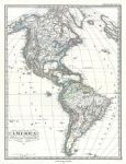
North & South America, 1879. "America" published in Adolf Stieler's Hand Atlas Uber Alle Theile Der Erde ..., 1879. Detailed steel engraved map with original hand colour. Centrefold as published, good condition with plate mark and good margins. Size 30.5 x 41 cms plus margins. Ref F407
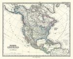
North America, 1879. "Nord-America" published in Adolf Stieler's Hand Atlas Uber Alle Theile Der Erde ..., 1879. Detailed steel engraved map with original hand colour. Centrefold as published, good condition with plate mark and good margins. Size 39 x 31 cms plus margins. Ref F406
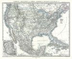
United States and Mexico, 1879. "Verein-Staaten von Nord America, Mexico, Yucatan .." published in Adolf Stieler's Hand Atlas Uber Alle Theile Der Erde ..., 1879. Detailed steel engraved map with original hand colour. Inset map of the Mexico City area. Centrefold as published, good condition with plate mark and good margins. Size 40 x 31.5 cms plus margins. Ref F405
© 2003 - 2020 Website copyright Steve Bartrick Royalty free stock images of antique prints of interest to historians, students and family history researchers