Home » All prints and maps

 
Weapon Trophies at the Tower of London, 1786

Weapon Trophies at the Tower of London, 1786.
"Various Weapons & Implements of War, which have been employed against the English by different Enemies, Now deposited in the Tower of London" engraved by G.Walker, published in Picturesque Views of the Antiquities of England & Wales, 1786. Copper engraved print, good condition. Size 21 x 32 cms including title, plus margins. Ref E9970

 
Habits of the Ancient Religious Orders, 1786

Habits of the Ancient Religious Orders, 1786.
"Habits of the Ancient Religious Orders" engraved by M.Coote, published in Picturesque Views of the Antiquities of England & Wales, 1786. Copper engraved print, good condition. Size 30 x 20 cms including title, plus margins. Ref E9969

 
Saxon & Gothic Architecture, 1786

Saxon & Gothic Architecture, 1786.
"Miscellaneous Plate of Architecture, Saxon & Gothic" engraved by Record, published in Picturesque Views of the Antiquities of England & Wales, 1786. Copper engraved print, good condition. Size 19 x 32 cms including title, plus margins. Ref E9968


Oxfordshire, Adderbury Church, Medieval Frieze, 1786

Oxfordshire, Adderbury Church, Medieval Frieze, 1786.
"Frieze on the North Front of Adderbury Church, in Oxfordshire" and " ... on the South Front ..." engraved by Record, published in Picturesque Views of the Antiquities of England & Wales, 1786. Copper engraved print, good condition. Size 30.5 x 20 cms including title, plus margins. Ref E9967

 
Kent, Canterbury, Christ Church, 1786

Kent, Canterbury, Christ Church, 1786.
"Stranger's Hall at Christ Church, Canterbury, in Kent" engraved by Coote, published in Picturesque Views of the Antiquities of England & Wales, 1786. Copper engraved print, good condition. Size 19 x 32 cms including title, plus margins. Ref E9966

 
Kent, Barfreston Church, 1786

Kent, Barfreston Church, 1786.
"Barfreston Church, in Kent" engraved by Peltro, published in Picturesque Views of the Antiquities of England & Wales, 1786. Copper engraved print, good condition. Size 19 x 32 cms including title, plus margins. Ref E9965


Kent, Barfreston Church (Saxon arch), Pic Views, 1786

Kent, Barfreston Church (Saxon arch), Pic Views, 1786.
"Grand Door of Barfreston Church in Kent" engraved by Peltro, published in Picturesque Views of the Antiquities of England & Wales, 1786. Copper engraved print, good condition. Size 19 x 33 cms including title, plus margins. Ref E9964

 
Norman Architecture (Columns), 1786

Norman Architecture (Columns), 1786.
"Early Norman Architecture" engraved by Record, published in Picturesque Views of the Antiquities of England & Wales, 1786. Copper engraved print, good condition. Size 19 x 33 cms including title, plus margins. Ref E9963

 
Berkshire, Donnington Castle & St.Georges Chapel in Windsor, 1786

Berkshire, Donnington Castle & St.Georges Chapel in Windsor, 1786.
"Dunnington Castle in Berkshire" and St.Georges Chapel at Windsor" engraved by Thornton, published in Picturesque Views of the Antiquities of England & Wales, 1786. Pair of copper engraved prints on one sheet. Good condition. Size 19 x 33.5 cms including title, plus margins. Ref E9962


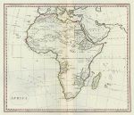
Africa, about 1820

Africa, about 1820.
"Africa" anonymous engraver and publisher, about 1800 (paper watermarked 1796). Copper engraved map with original hand colouring. Centrefold as published. Some creasing parallel to the fold, otherwise good condition. Size 40.5 x 35 cms plus good margins with full plate mark. Ref E9957

 
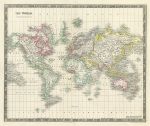
World on Mercators Projection (British Empire), about 1840

World on Mercators Projection (British Empire), about 1840.
"The World on Mercators Projection" drawn and engraved by John Dower, published by Henry Teesdale about 1840. Steel engraved map with full original hand colouring, with the British Empire shown in red. Centrefold as published. Split to lower 3 cms of fold, just into neatline (no loss), otherwise very good condition. Size 41.5 x 34 cms plus good margins with full plate mark.. Ref E9956

 
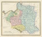
Poland as Divided in 1815, published 1839

Poland as Divided in 1815, published 1839.
"Poland as Divided among the Powers" anonymous engraver, published by Allan Bell & Co. 1839. Copper engraved map with full original hand colouring to indicate how Poland was divided according to the Treaty of Vienna in 1815. Centrefold as published. Good condition. Size 34.5 x 29.5 cms plus margins with full plate mark. Ref E9955


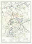
German Confederation, 1860

German Confederation, 1860.
"Carte Physique & Politique des Etats Secondaires de la Confederation Germanique" by L.Dussieux, published in Atlas General de Geographie ..., 1860 (dated 1846). Steel engraved map with original hand colouring. Centrefold as published. Size 27.5 x 39 cms plus good margins. Ref E9954

 
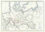
Prussia, 1860

Prussia, 1860.
"Carte Physique & Politique de la Prusse" by L.Dussieux, published in Atlas General de Geographie ..., 1860 (dated 1845). Steel engraved map with original hand colouring. Centrefold as published. Size 39.5 x 27.5 cms plus good margins. Ref E9952

 
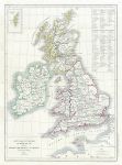
British Isles, 1860

British Isles, 1860.
"Carte Physique & Politique du Royaume-Uni de la Grande-Bretagne et d'Irlande" by L.Dussieux, published in Atlas General de Geographie ..., 1860 (dated 1847). Steel engraved map with original hand colouring. Centrefold as published. Size 28 x 39 cms plus good margins. Ref E9951


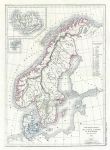
Scandinavia, 1860

Scandinavia, 1860.
"Carte Physique & Politique de la Suede, de la Norwege, et du Danemark" by L.Dussieux, published in Atlas General de Geographie ..., 1860 (dated 1845). Steel engraved map with original hand colouring. Centrefold as published. Size 27 x 39 cms plus good margins. Ref E9950

 
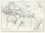
Oceana, 1860

Oceana, 1860.
"Carte Generale de L'Oceanie" by L.Dussieux, published in Atlas General de Geographie ..., 1860 (dated 1846). Steel engraved map with original hand colouring. Centrefold as published, damp staining to the two upper corners. Size 38.5 x 27.5 cms plus good margins. Ref E9949

 
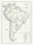
South America, 1860

South America, 1860.
"Carte Physique & Politique de L'Amerique Meridionale" by L.Dussieux, published in Atlas General de Geographie ..., 1860 (dated 1845). Steel engraved map with original hand colouring. Centrefold as published, damp staining to the two right hand corners. Size 27.5 x 39 cms plus good margins. Ref E9948

 
« Previous | ...1790 | 1791 | 1792 | 1793 | 1794 | 1795 | 1796 | 1797 | 1798 | 1799 | 1800... | Next »


© 2003 - 2020 Website copyright Steve Bartrick
Royalty free stock images of antique prints of interest to historians, students and family history researchers