Home » All prints and maps

 
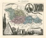
France, Moselle, 1884

France, Moselle, 1884.
"Moselle" steel engraved antique map with original hand colour, published by J.Migeon in France et Ses Colonies, 1884. Vignette view of the departmental capital, Metz, lower right, the other principle towns marked on the map are Briey, Sarreguemines and Thionville. Good condition. Size 22 x 18 cms plus good margins. Ref E7686

 
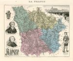
France, Nieve, 1884

France, Nieve, 1884.
"Nieve" steel engraved antique map with original hand colour, published by J.Migeon in France et Ses Colonies, 1884. Vignette view of the departmental capital, Nevers, upper right, the other principle towns marked on the map are Clamecy, Cosne, and Chateau-Chinon. Good condition. Size 22 x 18 cms plus good margins. Ref E7685

 
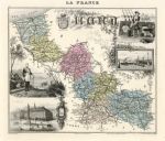
France, Nord, 1884

France, Nord, 1884.
"Nord" steel engraved antique map with original hand colour, published by J.Migeon in France et Ses Colonies, 1884. Vignette view of the departmental capital, Lille, lower left and Dunkirk upper right. The other principle towns marked on the map are Cambrai, Douai, Dunkerque, Hazerbrouck and Valenciennes. Good condition. Size 25 x 21 cms plus good margins. Ref E7684


Botanical print with fruit and butterflies, 1773

Botanical print with fruit and butterflies, 1773.
[ Botanical print with fruit and butterflies ] anonymous artist/engraver, published about 1773. Copper engraved print with original hand colour. Good condition with full plate mark. Size 23 x 28 cms to plate mark, plus margins. Ref E7683

 
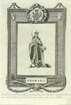
George I, 1800

George I, 1800.
"George I" engraved by Grainger after a picture by Wale. Published in History of England, about 1800. Copper engraved print, with full plate mark. Size 19 x 30 cms including title, plus margins. Ref E7682

 
Queen Anne, 1800

Queen Anne, 1800.
"Queen Anne" engraved by Grainger after a picture by Wale. Published in History of England, about 1800. Copper engraved print, with full plate mark. Size 19 x 30 cms including title, plus margins. Ref E7681


William III, 1800

William III, 1800.
"William III" engraved by Grainger after a picture by Wale. Published in History of England, about 1800. Copper engraved print, with full plate mark. Size 19 x 31.5 cms including title, plus margins. Ref E7680

 
King James II, 1800

King James II, 1800.
"James II" engraved by Grainger after a picture by Wale. Published in History of England, about 1800. Copper engraved print, with full plate mark. Size 20 x 31 cms including title, plus margins. Ref E7679

 
King Charles II, 1800

King Charles II, 1800.
"Charles II" engraved by Royce after a picture by Wale. Published in History of England, about 1800. Copper engraved print, with full plate mark. Size 20.5 x 31 cms including title, plus margins. Ref E7678


King Charles I, 1800

King Charles I, 1800.
"Charles I" engraved by Roberts after a picture by Wale. Published in History of England, about 1800. Copper engraved print, with full plate mark. Size 18 x 31 cms including title, plus margins. Ref E7677

 
King James I, 1800

King James I, 1800.
"James I" engraved by Royce after a picture by Wale. Published in History of England, about 1800. Copper engraved print, with full plate mark. Size 18 x 31 cms including title, plus margins. Ref E7676

 
Queen Mary I, 1800

Queen Mary I, 1800.
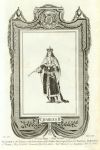
"Mary I" engraved by Goldar after a picture by Wale. Published in History of England, about 1800. Copper engraved print, with full plate mark. Size 18 x 31 cms including title, plus margins. Ref E7675


King Edward VI, 1800

King Edward VI, 1800.
"Edward IV" engraved by Taylor after a picture by Wale. Published in History of England, about 1800. Copper engraved print, with full plate mark. Size 18 x 31.5 cms including title, plus margins. Ref E7674

 
Australia, about 1880

Australia, about 1880.
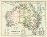
"Australia" chromolithograph published by William McKenzie, about 1880. Shows area divisions by colour with ‘West Australia’, ‘The North Territory’, ‘Alexandra Land’, ‘Queensland’, ‘New South Wales’, ‘Victoria’ and ‘South Australia’. List of counties given in the sea area. Centrefold as published. Size 27.5 x 22.5 cms plus margins. Ref E7673

 
Canada, Wellington Channel, 1856

Canada, Wellington Channel, 1856.
"Wellington Channel, Melville Island &c." drawn and engraved from an Admiralty chart, published by A. Fullarton & Co. in a gazetteer, about 1856. Steel engraved map with original hand colour. Size 23.5 x 11 cms plus margins. Ref E7672


Cape Verde Islands, 1856

Cape Verde Islands, 1856.
"Cape Verd Islands" drawn and engraved by J.Bartholomew, published by A. Fullarton & Co. in a gazetteer, about 1856. Steel engraved map with original hand colour. Size 23 x 14 cms plus margins. Ref E7671

 
Hertfordshire, Hatfield House, the Hall, Joseph Nash, 1839

Hertfordshire, Hatfield House, the Hall, Joseph Nash, 1839.
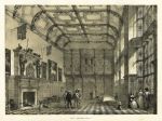
"Hall, Hatfield, Berks" tinted lithograph after Joseph Nash, published in his Mansions of England in the Olden Time, about 1839. Slight foxing. Size 41.5 x 31 cms including title, plus good margins. Ref E7670

 
Hertfordshire, Hatfield House, Principal Staircase, Joseph Nash, 1839

Hertfordshire, Hatfield House, Principal Staircase, Joseph Nash, 1839.
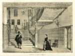
"Principal Staircase at Hatfield" tinted lithograph after Joseph Nash, published in his Mansions of England in the Olden Time, about 1839. Some foxing. Size 41.5 x 31.5 cms including title, plus good margins. Ref E7669

 
« Previous | ...1880 | 1881 | 1882 | 1883 | 1884 | 1885 | 1886 | 1887 | 1888 | 1889 | 1890... | Next »


© 2003 - 2020 Website copyright Steve Bartrick
Royalty free stock images of antique prints of interest to historians, students and family history researchers