Please see my main site ANTIQUEPRINTS.COM For original antique prints and maps
Charing Cross - 1837
Home » All prints and maps
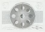
Phases and Movements of the Moon, 1855. "Phases and Movements of the Moon" engraved by Dower, published in Gallery of Nature, 1855. Steel engraved map, two vertical folds as published. Size 30 x 21 cms plus margins. Ref H7368
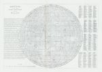
Moon, visible hemisphere map, 1855. "Selenographic Map of the Whole Visible Hemisphere of the Moon" engraved by Dower, published in Gallery of Nature, 1855. Steel engraved map, two vertical folds as published. Size 29.5 x 20 cms plus margins. Ref H7367
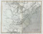
United States map, 1820. "United States" engraved by E.Jones after Arrowsmith, published in Rees's Cyclopedia; or, Universal Dictionary ..., 1820. Copper engraved antique map with recent hand colouring, centrefold as published. Slight creasing along centrefold, otherwise good condition. Size 31.5 x 25.5 cms, plus margins. Ref H7366
West Indies map, 1820. "West Indies" engraved by B.Smith after Arrowsmith, published in Rees's Cyclopedia; or, Universal Dictionary ..., 1820. Copper engraved antique map with recent hand colouring, centrefold as published. Creasing along centrefold, otherwise good condition. Size 40.5 x 25 cms, plus margins. Ref H7365
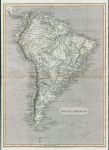
South America map, 1820. "South America" engraved by J.Russell after Arrowsmith, published in Rees's Cyclopedia; or, Universal Dictionary ..., 1820. Copper engraved antique map with recent hand colouring, centrefold as published. Good condition. Size 25.5 x 36 cms, plus margins. Ref H7364
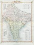
India map, 1858. "British India" lithographic map based on Rapkin's map of about 10 years earlier. Published in The History of the Indian Mutiny ..., about 1859. Centrefold as published, some original hand colour, augmented with recent wash colour. Good condition. Size 25 x 33.5 cms plus margins. Ref H7363
Cape of Good Hope map (Africa), 1820. "Cape of Good Hope" engraved by John Cooke after Arrowsmith, published in Rees's Cyclopedia; or, Universal Dictionary ..., 1820. Copper engraved antique map with recent hand colouring, centrefold as published. Good condition. Size 39.5 x 25 cms, plus margins. Ref H7362
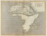
Africa map, 1820. "Africa" engraved by J.Russell after Arrowsmith, published in Rees's Cyclopedia; or, Universal Dictionary ..., 1820. Copper engraved antique map with recent hand colouring, centrefold as published. Good condition. Size 32.5 x 25.5 cms, plus margins. Ref H7361
Canada map, 1820. "British Possessions in North America" engraved by J.Russell after Arrowsmith, published in Rees's Cyclopedia; or, Universal Dictionary ..., 1820. Copper engraved antique map with recent hand colouring, centrefold as published. Good condition. Size 39.5 x 25 cms, plus margins. Ref H7360
North America map, 1820. "North America" engraved by J.Russell after Arrowsmith, published in Rees's Cyclopedia; or, Universal Dictionary ..., 1820. Copper engraved antique map with recent hand colouring, centrefold as published. Good condition. Size 39.5 x 25 cms, plus margins. Ref H7359
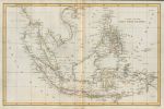
East Indies map, 1820. "Chart of the East India Islands" engraved by Cooper after Arrowsmith, published in Rees's Cyclopedia; or, Universal Dictionary ..., 1820. Copper engraved antique map with recent hand colouring, centrefold as published. Good condition. Size 38.5 x 25 cms, plus margins. Ref H7358
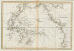
Pacific Ocean map, 1820. "Chart of the Pacific Ocean" engraved by Cooper after Arrowsmith, published in Rees's Cyclopedia; or, Universal Dictionary ..., 1820. With tracks of the explorers marked. Copper engraved antique map with recent hand colouring, centrefold as published. Good condition. Size 36.5 x 24.5 cms, plus margins. Ref H7357
Egypt map, 1820. "Egypt" engraved by Lowry(?) after Arrowsmith, published in Rees's Cyclopedia; or, Universal Dictionary ..., 1820. Copper engraved antique map with recent hand colouring, centrefold as published. Good condition. Size 25 x 40 cms, plus margins. Ref H7356
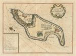
Senegal, map of Goree Island with fortifications, 1746. "Plan de L'Isle de Gore ..." (Senegal) published in Histoire Generale des Voyages ..., 1746. Copper engraved antique map with recent hand colour. Centrefold as published, good condition with full plate mark. Size 27.5 x 20 cms, plus margins. Ref H7355
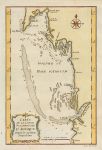
Mauritania coastline, Cap Blanc to Tanit, 1746. "Carte de la Coste Occidentale D'Afrique. Depuis le Cap Blanc Jusqu'a Tanit" anonymous engraver after Bellin, published in Histoire Generale des Voyages ..., 1746. Copper engraved antique map with recent hand colour. Good condition with full plate mark. Size 15 x 23 cms, plus margins. Ref H7354
Senegal & Mauritania coastline, 1746. "Carte D'Une Partie de la Coste D'Afrique. Depuis Tanit Jusqu'a la Riviere du Senegal" anonymous engraver after Bellin, published in Histoire Generale des Voyages ..., 1746. Copper engraved antique map with recent hand colour. Good condition with full plate mark. Size 14.5 x 23.5 cms, plus margins. Ref H7353
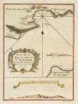
Cape Verde, Bay of São Vicente, 1746. "Plan de la Baye de L'Isle de St. Vincent. Une des Isles du Cap Verde" anonymous engraver after Bellin, published in Histoire Generale des Voyages ..., 1746. Copper engraved antique map with recent hand colour. Good condition with full plate mark. Size 15 x 20.5 cms, plus margins. Ref H7352
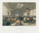
London, General Post Office (Inland Office), 1841. "General Post Office. Inland Office" engraved by Ellis after a picture by Gilbert, published in London Interiors, 1845. Steel engraved antique print with recent hand colouring. Good condition. Size 18 x 15.5 cms including title, plus good margins. Ref H7351
© 2003 - 2020 Website copyright Steve Bartrick Royalty free stock images of antique prints of interest to historians, students and family history researchers